Browse All

1861 Riviere des Lacs to Rocky Mountains. Exploration Book Riviere Des Lacs to the Rocky Mountains; … |

1877 Covers: Map Of The Yellowstone And Misso … Pocket Map (Covers to) Western Sheet. Map Of The Ye … |

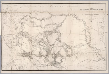
1877 Map Of The Yellowstone And Missouri Rive … Pocket Map Western Sheet. Map Of The Yellowstone An … |

1883 Map Of Montana Pocket Map Map of Montana. Published by H.R. Page & … |

1934 Index: Montana, Railway Distance Maps Guide Book (Index to) Leahy's Hotel Guide and Railw … |

1934 Railway Distance Map of the State of Mon … Guide Book Leahy's Hotel Guide and Railway Distance … |

1937 Road map Idaho, Mont., Wyo. Pocket Map Texaco road map Idaho, Montana, Wyoming. … |

1937 Cover: Road map Idaho, Mont., Wyo. Pocket Map (Covers to) Texaco road map Idaho, Monta … |

1906 Montana, Wyoming (North). Utah, Colorado … World Atlas Montana, Wyoming (North). Utah, Colorado … |

1886 Montana, Published by H.R. Page & Co., C … County Atlas Map of Montana, Published by H.R. Page & … |

1878 (Map 12 - Montana, North Dakota). Case Map (Map 12 - Montana, North Dakota). |

1878 (Map 16 - Washington, Oregon, Montana, I … Case Map (Map 16 - Washington, Oregon, Montana, I … |

1880 Montana Mining Atlas Montana. (to accompany) Pocket Mining At … |

1876 Map Of The Yellowstone And Missouri Rive … Separate Map War Department Map Of The Yellowstone An … |

1897 Map Of The State Of Montana Separate Map Department Of The Interior General Land … |

1987 Montana -- Physical Wall Map Montana. |

1865 Map of Oregon, Washington, Idaho, and Pa … World Atlas Map of Oregon, Washington, Idaho, and Pa … |

1874 County map of Colorado, Wyoming, Dakota, … World Atlas County map of Colorado, Wyoming, Dakota, … |

1874 Map of Oregon, washington, Idaho, and pa … World Atlas Map of Oregon, Washington, Idahoe, and p … |

1891 Sectional map of Washington, Oregon, Ida … Separate Map C.H. Amerine's : Sectional map of Washin … |

1876 Covers: Report of a Reconnaissance From … Exploration Book (Covers to) Report of a Reconnaissance F … |

1876 Title Page: Report of a Reconnaissance F … Exploration Book (Title Page to) Report of a Reconnaissan … |

1876 Contents: Contents to Report of a Reconn … Exploration Book (Contents to) Contents. (to accompany) R … |

1876 Judith Basin : drawn under the direction … Exploration Book Judith Basin : drawn under the direction … |

1876 Upper Geyser Basin : drawn under the dir … Exploration Book Upper Geyser Basin : drawn under the dir … |

1875 Plate. 1. New species of fossils. Capt. … Exploration Book New species of fossils. Capt. Wm. Ludlow … |

1875 Plate. 2. New species of fossils. Capt. … Exploration Book New species of fossils. Capt. Wm. Ludlow … |

1875 Map of a Reconnaissance From Carroll, Mo … Exploration Book Map of a Reconnaissance From Carroll, Mo … |
1868 Map of the Yellowstone and Missouri Rive … Exploration Book U.S. War Department : Map of the Yellows … |

1877 County map of Colorado, Wyoming, Dakota, … World Atlas County map of Colorado, Wyoming, Dakota, … |

1877 Map of Oregon, Washington, Idaho and par … World Atlas Map of Oregon, Washington, Idaho and par … |

1868 Map of Oregon, Washington, Idaho, and pa … World Atlas Map of Oregon, Washington, Idaho, and pa … |

1927 Montana National Atlas Montana. (Copyrighted by) National Map C … |

1929 Legend: 136-37. Mont., N.D., S.D., Wyo., … World Atlas (Legend to) Stati Uniti, United States o … |

1929 136-37. Mont., N.D., S.D., Wyo., Neb. World Atlas Stati Uniti, United States of America, M … |

1880 Ore., Wash., Ida., Mont. World Atlas Map of Oregon, Washington, Idaho, and pa … |

1890 Mont., Ida., Wyo. World Atlas County and township map, Montana, Idaho … |

1870 Ore., Wash., Idaho, Mont. [State Atlas, World Atlas] Map of Oregon, Washington, Idaho, and pa … |

1880 Montana. World Atlas Territory of Montana. Entered ... 1879 b … |

1900 Plate CXXXVI. Hamilton Quadrangle, Monta … [Geologic Atlas, Geology Book] Plate CXXXVI. Hamilton Quadrangle, Monta … |

1966 Faults. Trust Fault. Chief Mountain, Mon … Physical Atlas Faults. Trust Fault. Chief Mountain, Mon … |

1966 Streams. Youthful Streams. Portage, Mont … Physical Atlas Streams. Youthful Streams. Portage, Mont … |

1966 Streams. Alluvial Fans. Ennis, Mont. Physical Atlas Streams. Alluvial Fans. Ennis, Mont. (on … |

1966 Alpine Glaciation. The Cycle of Glacial … Physical Atlas Alpine Glaciation. The Cycle of Glacial … |
1940 Road map of Montana National Atlas Rand McNally Road map, Montana. Copyrigh … |

1869 Map Of The Yellowstone And Missouri Rive … Case Map U.S. War Department Map Of The Yellowsto … |

1869 Covers: Map Of The Yellowstone And Misso … Case Map (Covers to) U.S. War Department Map Of T … |

1885 Montana National Atlas Montana. (to accompany) Bradstreet's Poc … |

1900 Section Title Page: Lewis and Clarke For … [Geologic Atlas, Geology Book] (Section Title Page) Lewis and Clarke Fo … |

1900 Table of Contents: Lewis and Clarke Fore … [Geologic Atlas, Geology Book] (Table of Contents to) Lewis and Clarke … |