Who What Where WhenREMOVE |
REFINE
Browse All : Images of New England and Vermont
1-6 of 6
Author
Tanner, Henry S.
Full Title
(Covers to) Map Of The States Of Maine, New Hampshire, Vermont, Massachusetts, Connecticut & Rhode Island. By H.S. Tanner 1847. Engraved & Published by H.S. Tanner, Philadelphia.
Publisher
H.S. Tanner
Author
Tanner, Henry S.
Full Title
Map Of The States Of Maine, New Hampshire, Vermont, Massachusetts, Connecticut & Rhode Island. By H.S. Tanner 1847. Engraved & Published by H.S. Tanner, Philadelphia.
Publisher
H.S. Tanner
Author
Tanner, Henry S.
Full Title
Map of the States of Maine, New Hampshire, Vermont, Massachusetts, Connecticut, & Rhode Island. By H.S. Tanner. American Atlas. Engraved and Published by H.S. Tanner, Philadelphia. Entered according to Act of Congress, 14th Day of Novr. 1820, by H.S. Tanner, of the State of Pennsylvania.
Publisher
Henry Tanner
Author
Cram, George Franklin
Full Title
Cram's Rail Road & County Map of New England.
Publisher
George F. Cram
Author
Burr, David H., 1803-1875
Full Title
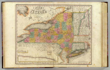
Map of the State of New-York and the surrounding country by David H. Burr. Compiled from his large map of the State, 1832. (with) Profile of the Grand Erie Canal. (with) Profile of the Champlain Canal. (with) Profile of the Seneca Canal. Entered according to Act of Congress Jany. 5th., 1829 by David H. Burr of the State of New York. Engd. by Rawdon, Clark & Co., Albany & Rawdon, Wright & Co., New York.
Publisher
D.H. Burr
1-6 of 6
|


