Browse All

1909 Cover: Birds eye view map, New York & vi … Pocket Map (Covers to) Birds Eye View Map Of New Yo … |

1909 Birds Eye View Map Of New York And Vicin … Pocket Map Birds Eye View Map Of New York And Vicin … |

1776 The Provinces of New York, and New Jerse … National Atlas The Provinces of New York, and New Jerse … |

1956 Various Regions and Cities in New Jersey … National Atlas Newark and Vicinity. To and Through Manh … |

1886 New York City, Brooklyn, Jersey City, Ho … World Atlas Colton's New York City, Brooklyn, Jersey … |

1802 Road from Philadelphia to New York. (Map … Guide Book Road from Philadelphia to New York. (Map … |

1874 New York City, Brooklyn, Jersey City, Ho … World Atlas Colton's New York City, Brooklyn, Jersey … |

1873 New York, Pennsylvania, and New Jersey. World Atlas Map of New York, Pennsylvania, and New J … |

1872 Atlas of the United States, New England, … [National Atlas, State Atlas] Atlas of the United States, New England, … |

1852 Gay Head to Cape Henlopen Chart Atlas General chart of the coast from Gay Head … |

1845 New York Bay, Harbor. Chart Atlas Map of New-York Bay and Harbor and the e … |

1824 New York med Trakten Daromkring. National Atlas New York med Trakten Daromkring. (Stockh … |

1824 Inrednings ritning till ett vanligt lite … National Atlas Inrednings ritning till ett vanligt lite … |

1892 Colton's road maps. Pocket Map Colton's road maps. G.W. & C.B. Colton & … |

1892 (Colton's road maps) Pocket Map (Colton's road maps). G.W. & C.B. Colton … |

1892 (Colton's road maps) Pocket Map (Colton's road maps). G.W. & C.B. Colton … |

1807 Septentrionale du New Jersey, et Positio … Historical Atlas Partie Septentrionale du New Jersey, et … |

1883 135. Industries by cities. Statistical Atlas Selected industries in twenty principal … |

1878 New York Bay and Harbor, New York. State Atlas New York Bay and Harbor, New York. From … |

1878 (Map 3 - West Virginia, Ohio, Pennsylvan … Case Map (Map 3 - Virginia, West Virginia, Ohio, … |

1891 Index map. City Atlas Index map showing the area covered by th … |

1891 New York City, County. City Atlas City and county of New York. Copyrighted … |

1891 Brooklyn, N.Y. Bay, Jersey City, Hoboken … City Atlas Brooklyn, New York Bay, Jersey City, Hob … |

1891 Richmond Co., Staten Island. City Atlas Richmond County, Staten Island. Copyrigh … |

1891 Westchester Co., Yonkers-state line. City Atlas Westchester County, Yonkers to Dobbs Fer … |

1891 Contents: Atlas Metropolitan District. City Atlas (Contents to) Atlas of the Metropolitan … |

1891 Cover: Atlas Metropolitan District. City Atlas (Covers to) Atlas of the Metropolitan Di … |
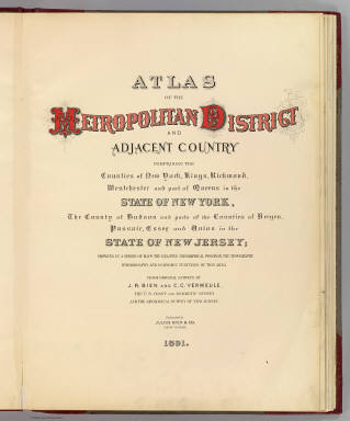
1891 Title Page: Atlas Metropolitan District. City Atlas (Title Page to) Atlas of the Metropolita … |

1867 Map of New York and Vicinity Accompanyin … County Atlas Map of New York and Vicinity Accompanyin … |

1891 4 Yonkers, Bergen Co. County Atlas Portion of Yonkers and 24th ward. Portio … |

1891 5 Bergen Co., Yonkers. County Atlas Portion of Bergen County, N.J. Portion o … |

1891 6 Rockland, Westchester counties. County Atlas Portion of Rockland County. Portion of W … |

1891 Cover: Atlas Hudson River Valley. County Atlas (Covers to) Atlas of the Hudson River Va … |

1891 Title Page: Atlas Hudson River Valley. County Atlas (Title Page to) Atlas of the Hudson Rive … |

1891 Index: Atlas Hudson River Valley. County Atlas Index to maps in Hudson River Valley atl … |

1891 1 New York, Brooklyn, Jersey City. County Atlas Map of New-York, Brooklyn, Jersey City & … |

1891 2 New York, etc. County Atlas Watson's new map of New-York and adjacen … |

1891 3 Bergen Co., N.J. County Atlas Portion of Bergen County, N.J. Copyright … |

1831 N.Y., N.J., Pa., Del., Md. World Atlas New York. N. Jersey, Pennsylvania, Delaw … |

1895 2. Harlem-Yonkers-Pelham Manor. County Atlas Section 2. Showing from Harlem northward … |

1895 4. Yonkers-Tarrytown-Hartsdale. County Atlas Section 4. Showing from Yonkers northwar … |

1895 7. Tarrytown-Oscawana-Merritt's Corners. County Atlas Section 7. Showing from Tarrytown northw … |

1902 2. Harlem-Yonkers-Pelham Manor. County Atlas Section 2. Showing from Harlem northward … |

1902 4. Yonkers-Tarrytown-Hartsdale. County Atlas Section 4. Showing from Yonkers northwar … |

1932 Plate 160. Military History. American Re … [Historical Atlas, National Atlas] Plate 160. Military History. The America … |

1902 7. Tarrytown-Oscawana-Merritt's Corners. County Atlas Section 7. Showing from Tarrytown northw … |

1939 Cleveland - New York. Allentown - Bethle … [Ephemera, Pamphlet] Cleveland - New York. Allentown - Bethle … |

1888 6 Central red sandstone. State Atlas A topographical map of the valley of the … |

1888 7 NE red sandstone. State Atlas A topographical map of the counties of B … |

1888 9 Monmouth shore. State Atlas A topographical map of the Monmouth shor … |