Browse All

1879 XVIII. Stone implements, New Mexico. Exploration Book Implements of stone, ancient pueblos, Ne … |

1879 XIX. Stone implements, New Mexico. Exploration Book Implements of stone, ancient pueblos, Ne … |

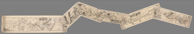
1889 Main-route, side meanders, topographical … Exploration Book Main-route and side meanders, and topogr … |

1877 Beaver, Cheyenne, Fort Union, Georgetown … Exploration Book Sketch of Beaver, Utah showing position … |

1877 Diurnal temperature. Exploration Book Diurnal temperature. Georgetown, Col. Sa … |

1877 Differences, wet, dry bulb thermometers. Exploration Book Mean differences, wet and dry bulb therm … |

1877 Diurnal force of vapor. Exploration Book Diurnal force of vapor. Colorado Springs … |

1890 Texas. World Atlas County map of the state of Texas. Showin … |

1890 Arizona, New Mexico. World Atlas County and township map of Arizona and N … |

1870 Arizona, New Mexico. [State Atlas, World Atlas] Arizona and New Mexico. Entered ... 1870 … |

1880 Texas. World Atlas County map of the state of Texas. Showin … |

1880 Arizona, New Mexico. World Atlas County map of Arizona and New Mexico. En … |

1966 Vulcanism. Dikes-Neck-Caldera. Shiprock, … Physical Atlas Vulcanism. Dikes-Neck-Caldera. Shiprock, … |

1966 Vulcanism.Lava Flows-Dikes. Raton, N.M. … Physical Atlas Vulcanism. Lava Flows-Dikes. Raton, N.M. … |

1859 A New Map of Kansas. World Atlas A New Map of Kansas by W.H. Holmes. Publ … |

1859 Nebraska, Kansas, New Mexico, and Indian … World Atlas A New Map of Nebraska, Kansas, New Mexic … |

1940 Road map of Arizona, New Mexico National Atlas Rand McNally Road map, Arizona, New Mexi … |

1882 First Operating Division of the Western … Manuscript Map Map of the First Operating Division of t … |

1882 2nd Operating Division of the Western Di … Manuscript Map Map of the 2nd Operating Division of the … |
1882 Composite: 1st through 6th Operating Div … Manuscript Map (Composite of) Maps of the First through … |

1885 New Mexico National Atlas New Mexico. (to accompany) Bradstreet's … |

1935 New Mexico. National Atlas New Mexico. |

1883 New Mexico. World Atlas New Mexico. |

1810 Mexico 4. Regional Atlas (A new map of Mexico and adjacent provin … |

1844 A map of the Indian territory : Northern … National Atlas A map of the Indian territory : Northern … |

1845 A map of the Indian Territory, northern … National Atlas A map of the Indian Territory, northern … |

1873 New Mexico and Arizona. World Atlas Gray's Atlas Map of New Mexico and Arizo … |

1884 Arizona and New Mexico. National Atlas Arizona and New Mexico. |

1878 New Mexico. National Atlas Cram's Rail Road & Township Map of New M … |

1891 Map of New Mexico and Arizona. 85 World Atlas Map of New Mexico and Arizona. Copyright … |

1939 Rand McNally Road map: Arizona, New Mexi … National Atlas Rand McNally Road map: Arizona, New Mexi … |

1846 Map Of Texas. World Atlas Map Of Texas From the most recent author … |

1891 (Texas) Railroad Map of the United State … Case Map Rand, McNally & Co.'s New Shippers' Rail … |

1891 Covers: (Texas) Railroad Map of the Unit … Case Map (Covers to) Rand, McNally & Co.'s New Sh … |

1889 Indian Territory, New Mexico, South Dako … National Atlas Indian Territory, New Mexico, South Dako … |

1897 New Mexico. World Atlas Rand, McNally & Co.'s business atlas map … |

1967 209-210. United States of America, West. … World Atlas 209-210. United States of America, West. … |

1869 California, Nevada, Utah, Colorado, Ariz … World Atlas Colton's Map of California, Nevada, Utah … |

1948 New Mexico. Arizona. World Atlas New Mexico. P6376. (inset) Silver City a … |

1865 California, Utah, Nevada, Colorado, New … World Atlas Johnson's California, With Utah, Nevada, … |

1931 Soil Map of the United States, Section 6 … National Atlas Soil Map of the United States by Curtis … |

1931 Soil Map of the United States, Section 1 … National Atlas Soil Map of the United States by Curtis … |

1874 New Mexico and Arizona. World Atlas Gray's Atlas Map of New Mexico and Arizo … |

1924 Text Page: Industrial Statistics of the … National Atlas (Text Page) Industrial Statistics of the … |

1924 AutoTrails Map, Southern Nebraska, Easte … National Atlas Commercial Atlas of America. Rand McNall … |

1924 New Mexico. National Atlas Commercial Atlas of America. Rand McNall … |

1924 Text Page: New Mexico - Geographical Fea … National Atlas (Text Page) New Mexico - Counties, Islan … |

1924 AutoTrails Map, Utah, Colorado, New Mexi … National Atlas Commercial Atlas of America. Rand McNall … |

1924 Arizona and New Mexico. National Atlas Commercial Atlas of America. Rand McNall … |

1854 Texas. National Atlas Texas. H. Lange's Atlas v. Nord Amerika … |