Who What Where WhenREMOVE |
Author
Hammond, C.S.
Full Title
(Covers to) Birds Eye View Map Of New York And Vicinity Copyright 1909 by C. S. Hammond & Co., N. Y. Drawn & Printed By C. S. Hammond & Co., N. Y.
Publisher
C.S. Hammond & Co.
Author
Hammond, C.S.
Full Title
Birds Eye View Map Of New York And Vicinity Copyright 1909 by C. S. Hammond & Co., N. Y. Drawn & Printed By C. S. Hammond & Co., N. Y.
Publisher
C.S. Hammond & Co.
Author
Jefferys, Thomas
Full Title
The Provinces of New York, and New Jersey; with part of Pensilvania, and the Province of Quebec. Drawn by Major Holland, Engraved by Thomas Jefferys, Geographer to His Majesty. Corrected and Improved, from the Original Materials, By Governr. Pownall, Member of Parliament 1776. (with) three inset maps: A Chart Of The Mouth Of Hudson's River, from Sandy Hook to New York; A Plan Of The City Of New York; and Plan Of Amboy, With its Environs, from an Actual Survey. London. Printed for Robt Sayer & John Bennett ... 17 Augt. 1776.
Publisher
Sayer and Bennett
Author
Shell Oil Company
Full Title
Newark and Vicinity. To and Through Manhattan. (Verso to) Shell Highway Map of New Jersey.
Publisher
Shell Oil Company
Author
Colton, G.W.
Full Title
Colton's New York City, Brooklyn, Jersey City, Hoboken, Etc. Published by G. W & C. B. Colton & Co., No. 182 William St. New York.
Publisher
G. W & C. B. Colton & Co.
Author
[Jones, T.W., Moore, S.S.]
Full Title
Road from Philadelphia to New York. (Maps) 14 and 15. W. Harrison, Junr. sc. Smither sc.
Publisher
Mathew Carey
Author
Colton, G.W.
Full Title
Colton's New York City, Brooklyn, Jersey City, Hoboken, Etc. Published by G. W & C. B. Colton & Co., No. 172 William St. New York.
Publisher
G. W & C. B. Colton & Co.
Author
[Jones, C.H., Hamilton, T.H., Williams, J.David]
Full Title
Map of New York, Pennsylvania, and New Jersey. (inset) Long Island.
Publisher
J. David Williams
Author
[Lloyd, H.H., Warner & Beers]
Full Title
Atlas of the United States, New England, New York, and New Jersey. Warner & Beers, Publishers. From H.H. Lloyd & Co.'s Atlas of the United States.
Publisher
Warner & Beers
Author
[Bache, A. D., Hassler, F. R.]
Full Title
General chart of the coast from Gay Head to Cape Henlopen. From a trigonometrical survey under the direction of F.R. Hassler and A.D. Bache, Superintendents of the Survey of the Coast of the United States. Published in 1852. A.D. Bache, Superintendent. Reduction for engraving by J. Farley asst., W.M.C. Fairfax asst., C. Mahon, J.J. Ricketts & J. Lambert draughtsmen. Views by J. Farley asst. Topography engraved by F. Dankworth & O.A. Lawson. Lettering by John Knight. Views by O.A. Lawson. Soundings by J. Knight & W. Smith. Sections by G. McCoy & O.A. Lawson. Electrotype copy no. 2 by G. Mathiot, U.S.C.S. (with logo) U.S. Coast Survey Office.
Publisher
U.S.
Author
[Bache, A. D., Hassler, F. R.]
Full Title
Map of New-York Bay and Harbor and the environs. From a trigonometrical survey under the direction of F.R. Hassler, Superintendent of the Survey of the Coast of the United States. Triangulation by James Ferguson and Edmund Blunt, assistants. The hydrography under the direction of Thomas R. Gedney, Lieutenant, U.S. Navy. The topography by C. Renard, T.A. Jenkins & B.F. Sands, assists. Published in 1845. A.D. Bache, Superintendent. Topography engraved by S. Siebert & A. Rolle, views engraved by O.A. Lawson. Engraving supervised & views of the coast drawn by J. Farley. Hydrography engraved by F. Dankworth, lettering by F. Dankworth & J. Knight. Electrotype copy no. 5 by G. Mathiot, U.S.C.S. (with logo) U.S. Coast Survey Depot.
Publisher
U.S.
Author
Klinckowstrom, Axel Leonhard
Full Title
New York med Trakten Daromkring. (Stockholm: Stente af C. Muller, 1824)
Publisher
C. Muller
Author
Klinckowstrom, Axel Leonhard
Full Title
Inrednings ritning till ett vanligt litet boningshus af trad i Newyork, Newyerssey och Pensylvania Staterne. (Stockholm: Stente af C. Muller, 1824)
Publisher
C. Muller
Author
G.W. & C.B. Colton & Co.
Full Title
Colton's road maps. G.W. & C.B. Colton & Co. 312 Broadway, New York. (1892)
Publisher
G.W. & C.B. Colton
Author
G.W. & C.B. Colton & Co.
Full Title
(Colton's road maps). G.W. & C.B. Colton & Co. 312 Broadway, New York. (1892)
Publisher
G.W. & C.B. Colton
Author
G.W. & C.B. Colton & Co.
Full Title
(Colton's road maps). G.W. & C.B. Colton & Co. 312 Broadway, New York. (1892)
Publisher
G.W. & C.B. Colton
Author
Marshall, John
Full Title
Partie Septentrionale du New Jersey, et Positions des Armees Americaine et Britannique Apres le Passage de la Riviere de Nord, en 1776. (1807)
Publisher
Dentu, Imprimeur-Libraire.
Full Title
Selected industries in twenty principal cities. Based on the returns of the tenth census. 1. Chicago, Ill. 2. New York, N.Y. 3. Brooklyn, N.Y. 4. Pittsburgh, Pa. 5. Philadelphia, Pa. 6. Jersey City, N.J. Copyright, 1883, by Charles Scribner's Sons.
Publisher
Charles Scribner's Sons
Author
United States Coast Survey
Full Title
New York Bay and Harbor, New York. From a trigonometrical survey ... Survey of the Coast of the United States. Triangulation by J. Ferguson and E. Blunt, assistants. Topography by H.L. Whiting, S.A. Gilbert, A.M. Harrison, assts., F.W. Dorr, C. Rockwell and J. Mechan sub-assts. Hydrography by the parties under the command of Lieuts. Comdg. R. Wainwright and T.A. Craven, U.S.N. assists. Published in 1866. Edition of 1877. (Philadelphia, Woolman & Rose, 1878)
Publisher
Woolman & Rose
Author
U.S. General Land Office
Full Title
(Map 3 - Virginia, West Virginia, Ohio, Pennsylvania, Maryland, Delaware, New Jersey, New York, Rhode Island, Massachusetts, Connecticut).
Publisher
Julius Bien
Author
[Bien, Joseph Rudolf, Vermeule, C. C. (Cornelius Clarkson), 1858-1950]
Full Title
Index map showing the area covered by this atlas, and boundaries and numbers of the various maps. Copyrighted by Julius Bien & Co., 1890. (1891)
Publisher
Julius Bien
Author
[Bien, Joseph Rudolf, Vermeule, C. C. (Cornelius Clarkson), 1858-1950]
Full Title
City and county of New York. Copyrighted by Julius Bien & Co., 1890. (1891)
Publisher
Julius Bien
Author
[Bien, Joseph Rudolf, Vermeule, C. C. (Cornelius Clarkson), 1858-1950]
Full Title
Brooklyn, New York Bay, Jersey City, Hoboken, Bayonne and Newark Bay. Copyrighted by Julius Bien & Co., 1890. (1891)
Publisher
Julius Bien
Author
[Bien, Joseph Rudolf, Vermeule, C. C. (Cornelius Clarkson), 1858-1950]
Full Title
Richmond County, Staten Island. Copyrighted by Julius Bien & Co., 1890. (1891)
Publisher
Julius Bien
Author
[Bien, Joseph Rudolf, Vermeule, C. C. (Cornelius Clarkson), 1858-1950]
Full Title
Westchester County, Yonkers to Dobbs Ferry, east to state line. Copyrighted by Julius Bien & Co., 1890. (1891)
Publisher
Julius Bien
Author
[Bien, Joseph Rudolf, Vermeule, C. C. (Cornelius Clarkson), 1858-1950]
Full Title
(Contents to) Atlas of the Metropolitan District and adjacent country comprising the counties of New York, Kings, Richmond, Westchester and part of Queens in the state of New York, the County of Hudson and parts of the counties of Bergen, Passaic, Essex and Union in the state of New Jersey ... From original surveys by J.R. Bien and C.C. Vermeule, the U.S. Coast and Geodetic Survey and the Geological Survey of New Jersey. Published by Julius Bien & Co. New York. 1891.
Publisher
Julius Bien
Author
[Bien, Joseph Rudolf, Vermeule, C. C. (Cornelius Clarkson), 1858-1950]
Full Title
(Covers to) Atlas of the Metropolitan District and adjacent country comprising the counties of New York, Kings, Richmond, Westchester and part of Queens in the state of New York, the County of Hudson and parts of the counties of Bergen, Passaic, Essex and Union in the state of New Jersey ... From original surveys by J.R. Bien and C.C. Vermeule, the U.S. Coast and Geodetic Survey and the Geological Survey of New Jersey. Published by Julius Bien & Co. New York. 1891.
Publisher
Julius Bien
Author
[Bien, Joseph Rudolf, Vermeule, C. C. (Cornelius Clarkson), 1858-1950]
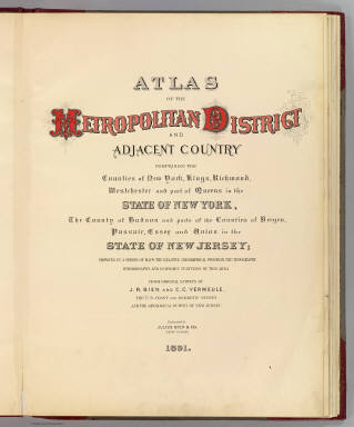
Full Title
(Title Page to) Atlas of the Metropolitan District and adjacent country comprising the counties of New York, Kings, Richmond, Westchester and part of Queens in the state of New York, the County of Hudson and parts of the counties of Bergen, Passaic, Essex and Union in the state of New Jersey ... From original surveys by J.R. Bien and C.C. Vermeule, the U.S. Coast and Geodetic Survey and the Geological Survey of New Jersey. Published by Julius Bien & Co. New York. 1891.
Publisher
Julius Bien
Author
Beers, Frederick W.
Full Title
Map of New York and Vicinity Accompanying Atlas of New York and Vicinity, Published by Beers, Ellis & Soule, 95 Maiden Lane, New York.
Publisher
Beers, Ellis & Soule
Author
[Beers, F. W. (Frederick W.), Watson & Co. (New York, N.Y.)]
Full Title
Portion of Yonkers and 24th ward. Portion of Bergen County, N.J. Copyrighted, 1891, by Watson & Co.
Publisher
Watson & Co.
Author
[Beers, F. W. (Frederick W.), Watson & Co. (New York, N.Y.)]
Full Title
Portion of Bergen County, N.J. Portion of city of Yonkers and Westchester County. Copyrighted, 1891, by Watson & Co.
Publisher
Watson & Co.
Author
[Beers, F. W. (Frederick W.), Watson & Co. (New York, N.Y.)]
Full Title
Portion of Rockland County. Portion of Westchester County. Copyrighted, 1891, by Watson & Co.
Publisher
Watson & Co.
Author
Beers, F. W. (Frederick W.)
Full Title
(Covers to) Atlas of the Hudson River Valley from New York City to Troy, including a section of about 8 miles in width. Published by Watson & Co., 278 Pearl Street and 36 Vesey Street, New York. Compiled from official records and careful surveys, under the supervision of F.W. Beers, C.E., 1891. Copyright 1891, by Watson & Co.
Publisher
Watson & Co.
Author
Beers, F. W. (Frederick W.)
Full Title
(Title Page to) Atlas of the Hudson River Valley from New York City to Troy, including a section of about 8 miles in width. Published by Watson & Co., 278 Pearl Street and 36 Vesey Street, New York. Compiled from official records and careful surveys, under the supervision of F.W. Beers, C.E., 1891. Copyright 1891, by Watson & Co.
Publisher
Watson & Co.
Author
Beers, F. W. (Frederick W.)
Full Title
Index to maps in Hudson River Valley atlas. Copyrighted 1891, by Watson & Co.
Publisher
Watson & Co.
Author
[Beers, F. W. (Frederick W.), Watson, Gaylord]
Full Title
Map of New-York, Brooklyn, Jersey City &c. Published by Gaylord Watson, 278 Pearl Street, New York. 1891.
Publisher
Watson & Co.
Author
[Beers, F. W. (Frederick W.), Watson, Gaylord]
Full Title
Watson's new map of New-York and adjacent cities. Published by Gaylord Watson, 278 Pearl Street, New York. 1891.
Publisher
Watson & Co.
Author
[Beers, F. W. (Frederick W.), Watson & Co. (New York, N.Y.)]
Full Title
Portion of Bergen County, N.J. Copyrighted, 1891, by Watson & Co.
Publisher
Watson & Co.
Author
Goodrich, S.G.
Full Title
New York. N. Jersey, Pennsylvania, Delaware & Maryland. G. Boynton Sc. Entered ... by S.G. Goodrich of Massachusetts. (Boston: Gray & Bowen ... 1831)
Publisher
Gray & Bowen
Author
Servoss, R. D.
Full Title
Section 2. Showing from Harlem northward to Yonkers, and eastward to Pelham Manor. Copyright 1895, by R.D. Servoss.
Publisher
R.D. Servoss.
Author
Servoss, R. D.
Full Title
Section 4. Showing from Yonkers northward to Tarrytown, and eastward to Hartsdale. Copyright 1895, by R.D. Servoss.
Publisher
R.D. Servoss.
Author
Servoss, R. D.
Full Title
Section 7. Showing from Tarrytown northward to Oscawana, and eastward to Merritt's Corners. Copyright 1895, by R.D. Servoss.
Publisher
R.D. Servoss.
Author
Servoss, R. D.
Full Title
Section 2. Showing from Harlem northward to Yonkers, and eastward to Pelham Manor. (1902)
Publisher
Isaac H. Blanchard Co.
Author
Servoss, R. D.
Full Title
Section 4. Showing from Yonkers northward to Tarrytown, and eastward to Hartsdale. (1902)
Publisher
Isaac H. Blanchard Co.
Author
[Paullin, Charles O., Wright, John K.]
Full Title
Plate 160. Military History. The American Revolution, 1775 - 1783. 1775 - 1776. 1777. 1778 - 1779. Naval Battles, 1776 - 1800, War of the Revolution and War with France. The South, 1778 - 1779. The South, 1780. New York and New Jersey, 1780, Greene's Campaigns, 1781. 1781, Yorktown, 1781.
Publisher
[Carnegie Institution of Washington, American Geographical Society of New York]
Author
Servoss, R. D.
Full Title
Section 7. Showing from Tarrytown northward to Oscawana, and eastward to Merritt's Corners. (1902)
Publisher
Isaac H. Blanchard Co.
Author
[United Air Lines, White, Ruth Taylor]
Full Title
Cleveland - New York. Allentown - Bethlehem - Philadelphia. Cleveland - New York. Suggestions to Air Travelers.
Publisher
United Air Lines
Author
[Cook, George Hammell, 1818-1889, Geological Survey of New Jersey, Smock, John Conover, Vermeule, C. C. (Cornelius Clarkson), 1858-1950]
Full Title
A topographical map of the valley of the Passaic with the country eastward to Newark and southward to the Raritan River. George H. Cook, State Geologist, John C. Smock, assistant geologist, C.C.Vermeule, topographer. 1885. Geological Survey of New Jersey. Atlas sheet no. 6, central red sandstone. Julius Bien & Co., Lith. (1888)
Publisher
Julius Bien
Author
[Cook, George Hammell, 1818-1889, Geological Survey of New Jersey, Smock, John Conover, Vermeule, C. C. (Cornelius Clarkson), 1858-1950]
Full Title
A topographical map of the counties of Bergen, Hudson and Essex, with parts of Passaic and Union. George H. Cook, State Geologist, John C. Smock, assistant geologist, C.C.Vermeule, topographer. 1884. Geological Survey of New Jersey. Atlas sheet no. 7, northeastern red sandstone. Julius Bien & Co., Lith., N.Y. (1888)
Publisher
Julius Bien
Author
[Cook, George Hammell, 1818-1889, Geological Survey of New Jersey, Vermeule, C. C. (Cornelius Clarkson), 1858-1950]
Full Title
A topographical map of the Monmouth shore with the interior from Metuchen to Lakewood. George H. Cook, State Geologist, C.C.Vermeule, topographer. 1886. Geological Survey of New Jersey. Atlas sheet no. 9, Monmouth shore. Julius Bien & Co., Lith. (1888)
Publisher
Julius Bien
|