Browse All

1895 11. Mt. Kisco-Yorktown-Cross River. County Atlas Section 11. Showing from Mount Kisco nor … |

1895 12. Trinity Lake-Ridgebury-Cross River-B … County Atlas Section 12. Showing from Trinity Lake no … |

1895 Cover: Road map Westchester Co., N.Y. County Atlas (Covers to) Sectional road map of Westch … |

1895 Title Page: Road map Westchester Co., N. … County Atlas (Title Page to) Sectional road map of We … |

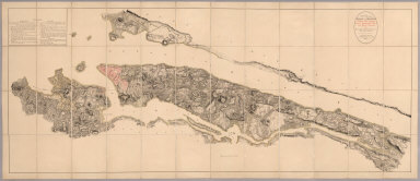
1902 Key map Westchester Co., N.Y. County Atlas Key map, showing the area covered by eac … |

1902 1. New York City. County Atlas Section 1. Showing the vicinity of New Y … |

1902 2. Harlem-Yonkers-Pelham Manor. County Atlas Section 2. Showing from Harlem northward … |

1902 3. Ft. Schuyler-Orienta-Glen Cove. County Atlas Section 3. Showing from Fort Schuyler no … |

1902 4. Yonkers-Tarrytown-Hartsdale. County Atlas Section 4. Showing from Yonkers northwar … |

1782 Composite: Steven's facsimile of British … [Manuscript Map, Separate Map] (Composite of) B.F. Steven's Facsimile o … |

1790 (Deed, New York) Ephemera (Deed from the state of New York, signed … |

1811 New York. World Atlas The State of New York, Compiled from the … |

1932 Plate 160. Military History. American Re … [Historical Atlas, National Atlas] Plate 160. Military History. The America … |

1804 A Map of the State Of New York. Case Map A Map of the State Of New York. By Simeo … |

1804 Cover: State of New York. Case Map (Covers to) A Map of the State Of New Yo … |

1782 Covers: Steven's facsimile of British he … Separate Map (Covers to) B.F. Steven's Facsimile of t … |

1782 Title: Steven's facsimile of British hea … Separate Map (Map Title Page to) B.F. Steven's Facsim … |
1782 Steven's facsimile of British head quart … [Manuscript Map, Separate Map] B.F. Steven's Facsimile of the Unpublish … |

1851 New York. National Atlas Atlas de Vereenigde Staten No. 3. De Sta … |

1885 New York National Atlas New York. (to accompany) Bradstreet's Po … |

1885 Map Peoples Line of Steamers. Timetable Map Peoples Line New Jersey Steamboat Co. be … |

1885 Text Page: Peoples Line. Timetable Map (Text Page to) Peoples Line New Jersey S … |

1918 Grand Central Terminal. Guide Book Grand Central Terminal of the New York C … |

1918 Heart of New York. Guide Book The heart of New York Grand Central Term … |

1918 Cover: Guide New York City. Guide Book (Covers to) A guide to New York City iss … |

1828 New York National Atlas New York. (to accompany) A New Pocket At … |

1902 5. Larchmont-Kensico Sta.-Hartsdale-Gree … County Atlas Section 5. Showing from Larchmont northw … |

1902 7. Tarrytown-Oscawana-Merritt's Corners. County Atlas Section 7. Showing from Tarrytown northw … |

1902 8. Kensico-Mt. Kisco-Pleasantville-Bedfo … County Atlas Section 8. Showing from Kensico northwar … |

1902 9. Darien-Trinity Lake-Stanwich-Wilton. County Atlas Section 9. Showing from Darien, Conn. no … |

1902 10. Croton Landing-Yorktown. County Atlas Section 10. Showing from Croton Landing … |

1902 11. Mt. Kisco-Yorktown-Cross River. County Atlas Section 11. Showing from Mount Kisco nor … |

1902 12. Trinity Lake-Ridgebury-Cross River-B … County Atlas Section 12. Showing from Trinity Lake no … |

1902 Cover: Road map Westchester Co., N.Y. County Atlas (Covers to) Servoss' sectional road map … |

1902 Title Page: Road map Westchester Co., N. … County Atlas (Title Page to) Servoss' sectional road … |

1939 Cleveland - New York. Allentown - Bethle … [Ephemera, Pamphlet] Cleveland - New York. Allentown - Bethle … |

1883 New York. World Atlas New York. (inset) Long Islands. Vicinity … |

1825 New York. World Atlas New York By H.S. Tanner. American Atlas. … |

1923 Covers: Map of New York : Patented Jan 4 … Case Map (Covers to) Map of New York : Patented J … |

1923 Map of New York : Patented Jan 4, 1921, … Case Map Map of New York : Patented Jan 4, 1921, … |

1838 New York World Atlas New York. (to accompany) A Comprehensive … |

1923 Map of New York : Patented Jan 4, 1921, … Case Map Map of New York : Patented Jan 4, 1921, … |

1891 Cover: Atlas Manhattan Island. City Atlas (Covers to) Atlas of the city of New Yor … |

1891 Contents: Sections, wards, blocks. City Atlas (Contents to) Atlas of the city of New Y … |

1891 Title Page: Atlas Manhattan Island. City Atlas (Title Page to) Atlas of the city of New … |

1891 Street index. City Atlas (Contents to) Atlas of the city of New Y … |

1891 Street index. City Atlas (Contents to) Atlas of the city of New Y … |

1891 Index map, legend. City Atlas Outline and index map of New York City. … |

1891 Pl. 1: ward 1. City Atlas Ward 1, New York City. (By Geo. W. & Wal … |

1891 Pl. 2: wards 2-6. City Atlas Part of wards 2, 3, 4, 5, & 6, New York … |