Browse All

1946 Nestucca River Entrance. [Aerial Photographs, Regional Atlas] Nestucca River Entrance. |

1946 Pacific City, Haystack Rock, Cape Kiwand … [Aerial Photographs, Regional Atlas] Pacific City, Haystack Rock, Cape Kiwand … |

1946 Sand Lake Entrance. [Aerial Photographs, Regional Atlas] Sand Lake Entrance. |

1946 Cape Lookout, [Aerial Photographs, Regional Atlas] Cape Lookout. |

1946 Netarts Bay. [Aerial Photographs, Regional Atlas] Netarts Bay. |

1946 Tillamook Bay Entrance. [Aerial Photographs, Regional Atlas] Tillamook Bay Entrance. |

1946 Nehalem entrance. [Aerial Photographs, Regional Atlas] Nehalem entrance. |

1946 Nehalem River. [Aerial Photographs, Regional Atlas] Nehalem River. |

1946 Smugglers Cove. [Aerial Photographs, Regional Atlas] Smugglers Cove. |

1946 Nehkahnie Mountain, Smugglers Cove. [Aerial Photographs, Regional Atlas] Nehkahnie Mountain, Smugglers Cove. |

1946 Catsops Plain. Tillamook Head. [Aerial Photographs, Regional Atlas] Catsops Plain. Tillamook Head. |

1946 Columbia River Entrance, Cape Disappoint … [Aerial Photographs, Regional Atlas] Columbia River Entrance, Cape Disappoint … |

1946 Clatsop Spit, Columbia River Estuary. [Aerial Photographs, Regional Atlas] Clatsop Spit, Columbia River Estuary. |

1946 Peacock Spit, Columbia River. [Aerial Photographs, Regional Atlas] Peacock Spit, Columbia River. |

1846 Oregon & Upper California. World Atlas Oregon and Upper California. Published b … |

1896 Pacific Coast Steamship Company. Timetable Map Map showing routes of the Pacific Coast … |

1896 Cover: Pacific Coast Steamship Co. Timetable Map (Covers to) Pacific Coast Steamship Co. … |

1896 Text Page: Pacific Coast Steamship Co. Timetable Map (Text Page to) Pacific Coast Steamship C … |

1857 California, Oregon, Washington, Utah, Ne … World Atlas A new map of the state of California, th … |

1846 A New Map of Texas Oregon and California … Pocket Map A New Map of Texas Oregon and California … |

1855 California, Oregon, Washington, Utah, Ne … World Atlas A new map of the state of California, th … |

1911 State Of Oregon. Pocket Map Map of the state of Oregon. Published by … |

1911 Cover: State of Oregon. Pocket Map (Covers to) Map of the state of Oregon. … |

1888 Land grant W. Wash. & N. Oregon. Pocket Map Map showing land grant of the Northern P … |

1888 Cover: Land grant W. Wash. & N. Oregon. Pocket Map (Covers to) Map showing land grant of th … |

1888 Text Page: Land grant W. Wash. & N. Oreg … Pocket Map (Text Page to) Map showing land grant of … |

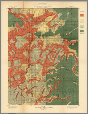
1900 Plate LXXII. Klamath Quadrangle, Oregon. … [Geologic Atlas, Geology Book] Plate LXXII. Klamath Quadrangle, Oregon. … |

1900 View: Plate LXXIII. Summit of Siskiyou M … [Geologic Atlas, Geology Book] (View) Plate LXXIII. A. Summit of Siskiy … |

1899 Plate LXXIV. Part of Southern Oregon Sho … [Geologic Atlas, Geology Book] Plate LXXIV. Part of Southern Oregon Sho … |

1900 View: Plate LXXV. Yellow-Pine Type of Fo … [Geologic Atlas, Geology Book] (View) Plate LXXV. A. B. Yellow-Pine Typ … |

1899 Plate LXXVI. Part of Southern Oregon Sho … [Geologic Atlas, Geology Book] Plate LXXVI. Part of Southern Oregon Sho … |

1900 View: Plate LXXVII. Yellow-Pine Forest E … [Geologic Atlas, Geology Book] (View) Plate LXXVII. A. Yellow-Pine Type … |

1900 View: Plate LXXVIII. Group of Red Firs, … [Geologic Atlas, Geology Book] (View) Plate LXXVIII. Group of Red Firs, … |

1900 View: Plate LXXIX. Burnt Alpine Hemlock, … [Geologic Atlas, Geology Book] (View) Plate LXXIX. A. B. Burnt Alpine H … |

1899 Plate LXXX. Part of Southern Oregon Show … [Geologic Atlas, Geology Book] Plate LXXX. Part of Southern Oregon Show … |

1900 View: Plate LXXXI. Logging Tracks and Lo … [Geologic Atlas, Geology Book] (View) Plate LXXXI. A. Logging Tracks an … |

1900 Plate LXXXII. Part of Southern Oregon Sh … [Geologic Atlas, Geology Book] Plate LXXXII. Part of Southern Oregon Sh … |

1900 View: Plate LXXXIII. Mount Pitt, from Pe … [Geologic Atlas, Geology Book] (View) Plate LXXXIII. A. Mount Pitt, fro … |

1899 Plate LXXXIV. Part of Southern Oregon Sh … [Geologic Atlas, Geology Book] Plate LXXXIV. Part of Southern Oregon Sh … |

1935 Oregon road map. Pocket Map 1935 road map Oregon. Prepared exclusive … |

1935 Western States road map. Pocket Map 1935 road map Western United States prep … |

1935 Cover: Oregon road map. Pocket Map (Covers to) 1935 road map Oregon. Prepar … |

1900 Plate CXXVI. Port Orford California, Ore … [Geologic Atlas, Geology Book] Plate CXXVI. Port Orford Quadrangle, Ore … |

1900 Plate CXXVII. Coos Bay Quadrangle, Orego … [Geologic Atlas, Geology Book] Plate CXXVII. Coos Bay Quadrangle, Orego … |
1900 Plate CXXVIII. Roseburg Quadrangle, Oreg … [Geologic Atlas, Geology Book] Plate CXXVIII. Roseburg Quadrangle, Oreg … |

1856 California, Oregon, Washington, Utah, Ne … World Atlas A new map of the state of California, th … |

1966 Faulted Structure. Youth. Modoc Point, O … Physical Atlas Faulted Structure. Youth. Modoc Point, O … |

1966 Vulcanism. Dikes-Neck-Caldera. Shiprock, … Physical Atlas Vulcanism. Dikes-Neck-Caldera. Shiprock, … |

1966 Eolian Activity. Coastal Dunes-Transvers … Physical Atlas Eolian Activity. Coastal Dunes-Transvers … |

1859 California, Territories of Oregon, Washi … World Atlas A New Map of the States of California, t … |