Browse All

1899 No. 22. Cebu. National Atlas No. 22. Cebu. Islas Filipinas Observator … |

1899 No. 23. Bohol. National Atlas No. 23. Bohol. Islas Filipinas Observato … |

1899 No. 24. Norte de Paragua. National Atlas No. 24. Norte de Paragua. Islas Filipina … |

1899 No. 25. Sur de Paragua, Balabac. National Atlas No. 25. Sur de Paragua, Balabac. Islas F … |

1899 No. 26. Mindanao Jolo. National Atlas No. 26. Mindanao Jolo. Islas Filipinas O … |

1899 No. 27. Mindanao Oriental. National Atlas No. 27. Mindanao Oriental. Islas Filipin … |

1899 No. 28. Mindanao Occidental, Jolo. National Atlas No. 28. Mindanao Occidental, Jolo. Islas … |

1899 No. 29. Bahia de Manila. National Atlas No. 29. Bahia de Manila. Islas Filipinas … |

1899 No. 30. Estrecho de Juanico. National Atlas No. 30. Estrecho de Juanico. Islas Filip … |

1952 Philippines -- Physical-Political. Wall Map Phillipines, Western Pacific Region. |

1825 Eastern I World Atlas Eastern I. London, Published Jany. 4.182 … |

1968 Southeast Asia -- Physical-Political Wall Map Southeast Asia. |

1955 East & Southeast Asia -- Physical Wall Map Hinterindien und Indonesien. |

1957 Australia and Polynesia -- Physical Wall Map Australien und Ozeanien. |

1764 Carte Des Isles Philippines Celebes et M … Chart Atlas Carte Des Isles Philippines Celebes et M … |

1764 Carte des Isles Philippines : Dressee su … Chart Atlas Carte des Isles Philippines : Dressee su … |

1764 Carte des Isles Philippines : Dressee su … Chart Atlas Carte des Isles Philippines : Dressee su … |

1764 Plan de la Baye de Manille Situee dans l … Chart Atlas Plan de la Baye de Manille situee dans l … |

1906 New Guinea. Philippine Islands. Tasmania … World Atlas New Guinea. Philippine Islands. Tasmania … |

1845 Eastern I World Atlas Eastern I. Re- Published, Jany st. 1845, … |

1848 East India Islands with Bengal Dependenc … World Atlas East India Islands with Bengal Dependenc … |

1865 Asiatic Archipelago. World Atlas Asiatic Archipelago. |

1827 Partie, Iles Philippines. Oceanique no. … World Atlas Partie des Iles Philippines. Oceanique n … |

1827 Partie, Iles Philippines. Oceanique no. … World Atlas Partie des Iles Philippines. Oceanique n … |

1827 Partie, Iles Philippines. Oceanique no. … World Atlas Partie des Iles Philippines. Oceanique n … |

1827 Partie, l'Ile Gilolo. Oceanique no. 15. World Atlas Partie de l'Ile Gilolo. Oceanique no. 15 … |

1827 Partie, la Chine. Asie 99. World Atlas Partie de la Chine. Asie no. 99. (Dresse … |

1832 East India Isles. World Atlas East India Isles. |

1831 E. India Islands. World Atlas East India Islands. Published by D. Liza … |

1883 Asiatic Archipelago. World Atlas Asiatic Archipelago. Letts's popular atl … |

1922 Malay Archipelago. World Atlas Malay Archipelago. (with Manila Region). … |

1929 Legend: 95-96. Indocina, Siam, Arcipelag … World Atlas (Legend to) Indocina, Siam e Arcipelago … |

1929 95-96. Indocina, Siam, Arcipelago Malese … World Atlas Indocina, Siam e Arcipelago Malese, Indo … |

1850 Ost-Indien Mit Den Inseln. (East Indies) … World Atlas No. XLVIII. Stieler's Hand-Atlas (No. 44 … |

1851 Die Ostindischen Inseln. (East Indies). World Atlas No. L. Stieler's Hand-Atlas (No. 44c). D … |

1850 Ost-Indien Mit Den Inseln. (East Indies) … World Atlas No. XLVIII. Stieler's Hand-Atlas (No. 44 … |

1852 Die Ostindischen Inseln. (East Indies). World Atlas No. L. Stieler's Hand-Atlas (No. 44c). D … |

1881 Ostindische Inseln (East Indies). World Atlas Stieler's Hand-Atlas No. 67. Ostindische … |

1808 East India Isles. World Atlas East India Isles. |

1817 East India Islands. World Atlas East India Islands. |

1806 The Islands of the East Indies with the … World Atlas The Islands of the East Indies with the … |

1806 The Islands of the East Indies with the … World Atlas The Islands of the East Indies with the … |

1875 Ost-Indien. World Atlas Ost-Indien. Gezeichnet von F. v. Stulpna … |

1773 Admiralty I. views. Exploration Book Three views of the Admiralty Isles. (wit … |

1773 Dangerous shoal. Exploration Book A dangerous shoal seen Septr. the 28, 17 … |
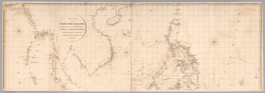
1812 Top sheet: Chart of the East India Islan … Chart Map (Top sheet of) Chart of the East India I … |

1812 Bottom sheet: Chart of the East India Is … Chart Map (Bottom sheet of) Chart of the East Indi … |

1812 Composite: Chart of the East India Islan … Chart Map (Composite of) Chart of the East India I … |

1935 Philippine Islands. National Atlas Philippine Islands. |

1747 East India Islands. Geography Book A new and accurate map of the East India … |