Who What Where WhenREMOVEWHO
WHEN
|
Author
Brown & Parsons
Full Title
(Covers to) Map Of Massachusetts, Connecticut And Rhode Island Constructed from the Latest Authorities. Published by Brown & Parsons Hartford, Ct. 1847.
Publisher
Brown & Parsons.
Author
Brown & Parsons
Full Title
Map Of Massachusetts, Connecticut And Rhode Island Constructed from the Latest Authorities. Published by Brown & Parsons Hartford, Ct. 1847.
Publisher
Brown & Parsons.
Author
Kenyon Company
Full Title
(Covers to) Map of New England ... Copyright 1920 The Kenyon Company, Inc., Map Makers Des Moines, Iowa. Principal Automobile Highways Shown Thus ... (inset) Eastern Portion Of Massachusetts. (on verso) Index of New England States, With Official 1920 Census...
Publisher
The Kenyon Company, Inc.
Author
Kenyon Company
Full Title
(Text page to) Map of New England ... Copyright 1920 The Kenyon Company, Inc., Map Makers Des Moines, Iowa. Principal Automobile Highways Shown Thus ... (inset) Eastern Portion Of Massachusetts. (on verso) Index of New England States, With Official 1920 Census...
Publisher
The Kenyon Company, Inc.
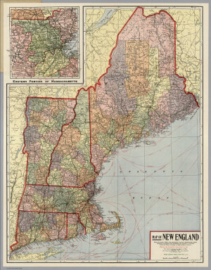
Author
Kenyon Company
Full Title
Map of New England ... Copyright 1920 The Kenyon Company, Inc., Map Makers Des Moines, Iowa. Principal Automobile Highways Shown Thus ... (inset) Eastern Portion Of Massachusetts. (on verso) Index of New England States, With Official 1920 Census...
Publisher
The Kenyon Company, Inc.
Author
Mitchell, Samuel Augustus Jr.
Full Title
County and township map of the states of Massachusetts, Connecticut and Rhode Island. Drawn and engraved by W.H. Gamble, Philadelphia. Entered ... 1874, by S. Augustus Mitchell ... Washington.
Publisher
S.A. Mitchell Jr.
Author
Mitchell, Samuel Augustus Jr.
Full Title
County and township map of the States of Massachusetts, Connecticut and Rhode Island. Drawn and Engraved by W.H. Gamble Philadelphia. Entered ... 1876 by S. Augustus Mitchell, . ... Washington.
Publisher
S.A. Mitchell Jr.
Author
Mitchell, Samuel Augustus
Full Title
Massachusetts and Rhode Island.
Publisher
Thomas, Cowperthwait & Co.
Author
Mitchell, Samuel Augustus
Full Title
Map of Massachusetts and Rhode Island: Published by Charles Desilver, No. 251 Market Street, Philadelphia. Entered ... 1856 by Charles Desilver ... Pennsylvania. (inset map) Boston.
Publisher
Charles DeSilver
Author
Hayward, James
Full Title
Plan of a survey for the proposed Boston and Providence rail way. By James Hayward. Jan. 1828. (engraved by) Annin & Smith. (to accompany) Report of the Board of Commissioners, of Internal Improvement in Relation to the Examination of Sundry Routes for a Railway from Boston to Providence.
Publisher
Board of Commissioners
Author
Johnson, A.J.
Full Title
Johnson's Massachusetts Connecticut And Rhode Island By Johnson & Browning. No. 18-19.
Publisher
Johnson and Browning
Author
National Map Company
Full Title
Massachusetts and Rhode Island. (Copyrighted by) National Map Company, Indianapolis. (to accompany) Official Paved Road and Commercial Survey of the United States. (inset) Boston.
Publisher
National Map Company
Author
Mitchell, Samuel Augustus Jr.
Full Title
County map of Massachusetts, Connecticut, and Rhode Island. Drawn & Eng'd. by W.H. Gamble. Entered ... 1867 by S. Augustus Mitchell, Jr. ... Pennsylvania.
Publisher
S.A. Mitchell Jr.
Author
[Hinton, Isaac Taylor, 1799-1847, Simpkin & Marshall]
Full Title
Map of the states of Massachusetts and Connecticut, and Rhode Island. (with) Plan of Boston &c. London, published Feb. 1, 1832 by I.T. Hinton & Simpkin & Marshall. Engraved & printed by Fenner Sears & Co. (1832)
Publisher
[Simpkin & Marshall, Thomas Wardle]
Full Title
Massachusetts and Rhode Island. Entered ... 1836, by Eleazer Huntington ... Connecticut.
Publisher
Reed & Barber
Author
Goodrich, S.G.
Full Title
Massachusetts. Rhode Island. G. Boynton Sc. Entered ... by S.G. Goodrich of Massachusetts. (Boston: Gray & Bowen ... 1831)
Publisher
Gray & Bowen
Author
Touring club italiano
Full Title
(Legend to) Stati Uniti, United States of America, Massachusetts, Connecticut, Rhode Island, New Jersey, Delaware, Maryland, con parte di Pennsylvania, New York, Vermont, New Hampshire. Propr. Artistico-letteraria del T.C.I. Ufficio cartografico del T.C.I. (1929)
Publisher
Touring club italiano
Full Title
County and township map of the states of Massachusetts, Connecticut and Rhode Island. Drawn and engraved by W.H. Gamble, Philadelphia. Copyright 1887 by Wm. M. Bradley & Bro. (1890)
Publisher
John Y. Huber & Co.
Full Title
Massachusetts, Rhode-Island and Connecticut. (with) Boston and its vicinity. N. & S.S. Jocelyn Sc. (New-Haven: N. & S.S. Jocelyn. 1823)
Publisher
N. & S.S. Jocelyn
Author
Greenleaf, Jeremiah
Full Title
Massachusetts. Rhode Island. And Connecticut.
Publisher
G.R. French
Author
Mitchell, Samuel Augustus
Full Title
County map of Massachusetts, Connecticut, and Rhode Island. Drawn and engraved by W.H. Gamble, Philada. Entered ... 1870 by S. Augustus Mitchell, Jr. ... Pennsylvania.
Publisher
[R.A. Campbell, S.A. Mitchell, Jr.]
Author
Mitchell, Samuel Augustus
Full Title
County and township map of the states of Massachusetts, Connecticut and Rhode Island. Drawn and engraved by W.H. Gamble, Philadelphia. Entered ... 1879 by S. Augustus Mitchell ... Washington. (1880)
Publisher
S.A. Mitchell
Author
[Bowen, Emanuel, Gibson, John]
Full Title
New England. (to accompany) Atlas Minimus or a New Set of Pocket Maps of the Several Empires, Kingdoms and States of the Known World, with Historical Extracts relative to each. Drawn and Engraved by J. Gibson from the Best Authorities, Revis'd, Corrected and Improv'd by Eman: Bowen Geographer to His Majesty.
Publisher
J. Newberry
Author
Mitchell, Samuel Augustus
Full Title
Map of Massachusetts and Rhode Island. Philadelphia, Published By Charles Desilver, No. 714 Chesnut Street. Entered according to Act of Congress in the year 1859 by Charles Desilver in the Clerk's office if the District Court of the Eastern District of Pennsylvania. 9.
Publisher
Charles Desilver.
Author
Scarborough Company
Full Title
Complete Road Atlas Massachusetts and Rhode Island. Published By The Scarborough Company, Boston, Mass. 144 Essex St. Copyright, 1905, By The Scarborough Company, Boston, Mass. ...
Publisher
The Scarborough Company
Author
Scarborough Company
Full Title
(Composite of) Sheets 1 - 5. Scarborough's Complete Road Atlas of Massachusetts and Rhode Island. Copyright, 1905, by the Scarborough Co., 144 Essex St. Boston, Mass.
Publisher
The Scarborough Company
Author
[Rand McNally and Company, State Farm Insurance Companies Travel Bureau]
Full Title
Rand McNally Road map, Connecticut, Massachusetts, Rhode Island. Copyright by Rand McNally & Company, Chicago, Ill. Lithographed in the U.S.A. (to accompany) State Farm Road Atlas: United States, Canada, Mexico,Central and South America. Copyright 1940 by Rand McNally & Company, Chicago, Ill.
Publisher
State Farm Insurance Companies Travel Bureau
Author
Cram, George Franklin
Full Title
Massachusetts, Rhode Island, & Connecticut.
Publisher
A.C. Shewey and Co.
Author
[Morse, Sidney E., Breese, S.]
Full Title
Massachusetts and Rhode Island. (to accompany) Supplement To The New-York Observer. The Cerographic Atlas Of The United States. No.3. 1845.
Publisher
Sidney E. Morse & Co.
Author
Gray, O.W.
Full Title
Gray's Atlas Map of Massachusetts and Rhode Island. (inset) Vicinity of Boston.
Publisher
Stedman, Brown & Lyon
Author
Finley, Anthony
Full Title
Map of Massachusetts, Connecticut, and Rhode Island, Constructed from the Latest Authorities.
Publisher
Anthony Finley
Author
[Gray, Frank A., Gray, O.W.]
Full Title
Gray's New Map of Massachusetts, Rhode Island, and Connecticut by Frank A. Gray. Copyright 1876 by O.W. Gray & Son. (inset) Boston.
Publisher
Stedman & Brown
Author
[Geological Survey (U.S.), Massachusetts. Topographical Survey Commission]
Full Title
Massachusetts-Rhode Island. Blackstone sheet. Preliminary edition subject to corrections. U.S. Geological Survey, J.W. Powell, Director. State of Massachusetts ... commissioners. Henry Gannett, Chief Geographer. Marcus Baker, geographer in charge. Triangulation by the U.S. Coast and Geodetic and Borden surveys. Topography by Laurence Thompson, under direction of Sumner H. Bodfish. Surveyed in 1886. Forbes Co., Boston & N.Y. (1890)
Publisher
Topographical Survey Commission
Author
[Geological Survey (U.S.), Massachusetts. Topographical Survey Commission]
Full Title
Massachusetts-Rhode Island. Franklin sheet. Preliminary edition subject to corrections. U.S. Geological Survey, J.W. Powell, Director. State of Massachusetts ... commissioners. Henry Gannett, Chief Geographer. Marcus Baker, geographer in charge. Triangulation by the U.S. Coast and Geodetic and Borden surveys. Topography by Sumner H. Bodfish and Van H. Manning, Jr. Surveyed in 1887. Forbes Co., Boston & N.Y. (1890)
Publisher
Topographical Survey Commission
Author
[Rand McNally and Company, State Farm Insurance Companies Travel Bureau]
Full Title
Rand McNally Road map: Connecticut, Massachusetts, Rhode Island. Copyright by Rand McNally & Company, Chicago, Ill. Lithorgaphed in the U.S.A. U.3614. (to accompany) State Farm road atlas : United States, Canada, Mexico.
Publisher
State Farm Insurance Companies Travel Bureau
Author
[Morse, Sidney E., Breese, Samuel]
Full Title
Massachusetts and Rhode Island. (By Sidney E. Morse and Samuel Breese. New York: Published by Harper & Brothers, 1845). (to accompany) Morse's Cerographic Maps. No. IX.
Publisher
Harper and Brothers
Author
Mitchell, Samuel Augustus
Full Title
Massachusetts And Rhode Island: (with) Boston. Published By S. Augustus Mitchell, N.E. corner of Market & 7th Street Philada., 1846. Entered ... 1846 by H.N. Burroughs ... Pennsylvania.
Publisher
S.A. Mitchell
Author
Mitchell, Samuel Augustus
Full Title
Map Of Massachusetts, Connecticut And Rhode Island Constructed from the Latest Authorities. Published by S. Augustus Mitchell Philadelphia. 1831. J.H. Young Sc.
Publisher
S.A. Mitchell
Author
Colton, G.W.
Full Title
Colton's Massachusetts and Rhode Island. (inset) Vicinity of Boston. Published By J. H. Colton. No. 172 William St. New York.
Publisher
J. H. Colton.
Author
Colton, G.W.
Full Title
Colton's Massachusetts, Connecticut and Rhode Island. Published by G. W & C. B. Colton & Co., No. 172 William St. New York.
Publisher
G. W & C. B. Colton & Co.
Author
Smith, J. Calvin
Full Title
(New York, New Jersey, Massachusetts, Connecticut, Rhode Island).
Publisher
Theodor Fischer
Author
Finley, Anthony
Full Title
Map of Massachusetts, Connecticut, and Rhode Island Constructed from the Latest Authorities. Drawn by D.H. Vance. Published by A. Finley, Philada. Engraved by J.H. Young.
Publisher
Anthony Finley
Author
Hammond, C.S.
Full Title
Southern New England. Massachusetts, Connecticut, and Rhode Island. 9357.
Publisher
Garden City Publishing Company, Inc.
Author
Johnson, A.J.
Full Title
Johnson's Vermont, New Hampshire, Massachusetts, Rhode Island, and Connecticut.
Publisher
Johnson and Ward
Author
Johnson, A.J.
Full Title
Johnson's Massachusetts, Connecticut, And Rhode Island, Published By Johnson and Ward. (inset) Vicinity of Boston.
Publisher
Johnson and Ward
Author
Gray, Ormando Willis
Full Title
Gray's Atlas Map of Massachusetts and Rhode Island. (inset) Vicinity of Boston.
Publisher
Stedman, Brown & Lyon
Author
Rand McNally and Company
Full Title
Commercial Atlas of America. Rand McNally Black and White Mileage Map, Connecticut, Massachusetts, and Rhode Island.
Publisher
Rand McNally and Company
Author
Tanner, Henry S.
Full Title
Massachusetts And Rhode Island: By H.S. Tanner. Engraved by J. & W.W. Warr. (with) Boston. Entered ... 1833 by H.S. Tanner ... Pennsylvania. Philadelphia Published by H.S. Tanner. (above neat line) Tanner's Universal Atlas.
Publisher
H.S. Tanner
Author
[Bartholomew, John, Black, Adam & Charles]
Full Title
New York, Vermont, New Hampshire, Rhode Island, Massachusetts & Connecticut. Published by A. & C. Black. Edinburgh. Printed in Colours by Schenck & Macfariane. Edinburgh. Drawn & Engraved by J. Bartholomew, Edinburgh.
Publisher
A. & C. Black
Author
Mitchell, Samuel Augustus Jr.
Full Title
County and township map of the states of Massachusetts, Connecticut and Rhode Island. Drawn and engraved by W.H. Gamble, Philadelphia. Copyright by S. Augustus Mitchell 1884.
Publisher
Wm. M. Bradley & Bro.
|