1856
Connecticut.
World Atlas
Connecticut With Portions Of New York &
…
|

1865
Massachusetts, Rhode Island, and Connect
…
World Atlas
Massachusetts, Rhode Island, and Connect
…
|

1953
Connecticut. Rhode Island.
World Atlas
Connecticut. Rhode Island. U.S. State.
|

1857
Connecticut with Portions of New York an
…
National Atlas
Connecticut with Portions of New York an
…
|

1893
30. Stonington sheet.
State Atlas
No. 30. Conn.-R.I.-N.Y. Stonington sheet
…
|

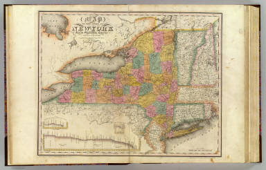
1832
New-York State, surrounding country.
State Atlas
Map of the State of New-York and the sur
…
|

1865
Connecticut with Portions of New York &
…
World Atlas
Colton's Connecticut with Portion of New
…
|

1852
New York, New Jersey, Massachusetts, Con
…
National Atlas
(New York, New Jersey, Massachusetts, Co
…
|

1924
Text Page: Rhode Island, New York - Geog
…
National Atlas
(Text Page) Rhode Island - Counties, Hil
…
|

1856
New York, Vermont, New Hampshire, Rhode
…
National Atlas
New York, Vermont, New Hampshire, Rhode
…
|

1889
Text Page: Rhode Island. New York.
National Atlas
(Text Page) Rhode Island. New York.
|