|
REFINE
Browse All : Images of San Francisco Bay Area (Calif.) and California
1-25 of 25
Author
Blum, George W.
Full Title
Untitled map of Sonoma, Marin, Lake, and Napa Counties.
Publisher
Geo. W. Blum
Author
La Perouse, Jean-Francois de Galaup, comte de, 1741-1788
Full Title
Plan du Port de St. Francois, situe sur la cote de la Californie Septentrionale. La Pointe des Rois par 37059' de latitude nord et 124054' de longitude occidentale. Atlas du Voyage de la Perouse no. 33. (Au Depot General de la Marine en 1828)
Publisher
Depot de la Marine
Author
Bache, A. D.
Full Title
Reconnaissance of the Western Coast of the United States from San Francisco to San Diego by the hydrographic party under the command of Lieut. James Alden, U.S.N., assistant. U.S. Coast Survey. A.D. Bache, Superintendent. Drawn by W.B. McMurtrie; reduction for engraving by W.M.C. Fairfax. Outlines & topography engraved by G. McCoy; views by G. McCoy & S.V. Hunt; lettering by W. Smith. Electrotype copy no. 6 by G. Mathiot, U.S.C.S. (with logo) U.S. Coast Survey Office.
Publisher
U.S.
Author
Rand McNally and Company
Full Title
Denver and vicinity. San Francisco and vicinity. Los Angeles and vicinity. Copyright by Rand McNally & Co., Chicago, Ill. (1927)
Publisher
Rand McNally
Author
Eddy, William M.
Full Title
(covers to) Approved and declared to be the official map of the State of California by an act of the Legislature passed March 25th 1853. Compiled by W.M. Eddy State Surveyor General. Published for R.A. Eddy, Marysville, California by J.H. Colton, No. 86 Cedar St. New York 1854. Authorities --- (with inset:) San Francisco and Adjoining Bays. Engraved on stone by Schedler & Liebler, 129 William St. New York. Printed by D. McLellan, 26 Spruce St. N.Y. Entered according to act of Congress in the year 1853 by Wm. M. Eddy in the Clerk's Office of the District Court of the United States for the Northern District of California.
Publisher
R.A. Eddy
Author
Eddy, William M.
Full Title
Approved and declared to be the official map of the State of California by an act of the Legislature passed March 25th 1853. Compiled by W.M. Eddy State Surveyor General. Published for R.A. Eddy, Marysville, California by J.H. Colton, No. 86 Cedar St. New York 1854. Authorities --- (with inset:) San Francisco and Adjoining Bays. Engraved on stone by Schedler & Liebler, 129 William St. New York. Printed by D. McLellan, 26 Spruce St. N.Y. Entered according to act of Congress in the year 1853 by Wm. M. Eddy in the Clerk's Office of the District Court of the United States for the Northern District of California.
Publisher
R.A. Eddy
Author
Thomas Bros. Maps
Full Title
State of California.
Publisher
Thomas Bros. Maps
Author
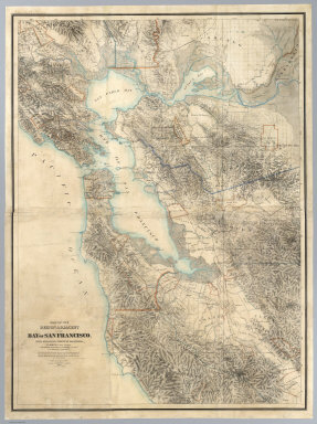
[Hoffmann, Charles F., Whitney, J.D., Geological Survey of California]
Full Title
Map Of The Region Adjacent To The Bay Of San Francisco. State Geological Survey Of California, J.D. Whitney, State Geologist. W. H. Brewer, W. M. Gabb, and A. Rémond, Assistants. C.F. Hoffman, Topographer. The Coast, Rancho, Township and Section Lines from Materials furnished by the U.S. Coast Survey and the U.S. Surveyor General's Office, the Topography chiefly from Original Surveys by C.F. Hoffman ... 1867. Engraved by Julius Bien, N.Y.
Publisher
Julius Bien
Author
Goddard, George H. (George Henry), 1817-1906
Full Title
Bird's-eye view of the city of San Francisco and surrounding country. Drawing by George H. Goddard, 1868. (1905)
Publisher
City of San Francisco
Author
U.S. Geological Survey
Full Title
San Francisco and vicinity, California. From Geological Survey atlas sheets surveyed in 1892-1913.
Publisher
U.S. Geological Survey
Author
California. State Earthquake Investigation Commission
Full Title
Map of the region about San Francisco Bay showing the relation of the city of San Francisco to the San Andreas Rift, the fault of April 18, 1906 and the fault of October 21, 1868. Earthquake Investigation Commission. Julius Bien & Co., Lith., N.Y. (Carnegie Institution of Washington. 1908)
Publisher
Carnegie Institution
Author
California. State Earthquake Investigation Commission
Full Title
Distribution of earth movement on April 18, 1906 and in 1868 as revealed by the displacement of the triangulation stations of the Coast and Geodetic Surveyed, determined by resurvey, 1906-07. Earthquake Investigation Commission. A. Hoen & Co., Baltimore. (Carnegie Institution of Washington. 1908)
Publisher
Carnegie Institution
Author
Touring club italiano
Full Title
Stati Uniti, United States of America, California, Nevada, Utah, Arizona. (with San Francisco, Oakland, Berkeley region). Propr. Artistico-letteraria del T.C.I. Ufficio cartografico del T.C.I. (1929)
Publisher
Touring club italiano
Author
[Ringgold, Cadwalader, 1802-1867, Stuart, F. D. (Fred. D.)]
Full Title
General chart embracing surveys of the Farallones, entrance to the Bay of San Francisco, bays of San Francisco and San Pablo, Straits of Carquines and Suisun Bay and the Sacramento and San Joaquin rivers to the cities of Sacramento and San Joaquin, California by Cadwalader Ringgold, Commander, U.S. Navy. 1850. Constructed, projected and drawn by Fred. D. Stuart, hydrographer, late of the U.S. Ex. Ex., assisted by Chas. Everett, Jr., draughtsman. Entered ... 1851, by Cadwalader Ringgold ... District of Columbia.
Publisher
Jno. T. Towers
Author
[Blunt, Simon F., Ringgold, Cadwalader, 1802-1867, Stuart, F. D. (Fred. D.)]
Full Title
Chart of the Farallones and entrance to the Bay of San Francisco, California by Cadwalader Ringgold, Commander, U.S. Navy. Assisted by Simon F. Blunt, Lieut. U.S. Navy, 1850. Constructed, projected and drawn by Fred. D. Stuart, hydrographer, late of the U.S. Ex. Ex. C.B. Graham, Lithr., Washington, D.C. Entered ... 1851, by Cadwalader Ringgold ... District of Columbia.
Publisher
Jno. T. Towers
Author
Goddard, George H. (George Henry), 1817-1906
Full Title
Birds eye view of the city of San Francisco and surrounding country. Drawn by George H. Goddard. Lith. Britton & Rey, S.F. Entered according to act of Congress in the year 1868 by Snow & May in the ... U.S. District Court for the Northern District of California.
Publisher
Snow & May
Author
Sheets, Millard
Full Title
The Panorama Today in Northern California its resources activities and opportunities. Published on its 100th. Anniversary by American Trust Company, San Francisco. Millard Sheets. Lithogravure in U.S.A.
Publisher
American Trust Company
Author
Sheets, Millard
Full Title
The Pageant of History in Northern California its colorful and adventurous beginnings. Published on its 100th. Anniversary by American Trust Company, San Francisco. Millard Sheets. Lithogravure in U.S.A.
Publisher
American Trust Company
Author
[H.M. Gousha Company, Standard Oil Company of California]
Full Title
(Covers to) Street map of San Francisco. Prepared for Standard Oil Company of California ... Copyright by the H.M. Gousha Company, Chicago, San Jose. Lithographed in U.S.A. Chevron Supreme Gasoline ... (1953)
Publisher
The H.M. Gousha Company
Author
[H.M. Gousha Company, Standard Oil Company of California]
Full Title
Map of San Francisco and vicinity prepared for Standard Oil Company of California. Copyright by the H.M. Gousha Company, Chicago-San Jose.
Publisher
The H.M. Gousha Company
Author
Rand McNally and Company
Full Title
Rand, McNally & Co.'s indexed atlas of the world map of San Francisco. Rand, McNally & Co.'s new business atlas map of San Francisco. Copyright, 1891 ... Rand, McNally & Co., Engravers, Chicago. (1897)
Publisher
Rand McNally
Author
Lange, Henry, 1821-1893.
Full Title
Bai San Francisco und Vereinigung des Sacramento mit dem San Joaquin. (with view) San Francisco. H. Lange's Atlas v. Nord Amerika Blatt XVIII. Braunschweig: Verlag v. George Westermann. Lith. Anst. von L. Kraatz in Berlin.
Publisher
George Westermann.
Author
La Perouse, Jean-Francois de Galaup, comte de, 1741-1788
Full Title
Plan du Port de St. Francois, situe sur la cote de la Californie Septentrionale. La Pointe des Rois par 37059' de latitude nord et 124054' de longitude occidentale. L. Aubert scripsit. Atlas du Voyage de la Perouse no. 33. (Paris: L'Imprimerie de la Republique, An V, 1797)
Publisher
L'Imprimerie de la Republique
Author
U.S. Coast and Geodetic Survey
Full Title
San Francisco entrance, California. Published at Washington, D.C. September, 1903. By the U.S. Coast and Geodetic Survey, O.H. Tittmann, Superintendent. ... Additions to topography from other sources to July, 1905.
Publisher
U.S. Coast and Geodetic Survey
Author
U.S. Coast and Geodetic Survey
Full Title
United States - West Coast. San Francisco entrance, California. United States of America Department of Commerce ... Published at Washington, D.C., Dec. 1926. By the U.S. Coast and Geodetic Survey. E. Lester Jones, Director.
Publisher
U.S. Coast and Geodetic Survey
1-25 of 25
|