Browse All

1896 Sonoma, Marin, Lake, and Napa Counties. Guide Book Untitled map of Sonoma, Marin, Lake, and … |

1797 Port de St. Francois. Chart Atlas Plan du Port de St. Francois, situe sur … |

1853 San Francisco-San Diego. Chart Atlas Reconnaissance of the Western Coast of t … |

1927 Denver, San Francisco, Los Angeles. National Atlas Denver and vicinity. San Francisco and v … |

1854 Cover: California official map. Pocket Map (covers to) Approved and declared to be … |

1854 Official map of the State of California. Pocket Map Approved and declared to be the official … |

1982 California -- Political: Counties. Wall Map State of California. |
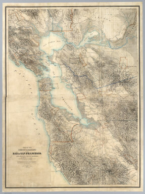
1867 Map Of The Region Adjacent To The Bay Of … Wall Map Map Of The Region Adjacent To The Bay Of … |

1905 Bird's-eye view, San Francisco. City Atlas Bird's-eye view of the city of San Franc … |

1915 San Francisco and vicinity, California Separate Map San Francisco and vicinity, California. … |

1908 San Francisco Bay showing San Andreas Ri … Physical Atlas Map of the region about San Francisco Ba … |

1908 Distribution of earth movement, April 18 … Physical Atlas Distribution of earth movement on April … |

1929 140-41. Calif., Nev., Utah, Ariz. World Atlas Stati Uniti, United States of America, C … |

1852 General chart, San Francisco Bay. Chart Map General chart embracing surveys of the F … |

1852 Farallones, San Francisco Bay. Chart Map Chart of the Farallones and entrance to … |

1868 San Francisco, surrounding country. [Separate Map, View] Birds eye view of the city of San Franci … |

1950 The Panorama Today in Northern Californi … Separate Map The Panorama Today in Northern Californi … |

1950 The Panorama Today in Northern Californi … Separate Map The Pageant of History in Northern Calif … |

1953 Cover: San Francisco street map. Pocket Map (Covers to) Street map of San Francisco. … |

1953 San Francisco and vicinity. Pocket Map Map of San Francisco and vicinity prepar … |

1897 San Francisco. World Atlas Rand, McNally & Co.'s indexed atlas of t … |

1854 Bai San Francisco und Vereinigung des Sa … National Atlas Bai San Francisco und Vereinigung des Sa … |

1797 Port de St. Francois. [Chart Atlas, World Atlas] Plan du Port de St. Francois, situe sur … |

1905 San Francisco entrance, California. Chart Map San Francisco entrance, California. Publ … |

1926 United States - West Coast. San Francisc … Chart Map United States - West Coast. San Francisc … |