Browse All

1883 Scotland 2. World Atlas Statistical map of Scotland. No. 2. Lett … |

1883 Scotland 3. World Atlas Statistical map of Scotland. No. 3. Lett … |

1883 Edinburgh. World Atlas Plan of the city of Edinburgh. Letts's p … |

1883 Geological, environs Edinburgh. World Atlas Geological map of the environs of Edinbu … |

1794 Gt. Britain, Ireland. World Atlas Great Britain and Ireland. Drawn from th … |

1794 Scotland (north) World Atlas A new and correct map of Scotland or Nor … |

1794 Scotland (south) World Atlas (A new and correct map of Scotland or No … |

1794 Composite: Scotland. World Atlas (Composite of) A new and correct map of … |

1804 Scotland. World Atlas Scotland. From Genl. Roy's map corrected … |

1804 Remote British Isles. World Atlas Remote British Isles. 1. Shetland Island … |

1812 Scotland. World Atlas Scotland. From Genl. Roy's map corrected … |

1929 Legend: 49-50. Irlandia, Scozia. World Atlas (Legend to) Irlandia, Ireland, Eirin. Sc … |

1929 49-50. Irlandia, Scozia. World Atlas Irlandia, Ireland, Eirin. Scozia, Scotla … |

1804 Scotland (outline) School Atlas Scotland ancient and modern. E.P. delint … |

1804 Scotland ancient, modern. School Atlas Scotland ancient and modern. E.P. delint … |

1820 Scotland. School Atlas Scotland. Philad. Published by M. Carey … |

1880 Ireland, Scotland. World Atlas Ireland in provinces and counties. Count … |

1890 Ireland, Scotland. World Atlas Ireland in provinces and counties. Count … |

1895 Scotland. World Atlas Scotland. (with) Orkney Islands. (with) … |

1821 Scotland. World Atlas Scotland. Published by J.V. Seaman, 296 … |

1840 Scotland. World Atlas Scotland. (with) two inset maps: Shetlan … |

1810 Scotland. Manuscript Map Scotland. (By Frances Bowen. 1810) |

1870 Ireland, Scotland. [State Atlas, World Atlas] Ireland in provinces and counties. Count … |

1835 Scotland. World Atlas Scotland. Fenner Sc., Paternoster Row. ( … |

1850 Composite: England und Wales, Schotland, … World Atlas (Composite of) No. XVII, XIX, XX. Stiele … |

1852 Die Brittischen Inseln und Die Nord-See. … World Atlas No. XVII. Stieler's Hand-Atlas (No. 15a. … |

1852 Schotland. (Scotland). World Atlas No. XIX. Stieler's Hand-Atlas (No. 15c.) … |

1796 Scotland. World Atlas Scotland with the Principal Roads from t … |

1795 Scotland. World Atlas Scotland with the Principal Roads from t … |

1758 Scotland World Atlas Scotland. (to accompany) Atlas Minimus o … |

1905 Ubersichtskarte von Groszbritannien und … World Atlas Ubersichtskarte von Groszbritannien und … |

1905 Schotiland World Atlas Schotiland. Juni. 1905. Bearbeitet von. … |

1859 Scotland. World Atlas Scotland. Entered according to Act of Co … |

1854 Geological, palaeontological map British … Physical Atlas Geological & palaeontological map of the … |

1854 Composite: Geological, palaeontological … Physical Atlas (Composite of) Geological & palaeontolog … |

1856 Ethnographic, Gt. Brit., Ireland. Physical Atlas Ethnographic map of Great Britain and Ir … |

1855 Britischen Inseln. World Atlas Die Britischen Inseln, oder die Vereinig … |

1853 Scotland. World Atlas Scotland, entworfen und gezeichnet von C … |
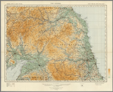
1921 Sheet 1. The Border. National Atlas Sheet 1. The Border. |

1807 Chart of Shetland Isles and Orkney Islan … Chart Map (Chart of Shetland Isles and Orkney Isla … |

1901 Index Map: Index to the Ordnance Survey … National Atlas (Index Map) Index to the Ordnance Survey … |

1901 Sheet 1. National Atlas Sheet 1. |

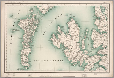
1901 Sheet 2. National Atlas Sheet 2. |

1901 Sheet 3. National Atlas Sheet 3. |

1901 Sheet 4. National Atlas Sheet 4. |

1901 Sheet 5. National Atlas Sheet 5. |

1901 Sheet 6. National Atlas Sheet 6. |
1902 Sheet 7. National Atlas Sheet 7. |

1902 Sheet 8. National Atlas Sheet 8. |

1902 Sheet 9. National Atlas Sheet 9. |