Browse All

1806 Hindoostan, Ceylon. World Atlas A new map of Hindoostan, from the latest … |

1886 India. World Atlas Colton's Hindostan or British India. Pub … |

1874 Hindostan. World Atlas Colton's Hindostan or British India. Pub … |

1861 India S. World Atlas India, southern sheet, by Keith Johnston … |

1861 Composite: India. World Atlas (Composite of) India ... by Keith Johnst … |

1862 Asie Meridionale. World Atlas Asie Meridionale, Inde Anglaise et Indo- … |

1855 Hindoostan World Atlas Hindoostan. Entered ... 1850 by Thomas C … |

1959 Index: India South, India North-East. Pl … World Atlas (Index to) India South, India North-East … |

1959 India South, India North-East. Plate 28, … World Atlas India South, India North-East. 1:4,000,0 … |

1959 Index: India North. Plate 29, V. II World Atlas (Index o) India North. Conic Projection, … |

1959 India North. Plate 29, V. II World Atlas India North. 1:4,000,000. The Geographic … |

1959 Index: India Plains Mt. Everest. Plate 3 … World Atlas (Index to) India Plains, Mt. Everest. La … |

1959 India Plains, Mt. Everest. Plate 30, V. … World Atlas India Plains, Mt. Everest. 1:2,000,000. … |

1824 Hindoostan World Atlas Hindoostan. Drawn by J. Wyld. (engraved … |

1827 Hindoostan. World Atlas Hindoostan. By Sidney Hall. London, publ … |

1828 Persia. World Atlas Persia. By Sidney Hall. London, publishe … |

1844 Vorder Indien, Hindostan. World Atlas Neueste Karte von Vorder Indien oder Hin … |

1870 Hindoostan and Farther India. World Atlas Johnson's Hindoostan and Farther India. … |

1856 Turchia Asiatica, Arabia, Persia, Afghan … World Atlas Turchia Asiatica, Arabia, Persia, Afghan … |

1959 Composite: India South, North-East, Nort … World Atlas (Composite of) Plates 28, 29, 30, 31, 32 … |

1812 Hindoostan. World Atlas Hindoostan. London, Published April 3d 1 … |

1901 North Western Frontier of India, Pamir R … World Atlas Map of the North Western Frontier of Ind … |

1901 India North. World Atlas (India and the adjacent parts of Beluchi … |

1901 India South. World Atlas India and the adjacent parts of Beluchis … |

1901 Composite: India. World Atlas (Composite of) India and the adjacent pa … |

1855 Vorderindien. World Atlas Vorderindien. Lithographie, Druck u. Ver … |

1845 Hindoostan. World Atlas Hindoostan. (Written and engraved by Jos … |

1836 Carte generale des Indes. World Atlas Carte generale des Indes en-deca et au-d … |

1832 India. World Atlas India, by J. Arrowsmith. London, pubd. 1 … |

1821 Carte generale des Indes. World Atlas Carte generale des Indes en-deca et au-d … |

1848 Hindostan. World Atlas Hindostan. |

1865 India. Classical Atlas India. (with) India ad mentem Ptolemaei. … |

1864 Ost Indien. World Atlas Ost Indien mit besonderer Berucksichtigu … |

1837 Asie Meridionale. World Atlas Asie Meridionale Comprenant L'Inde en De … |

1822 Ostindien. World Atlas Ostindien von C.G. Reichard. Nurnberg, b … |

1864 Map of India to Illustrate the Progress … World Atlas Map of India to Illustrate the Progress … |

1864 Greece, Turkey, Persia, India. School Atlas Greece, Turkey in Asia and Persia. India … |

1800 Les Indes Orientales. School Atlas Les Indes Orientales et leur archipel. A … |

1817 Hindoostan. World Atlas Hindoostan. (with) Isle of Ceylon. J. & … |

1817 N. Hindostan. World Atlas Northern Hindostan. (with) Cabul. (with) … |

1829 L'Inde. World Atlas Carte de l'Inde en deca et au dela du Ga … |

1831 Hindostan. World Atlas Hindostan. (with) Isle of Ceylon. Publis … |

1922 South-western Asia. World Atlas South-western Asia. The Edinburgh Geogra … |

1883 India. World Atlas General map of India. Letts's popular at … |
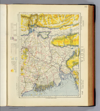
1883 India 8. World Atlas Statistical & general map of India. No. … |

1922 Persia. World Atlas Persia. The Edinburgh Geographical Insti … |

1922 Composite: Near East. World Atlas (Composite of) Section maps of the Near … |

1804 (Hindoostan north) World Atlas (A new map of Hindoostan from the latest … |

1804 Hindoostan (south) World Atlas A new map of Hindoostan from the latest … |

1804 Composite: Hindoostan. World Atlas (Composite of) A new map of Hindoostan f … |