Who What Where WhenREMOVEWHATShow More |
Author
U.S. General Land Office
Full Title
Department Of The Interior General Land Office J.A. Williamson, Commissioner. Territory Of Dakota. 1879. Compiled from the official Records of the General Land Office and other sources by C. Roeser, Principal Draughtsman G.L.O. Photo lith & print by Julius Bien 16 & 18 Park Place N.Y.
Publisher
Julius Bien
Author
Chicago and North Western Railway Company
Full Title
Map Of Chicago & North-Western Railway Lines (To) Dakota. (on verso) The Returns All In Better Than Ever This Year's Crop Reports From Along The Line Of The Chicago And North-Western Railway In Central And Southeastern Dakota ... Either Free Farms Or Cheap Farms Can now be had along or near the line of the Railroad ... Chas. N. Trivess, Printer, Chicago.
Publisher
Chas. N. Trivess, Printer
Author
Colton, G.W.
Full Title
Minnesota. Published By J.H. Colton & Co. No. 172 William St. New York. Entered ... 1855 by J.H. Colton & Co. ... New York. No. 49.
Publisher
J.H. Colton
Author
Hayden, F.V.
Full Title
(Title Page to) Geological Report of the Exploration of the Yellowstone and Missouri Rivers by Dr. F.V. Hayden, Assistant, under the direction of Captain (now Lieut. Col. and Brevet Brig. Gen.) W.F. Raynolds, Corps of Engineers, 1859-'60. Washington: Government Printing Office. 1869.
Publisher
U.S.
Author
Hayden, F.V.
Full Title
U.S. War Department Map Of The Yellowstone And Missouri Rivers And Their Tributaries explored by Capt. W.F. Raynolds Topl. Engrs. and 1st Lieut. H.E. Maynadier 10th Infy. Assistant. 1859-60. To accompany a report to the Bureau of Topographical Engineers. Lt. Col. Harman Bache in charge. Engraved in the Engineer Bureau War Dept. Prepared to accompany the Geological Report of F.V. Hayden M.D. ... Printed by Julius Bien, N.Y.
Publisher
Government Printing Office
Author
Rand McNally and Company
Full Title
Map of Dakota. Drawn From Official Plats Of Public Surveys, And Published In The Interest Of Immigration By The Chicago, Milwaukee & St. Paul Railway Co. Copyright, 1882, by Rand, McNally & Co., Map Publishers, Chicago, Ill. Rand, McNally & Co., Engr's Chicago ...
Publisher
Rand McNally
Author
Asher & Adams
Full Title
Asher & Adams' Dakota. Entered according to Act of Congress in the year 1874 by Asher & Adams ... at Washington. (New York, 1874)
Publisher
Asher and Adams
Author
Shell Oil Company
Full Title
Shell Map of North Dakota, South Dakota (cover title). Shell Highway Map of South Dakota. 9-W 1949-1.
Publisher
Shell Oil Company
Author
Peterson, E. Frank
Full Title
(Covers to) South Dakota by E. Frank Peterson, Lake Andes, S.D. Publisher Of The Illustrated Historical Atlas Of South Dakota ... Copyright 1906 By E. Frank Peterson. Huronite Printing Co., Huron, S.D. The Great State of South Dakota; the Land of Corn and Gold ... Riley's Land Agency Large List of Western Farm Lands For Sale ... Doland, South Dakota.
Publisher
E. Frank Peterson
Author
Peterson, E. Frank
Full Title
(Text Page) South Dakota by E. Frank Peterson, Lake Andes, S.D. Publisher Of The Illustrated Historical Atlas Of South Dakota ... Copyright 1906 By E. Frank Peterson. Huronite Printing Co., Huron, S.D. The Great State of South Dakota; the Land of Corn and Gold ... Riley's Land Agency Large List of Western Farm Lands For Sale ... Doland, South Dakota.
Publisher
E. Frank Peterson
Author
Peterson, E. Frank
Full Title
South Dakota by E. Frank Peterson, Lake Andes, S.D. Publisher Of The Illustrated Historical Atlas Of South Dakota ... Copyright 1906 By E. Frank Peterson. Huronite Printing Co., Huron, S.D. The Great State of South Dakota; the Land of Corn and Gold ... Riley's Land Agency Large List of Western Farm Lands For Sale ... Doland, South Dakota.
Publisher
E. Frank Peterson
Author
Vandermaelen, Philippe, 1795-1869
Full Title
Partie des Etats Unis. Amer. Sep. no. 40. Dessinee par H. Ghiesbreght. (Dresse par Ph. Vandermaelen, lithographie par H. Ode. Quatrieme partie. - Amer. sept. Bruxelles. 1827)
Publisher
Ph. Vandermaelen
Author
Scott, Samuel
Full Title
(Covers to) Map Of The Black Hills Of South Dakota And Wyoming With Full Descriptions Of Mineral Resources, Etc. By Samuel Scott, M.E. Custer City, S.D. 1897 ... (on verso) Copyrighted 1896 By Samuel Scott, M.E. E.P. Noll & Co. Map Publishers No. 9 N. Sixth St., Philadelphia, Pa. (with) Map Of The Black Hills Of South Dakota & Wyoming. 1897. By Samuel Scott Mining Engineer, Custer, S.D. Copyrighted 1896, by Samuel Scott, M.E. (untitled inset map of the Deadwood vicinity).
Publisher
E.P. Noll
Author
Scott, Samuel
Full Title
(Title Page to) Map Of The Black Hills Of South Dakota And Wyoming With Full Descriptions Of Mineral Resources, Etc. By Samuel Scott, M.E. Custer City, S.D. 1897 ... (on verso) Copyrighted 1896 By Samuel Scott, M.E. E.P. Noll & Co. Map Publishers No. 9 N. Sixth St., Philadelphia, Pa. (with) Map Of The Black Hills Of South Dakota & Wyoming. 1897. By Samuel Scott Mining Engineer, Custer, S.D. Copyrighted 1896, by Samuel Scott, M.E. (untitled inset map of the Deadwood vicinity).
Publisher
E.P. Noll
Author
Scott, Samuel
Full Title
Map Of The Black Hills Of South Dakota And Wyoming With Full Descriptions Of Mineral Resources, Etc. By Samuel Scott, M.E. Custer City, S.D. 1897 ... (on verso) Copyrighted 1896 By Samuel Scott, M.E. E.P. Noll & Co. Map Publishers No. 9 N. Sixth St., Philadelphia, Pa. (with) Map Of The Black Hills Of South Dakota & Wyoming. 1897. By Samuel Scott Mining Engineer, Custer, S.D. Copyrighted 1896, by Samuel Scott, M.E. (untitled inset map of the Deadwood vicinity).
Publisher
E.P. Noll
Author
Cram, George Franklin
Full Title
Railroad and County Map of Dakota. Geo. F. Cram. Engraver and Publisher, Chicago.
Publisher
George F. Cram
Author
Colton, G.W.
Full Title
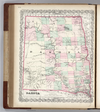
Colton's Dakota. Published By G. W & C. B. Colton & Co. No. 182 William St. New York.
Publisher
G. W & C. B. Colton & Co.
Author
Colton, G.W.
Full Title
Colton's Dakota. Published By G. W & C. B. Colton & Co. No. 172 William St. New York.
Publisher
G. W & C. B. Colton & Co.
Author
Colton, G.W.
Full Title
Colton's Map of Kansas, Nebraska, Dakota & Indian Territory. Published by G.W. & C.B. Colton & Co., No. 172 William St. New York.
Publisher
G.W. & C.B. Colton
Author
Rand McNally and Company
Full Title
(Covers to) Rand, McNally & Co.'s South Dakota. Rand, McNally & Co., Map Publishers and Engravers, Chicago, 1906. Copyright, 1906, ... 1898, ... 1895 ...
Publisher
Rand McNally & Co.
Author
Rand McNally and Company
Full Title
Rand, McNally & Co.'s South Dakota. Rand, McNally & Co., Map Publishers and Engravers, Chicago, 1906. Copyright, 1906, ... 1898, ... 1895 ...
Publisher
Rand McNally & Co.
Author
Rand McNally and Company
Full Title
(Covers to) Rand McNally & Co.'s Dakota. Copyright, 1882, by Rand, McNally & Co., Map Publishers, Chicago, Ill. Rand, McNally & Co., Engr's. Chicago. (with 15 page index) Rand McNally & Co.'s Indexed County And Township Map Of Dakota... Chicago, U.S.A.: Rand, McNally & Co. ... (on verso) Entered ... 1882, by Rand, McNally & Co. ... Washington.
Publisher
Rand McNally & Co.
Author
Rand McNally and Company
Full Title
(Title page to) Rand McNally & Co.'s Dakota. Copyright, 1882, by Rand, McNally & Co., Map Publishers, Chicago, Ill. Rand, McNally & Co., Engr's. Chicago. (with 15 page index) Rand McNally & Co.'s Indexed County And Township Map Of Dakota... Chicago, U.S.A.: Rand, McNally & Co. ... (on verso) Entered ... 1882, by Rand, McNally & Co. ... Washington.
Publisher
Rand McNally & Co.
Author
Rand McNally and Company
Full Title
Rand McNally & Co.'s Dakota. Copyright, 1882, by Rand, McNally & Co., Map Publishers, Chicago, Ill. Rand, McNally & Co., Engr's. Chicago. (with 15 page index) Rand McNally & Co.'s Indexed County And Township Map Of Dakota... Chicago, U.S.A.: Rand, McNally & Co. ... (on verso) Entered ... 1882, by Rand, McNally & Co. ... Washington.
Publisher
Rand McNally & Co.
Author
[Colton, J. H., Warren, Gouverneur Kemble, 1830-1882, Redpath, James, Hinton, Richard J]
Full Title
(Covers to) Hand Book To Kansas Territory And The Rocky Mountains' Gold Region; Accompanied By Reliable Maps and a Preliminary Treatise on the Pre-emption Laws of the United States. By James Redpath and Richard J. Hinton, of Kansas. New York: J.H. Colton, Publisher, 172 William Street. 1859. (on verso) Entered ... in the year 1859, (Published) by J.H. Colton ... New York.
Publisher
J. H. Colton.
Author
[Colton, J. H., Warren, Gouverneur Kemble, 1830-1882, Redpath, James, Hinton, Richard J]
Full Title
Catalog) Hand Book To Kansas Territory And The Rocky Mountains' Gold Region; Accompanied By Reliable Maps and a Preliminary Treatise on the Pre-emption Laws of the United States. By James Redpath and Richard J. Hinton, of Kansas. New York: J.H. Colton, Publisher, 172 William Street. 1859. (on verso) Entered ... in the year 1859, (Published) by J.H. Colton ... New York.
Publisher
J. H. Colton.
Author
[Colton, J. H., Warren, Gouverneur Kemble, 1830-1882, Redpath, James, Hinton, Richard J]
Full Title
(Title Page to) Hand Book To Kansas Territory And The Rocky Mountains' Gold Region; Accompanied By Reliable Maps and a Preliminary Treatise on the Pre-emption Laws of the United States. By James Redpath and Richard J. Hinton, of Kansas. New York: J.H. Colton, Publisher, 172 William Street. 1859. (on verso) Entered ... in the year 1859, (Published) by J.H. Colton ... New York.
Publisher
J. H. Colton.
Author
[Colton, J. H., Warren, Gouverneur Kemble, 1830-1882, Redpath, James, Hinton, Richard J]
Full Title
Kansas and Nebraska. 1859. (inset map) Nebraska and Kansas, Showing Pikes Peak And The Gold Region. 1859. (Published) by J.H. Colton & Co., 172 William St., New York.
Publisher
J. H. Colton.
Author
[Colton, J. H., Warren, Gouverneur Kemble, 1830-1882, Redpath, James, Hinton, Richard J]
Full Title
Military Map of Parts of Kansas, Nebraska and Dakota. By Lieut. G.K. Warren Top. Engrs. from the Explorations made by him in 1855, 56 & 57. (Published) by J.H. Colton & Co., 172 William St., New York.
Publisher
J. H. Colton.
Author
Cram, George Franklin
Full Title
South Dakota.
Publisher
George F. Cram
Author
U.S. General Land Office
Full Title
Department Of The Interior General Land Office N.C. McFarland, Commissioner. Territory Of Dakota. 1882. Compiled from the official Records of the General Land Office and other sources by C. Roeser, Principal Draughtsman G.L.O. Photo lith & print by Julius Bien & Co. 16 & 18 Park Place N.Y.
Publisher
Julius Bien & Co.
Author
Rand McNally and Company
Full Title
Map Of Dakota Printed Expressly For E.P. Gates, President Merchants' Bank, and Negotiator of Farm Loans, Grand Forks, Dakota. Rand, McNally & Co., Engravers, Chicago.
Publisher
Rand McNally and Co.
Author
U.S. General Land Office
Full Title
Department Of The Interior General Land Office S.S. Burdett, Commissioner. Territory Of Dakota. 1876. Compiled from the official Records of the General Land Office and other sources by C. Roeser, Principal Draughtsman G.L.O. Photo lith & print by Julius Bien 16 & 18 Park Place N.Y.
Publisher
Julius bien
Author
Mitchell, Samuel Augustus Jr.
Full Title
County Map of Colorado, Wyoming, Dakota, Montana.
Publisher
Ziegler & McCurdy
Author
Johnson, A.J.
Full Title
Johnson's Nebraska, Dakota, Colorado, Idaho, Kansas. By Johnson And Ward.
Publisher
Johnson and Ward
Author
Johnson, A.J.
Full Title
Johnson's Minnesota and Dakota By Johnson and Ward.
Publisher
Johnson and Ward
Author
[Jones, C.H., Hamilton, T.H., Williams, J.David]
Full Title
Map of Nebraska, Dakota, Montana, and Wyoming
Publisher
J. David Williams
Author
[Bayer, Herbert, Container Corporation of America]
Full Title
North Dakota. South Dakota. U.S. States.
Publisher
Container Corporation of America
Author
Colton, G.W. & C.B.
Full Title
Map showing the Route of the Duluth & Winnipeg Railroad And Its Connections. Prepared By G.W. & C.B. Colton & Co. 182 William Street New York. Entered ... 1881 by G.W. & C.B. Colton & Co. ... Washington.
Publisher
G.W. & C.B. colton & Co.
Author
[Lloyd, H.H., Warner & Beers]
Full Title
Atlas of the United States, Map of the Territory of Dakota, and the States of Minnesota, and Nebraska. Warner & Beers, Publishers. From H.H. Lloyd & Co.'s Atlas of the United States.
Publisher
Warner & Beers
Author
Page, H.R. & Co.
Full Title
(Text) Government Lands (continued). (Index Page) Guide to Dakota.
Publisher
H.R. Page & Co.
Author
Page, H.R. & Co.
Full Title
Page's Map of Dakota, 1885. Copyrighted 1880 by H.R. (Page).
Publisher
H.R. Page & Co.
Author
Johnson, A.J.
Full Title
Johnson's Nebraska, Dakota, Idaho, Montana and Wyoming. Entered ... 1865.
Publisher
A.J. Johnson
Author
[Michler, Nathaniel, United States. War Department]
Full Title
Fredericksburg. Prepared by Bvt. Brig. Gen. N. Michler ... by order of ... A.A. Humphreys. 1867. (with) Map exhibiting the route of the Sioux Expedition under the command of Brig. Gen. H.H. Sibley, 1863. Compiled and projected by John H. Wagner ... (with) Map of the fight of the 14th A.C. at Buzzard Roost, Ga., February 24th, 25th and 26th, 1864 by Theo. Wiseman, A.A. ... (with) Sketch of battle of Big Mound, fought July 24th, 1863 by the expeditionary forces commanded by Brigadier General H.H. Sibley. Sketched and drawn by Joseph McCloud. (with) Sketch of the battle at Dead Buffalo Lake, July 26th, 1863, commanded by Brig. Gen. H.H. Sibley. (with) Map accompanying report of the battle of Dry Fork Creek, Mo., on the 5th of July, 1861 ... report of Capt. T.W. Sweeny ... Julius Bien & Co., Lith., N.Y. (1891-1895)
Publisher
U.S. Government Printing Office
Author
Asher & Adams
Full Title
Asher & Adams' Dakota. Entered according to Act of Congress 1875 by Asher & Adams in the Office of the Librarian of Congress at Washington.
Publisher
Asher & Adams.
Author
Cram, George Franklin
Full Title
South Dakota. Geo. F. Cram, Engineer, Chicago. (1909)
Publisher
E.A. Davis
Author
Rand McNally and Company
Full Title
Rand McNally junior auto road map South Dakota. Copyright by Rand McNally & Company, Chicago, Ill. (1927)
Publisher
Rand McNally
Author
Stevens, Isaac I.
Full Title
Riviere Des Lacs to the Rocky Mountains; from Explorations and Surveys made under the direction of the Hon. Jefferson Davis Secretary of War by Isaac I. Stevens, Governor of Washington Territory 1853-4. Explorations and surveys for a railroad route from the Mississippi River to the Pacific Ocean. War Department. Route near the 47th and 49th parallels. Map No. 2. Engr. by Selmar Siebert.
Publisher
[A.O.P. Nicholson I-XI, T. Ford XII.]
Author
Rice, G. Jay
Full Title
Rice's Sectional Map Of Dakota. Published by the St. Paul Lithog. & Eng. Co. 1878. St. Paul, Minnesota. Copyright 1875 by G. Jay Rice.
Publisher
St. Paul Lithog & Eng. Co.
Author
Thayer, H. L.
Full Title
(Covers to) Thayer's Map of the Black Hills & Big Horn Country. Published By H.L Thayer Denver, Colorado. Carefully prepared from the Official Maps of the General Land Office. Explorations of Capt. Wm. Ludlow and from latest Maps of the routes of General Custer and other Officers of the Army, furnished by Capt. W.S. Stanton Chief Engr. Dept. of the Platte and from the Engineer Dept. at Washington. Entered ... 1877 by H.L. Thayer ... Washington. Edward Rollandet, Draftsman.
Publisher
H.L. Thayer
|