Browse All

1929 Legend: 95-96. Indocina, Siam, Arcipelag … World Atlas (Legend to) Indocina, Siam e Arcipelago … |

1929 95-96. Indocina, Siam, Arcipelago Malese … World Atlas Indocina, Siam e Arcipelago Malese, Indo … |

1895 India South, Burma, Malay Peninsula. World Atlas India, South. Burma and the Malay Penins … |

1881 Hinterindien, Malayische Archipel. World Atlas Hinterindien und der Malayische Archipel … |

1787 Empire du Mogol. School Atlas Empire du Mogol. (1787) |

1752 Carte de l'Inde. (Northern section). World Atlas Carte de l'Inde. (Northern section). Dre … |

1752 (Carte de l'Inde. Southern section). World Atlas (Carte de l'Inde. Southern section. Dres … |

1752 Composite: l'Inde. World Atlas (Composite of) Carte de l'Inde. Dressee … |

1765 Ad antiquam Indiae geographiam tabula. World Atlas Ad antiquam Indiae geographiam tabula. A … |

1850 Ost-Indien Mit Den Inseln. (East Indies) … World Atlas No. XLVIII. Stieler's Hand-Atlas (No. 44 … |

1850 Ost-Indien Mit Den Inseln. (East Indies) … World Atlas No. XLVIII. Stieler's Hand-Atlas (No. 44 … |
1812 Top sheet: Chart of the East India Islan … Chart Map (Top sheet of) Chart of the East India I … |

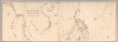
1812 Bottom sheet: Chart of the East India Is … Chart Map (Bottom sheet of) Chart of the East Indi … |

1812 Composite: Chart of the East India Islan … Chart Map (Composite of) Chart of the East India I … |

1818 Covers: Asia, SE section only Case Map (Covers to) Asia, SE section only |

1818 Asia, SE section only Case Map Asia, SE section only |

1944 Map V. Southeastern Asia Separate Map [World War II battlefronts]. Map V. Sout … |

1747 Mogul Empire, India. Geography Book A new and accurate map of the Empire of … |

1791 Indes Orientales. World Atlas Les Indes Orientales et leur archipel. A … |

1771 Indes I. World Atlas (Carte hydro-geo-graphique des Indes Ori … |

1771 Indes II. World Atlas (Carte hydro-geo-graphique des Indes Ori … |

1771 Indes III. World Atlas Carte hydro-geo-graphique des Indes Orie … |

1771 Indes IV. World Atlas (Carte hydro-geo-graphique des Indes Ori … |

1771 Composite: Indes. World Atlas (Composite of) Carte hydro-geo-graphique … |

1865 Japan. Nippon, Kiusiu, Sikok, Yesso and … World Atlas Colton's Japan. Nippon, Kiusiu, Sikok, Y … |

1869 Japan. Nippon, Kiusiu, Sikok, Yesso and … World Atlas Colton's Japan, Nippon, Kiusiu, Sikok, Y … |

1967 South-East Asia. Pergamon World Atlas. World Atlas South-East Asia. Pergamon World Atlas. P … |

1752 Asie 2. World Atlas Seconde partie de la carte d'Asie, conte … |

1884 Hindoostan, Farther India, China, Tibet. World Atlas Map of Hindoostan, Farther India, China … |

1813 East India Isles. World Atlas East India Isles. Drawn under the direct … |

1886 Hindoostan, Farther India, China, Tibet. World Atlas Map of Hindoostan, Farther India, China … |

1851 Malay Archipelago, Or East India Islands … World Atlas Malay Archipelago, Or East India Islands … |

1897 China, Indo-China, Malaysia. World Atlas Rand, McNally & Co.'s new 14 x 21 map of … |

1751 Indes Orientales. World Atlas Les Indes Orientales, ou sont distingues … |

1750 Indes Orientales. World Atlas Archipel des Indes Orientales, qui compr … |