Browse All

1929 145-46. Ark., Tenn., La., Miss., Fla., A … World Atlas Stati Uniti, United States of America, A … |

1903 52. Center Negro population 1880-1900. Statistical Atlas Sketch map showing the position of the c … |

1890 Kentucky, Tennessee. World Atlas County map of Kentucky and Tennessee. Co … |

1823 Kentucky, Tennessee. National Atlas Kentucky and Tennessee. N. & S.S. Jocely … |

1796 Tennassee: lately the S.Wn. Territory. National Atlas Tennassee: lately the S.Wn. Territory. W … |

1870 Kentucky, Tennessee. [State Atlas, World Atlas] County map of Kentucky, and Tennessee. E … |

1880 Kentucky, Tennessee. World Atlas County map of Kentucky and Tennessee. Dr … |

1840 Kentucky And Tennessee. World Atlas Kentucky And Tennessee. |

1811 Tennassee. World Atlas A Map of The Tennassee State formerly Pa … |

1823 Kentucky, Tennessee. World Atlas Kentucky, Tennessee. By H.S. Tanner. Pub … |

1823 Kentucky, Tennessee and part of Illinois … World Atlas Kentucky, Tennessee and part of Illinois … |

1833 Kentucky and Tennessee. World Atlas Kentucky and Tennessee. By H.S. Tanner. … |

1795 Map of The Tennassee State. World Atlas A Map of The Tennassee State formerly Pa … |

1796 Map of The Tennassee State. World Atlas A Map of The Tennassee State formerly Pa … |

1862 Tennessee. World Atlas The Tourist's Pocket Map of the State of … |

1940 Road map of Kentucky-Tennessee National Atlas Rand McNally Road map, Kentucky - Tennes … |

1822 Kentucky and Tennessee School Atlas Kentucky and Tennessee. Young & Delleker … |

1851 Tennessee, Alabama en Florida. National Atlas Atlas de Vereenigde Staten No. 7. Tennes … |

1885 Tennessee National Atlas Tennessee. (to accompany) Bradstreet's P … |

1828 Kentucky and Tennessee National Atlas Kentucky and Tennessee. (engraved by) J. … |

1883 New Rail Road and County Map of Kentucky … World Atlas New Rail Road and County Map of Kentucky … |

1825 Kentucky And Tennessee. World Atlas Kentucky And Tennessee By H.S. Tanner. I … |

1838 Tennessee World Atlas Tennessee. (to accompany) A Comprehensiv … |

1845 Kentucky and Tennessee National Atlas Kentucky and Tennessee. (to accompany) S … |

1845 Kentucky and Tennessee National Atlas Kentucky and Tennessee. Entered ... 1845 … |

1873 Kentucky and Tennessee. World Atlas Gray's Atlas Map of Kentucky and Tenness … |

1827 Kentucky and Tennessee. National Atlas Map of Kentucky and Tennessee, Construct … |

1876 Kentucky and Tennessee. National Atlas Gray's New Map of Kentucky and Tennessee … |

1878 Kentucky and Tennessee. National Atlas Cram's Rail Road & Township Map of Kentu … |

1895 Island No. 10, New Madrid. Military Atlas Map showing the system of rebel fortific … |

1895 Forts Henry & Donelson. Military Atlas Plan of Fort Henry and its outworks. Dra … |

1891 Map of Kentucky and Tennessee. 66 World Atlas Map of Kentucky and Tennessee. Copyright … |
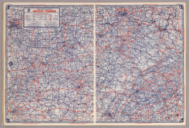
1939 Rand McNally Road map: Kentucky - Tennes … National Atlas Rand McNally Road map: Kentucky - Tennes … |

1846 New Map Of Tennessee. World Atlas A New Map Of Tennessee With its Roads An … |

1891 Covers: (Kentucky, Tennessee) Railroad M … Case Map (Covers to) Rand, McNally & Co.'s New Sh … |

1891 (Kentucky, Tennessee) Railroad Map of th … Case Map Rand, McNally & Co.'s New Shippers' Rail … |

1861 Cover: Panorama, Seat of War, Kentucky, … View (Covers to) Panorama of the Seat of War. … |

1861 Kentucky And Tennessee. View Panorama of the Seat of War. Birds Eye V … |

1862 Cover: Country between Monterey, Tenn. & … Separate Map (Cover to) Map Of The Country Between Mo … |

1862 Map Of The Country Between Monterey, Ten … Separate Map Map Of The Country Between Monterey, Ten … |

1862 Map Of The Field Of Shiloh, Near Pittsbu … Separate Map Map Of The Field Of Shiloh, Near Pittsbu … |

1861 Important Operations in Kentucky and Ten … Newspaper Important Operations in Kentucky and Ten … |

1861 The Seat of War in the West. Newspaper The Seat of War in the West. New York He … |

1796 Plan Of Fort Des Ecores at Margot. National Atlas Plan Of Fort Des Ecores at Margot. PL. 3 … |

1795 Map of The Tennassee (sic) Government. National Atlas A Map of The Tennassee (sic) Government … |

1823 Kentucky, Tennessee and part of Illinois … World Atlas Kentucky, Tennessee and part of Illinois … |

1889 New York, Delaware, Tennessee, New Hamps … National Atlas New York, Delaware, Tennessee, New Hamps … |

1894 Post Route Map Of Kentucky And Tennessee Pocket Map Post Route Map Of The States Of Kentucky … |

1894 Covers: Post Route Map Of Kentucky And T … Pocket Map (Covers to) Post Route Map Of The States … |

1967 203-204. United States of America, South … World Atlas 203-204. United States of America, South … |