Who What Where WhenREMOVEWHAT
|
Author
Cram, George Franklin
Full Title
Texas. (inset) (Texas Panhandle).
Publisher
George F. Cram
Author
[Burr, David H., 1803-1875, Colton, J. H.]
Full Title
(Covers to) Texas.
Publisher
J.H. Colton & Co.
Author
U.S. War Department
Full Title
(Covers to) Engineer Bureau, War Department. Map Of The States Of Kansas And Texas And Indian Territory, With Parts Of The Territories Of Colorado And New Mexico. From the most recent official surveys and explorations and other authentic information. 1867. J. Bien, Lith. 24 Vesey St. N.Y.
Publisher
J. Bien
Author
U.S. War Department
Full Title
Engineer Bureau, War Department. Map Of The States Of Kansas And Texas And Indian Territory, With Parts Of The Territories Of Colorado And New Mexico. From the most recent official surveys and explorations and other authentic information. 1867. J. Bien, Lith. 24 Vesey St. N.Y.
Publisher
J. Bien
Author
Mitchell, Samuel Augustus
Full Title
Map Of the State of Texas From the Latest Authorities. By J.H. Young. J.L. Hazzard, Sculp. Published by Thomas, Cowperthwait & Co., Philadelphia. Entered ... 1852, by Thomas, Cowperthwait & Co. ... Pennsylvania. (with two inset maps) Northern Texas, on the same scale as the large map, and Map of the Vicinity of Galveston City.
Publisher
Thomas, Cowperthwait & Co.
Author
Mitchell, Samuel Augustus Jr.
Full Title
County Map of the State of Texas, Showing also portions of the Adjoining States and Territories. (inset) Plan of Galveston and Vicinity. Entered ... 1874 by S. Augustus Mitchell ... Washington.
Publisher
Ziegler & McCurdy
Author
Radefeld, Carl Christian Franz, 1788-1874
Full Title
Texas. Nach den besten Quellen entw. u. gez. vom Hauptm. Radefeld. 1846. Stich, Druck und Verlag des Bibliographischen Instituts zu Hildburghausen, (1860)
Publisher
Bibliographischen Instituts
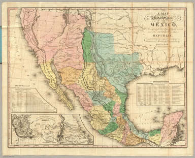
Author
Tanner, Henry S.
Full Title
(Covers to) A Map Of The United States Of Mexico, As organized and defined by the several Acts of the Congress of that Republic. Constructed from a great variety of Printed and Manuscript Documents by H.S. Tanner. Third Edition, 1846. Published by H.S. Tanner. Entered ... 1846, by H.S. Tanner ... New York. (inset) Map Of The Roads &c. From Vera Cruz & Alvarado To Mexico.
Publisher
H.S. Tanner
Author
Johnson, A.J.
Full Title
Johnson's New Map of the State of Texas By Johnson and Ward. (inset) Plan Of Galveston Bay From The U.S. Coast Survey. (inset) Plan of Sabine Lake. (inset) Plan of the Northern Part of Texas.
Publisher
Johnson and Ward
Author
Mitchell, Samuel Augustus
Full Title
Map of the State of Texas, from the Latest Authorities. by J.H. Young. Cowperthwait, Desilver & Butler: Philadelphia. Scale 1:3,400,000, J.L. Hazzard Sculp. Published by Thomas, Cowperthwait & Co. No. 253 Market Street, Philadelphia. Entered ... 1850 by Thomas, Cowperthwait & Co. ... Pennsylvania. (with two inset maps) North Texas on the same scale as the large map., and Map of the Vicinity of Galveston City.
Publisher
Cowperthwait, Desilver & Butler
Author
Southern Pacific Company
Full Title
Correct map of the railway & steamship lines operated by the Southern Pacific Company [United States and Mexico]. Poole Bros., Map Engravers, Chicago. (inset) County map of Texas showing the Atlantic System of the Southern Pacific Company. (inset) San Francisco, California. (inset) Los Angeles, California. (inset) New Orleans. (inset) San Antonio, Texas.
Publisher
Poole Brothers.
Author
Texas and Pacific Railway
Full Title
(Covers to:) The Texas and Pacific Railway. The shortest line to the great cotton grain and stock regions of Texas ... Woodward, Tiernan & Hale, Printers, St. Louis.
Publisher
The Texas & Pacific Railway Company
Author
Texas and Pacific Railway
Full Title
The Texas and Pacific Railway. The shortest line to the great cotton grain and stock regions of Texas ... Woodward, Tiernan & Hale, Printers, St. Louis.
Publisher
The Texas & Pacific Railway Company
Author
Texas and Pacific Railway
Full Title
A geographically correct map of the state of Texas. Published by the Texas & Pacific Railway Company. Compiled from actual surveys and containing all changes in lines of counties up to Sept. 1st, 1876. (1878)
Publisher
The Texas & Pacific Railway Company
Author
Texas and Pacific Railway
Full Title
(Covers to:) The Texas Pacific Railway. T And P. Texarkana. Shreveport. El Paso. New Orleans ... August, 1903. The Texas and Pacific Railway, the Short Line, Shreveport and New Orleans, to all points in northern Texas, California, Colorado and the West ... Woodward & Tiernan Printing Co.
Publisher
Woodward & Tiernan Printing Co.
Author
Texas and Pacific Railway
Full Title
The Texas Pacific Railway. T And P. Texarkana. Shreveport. El Paso. New Orleans ... August, 1903. The Texas and Pacific Railway, the Short Line, Shreveport and New Orleans, to all points in northern Texas, California, Colorado and the West ... Woodward & Tiernan Printing Co.
Publisher
Woodward & Tiernan Printing Co.
Author
Texas and Pacific Railway
Full Title
Map of the Texas & Pacific Railway and connections. The true southern route to and from California is via El Paso and the Texas Pacific Railway. (inset map of United States.)
Publisher
Woodward & Tiernan Printing Co.
Author
Galveston (Tex.)
Full Title
Map of North Galveston, Texas. North Galveston. The mainland city on Galveston Bay. Money, experience and enterprise will make this beautiful location into a thriving city within a marvelously short time ... D.R. Beatty, E.H. Porter, managers, Galveston, Texas. (1891)
Publisher
City of Galveston
Author
Texas Land and Immigration Company
Full Title
(Covers to:) Map of the state of Texas. Woodward, Tiernan & Hale, Map Engr's St. Louis. Texas Land and Immigration Co. St. Louis, Mo. (1876)
Publisher
Woodward, Tiernan & Hale
Author
Texas Land and Immigration Company
Full Title
(Verso of:) Map of the state of Texas. Woodward, Tiernan & Hale, Map Engr's St. Louis. Texas Land and Immigration Co. St. Louis, Mo. (1876)
Publisher
Woodward, Tiernan & Hale
Author
U.S. War Department
Full Title
Map of the States of Kansas and Texas and Indian Territory with Parts of the Territories of Colorado and New Mexico (North half sheet only).
Publisher
Julius Bien
Author
Haven, John
Full Title
Map Of The United States And Mexico, Including Oregon, Texas And The Californias.
Publisher
No. publisher
Author
Ensigns & Thayer
Full Title
Ornamental Map Of The United States & Mexico. Map Of The United States And Mexico Including Oregon, Texas and the Californias. Entered ... 1848, by Ensigns & Thayer ... New York. Published by Ensign & Thayer, 50 Ann Street New York. And 12 Exchange St., Buffalo. Sowle & Ward, 43 Cornhill, Boston. Rufus Blanchard: Cincinatti.
Publisher
[Ensigns & Thayer ; Rufus Blanchard, Sowle & Ward]
Author
Haven, John
Full Title
Map Of The United States And Mexico, Including Oregon, Texas And The Californias.
Publisher
No. publisher
Author
House & Brown
Full Title
Map Of Mexico, Texas, Old And New California, And Yucatan. Showing the principal Cities and Towns, Travelling Routes &c. Hartford: Published By House & Brown. 1849. Entered ... 1847 by House & Brown ... (inset map) Plan Of Operations At The Battle Of Monterey On The 21st, 22nd, & 23rd Sept. 1846. (inset) Map Of Vera Cruz And San Juan De Ulloa. (Lith. Of E.B.) & E.C. Kellogg, Hartford, Conn.
Publisher
House & Brown
Author
[Mitchell, Samuel Augustus, Dorby & Miller]
Full Title
Map Of Mexico, Including Yucatan & Upper California, exhibiting The Chief Cities And Towns, The Principal Travelling Routes &c. Philadelphia. Published by Dorby & Miller. Auburn, New York. 1850. Entered ... 1847 by S. Augustus Mitchell ... Pennsylva. (inset map) Battle Field Of Monterey.
Publisher
Dorby & Miller
Author
Bartholomew, John
Full Title
(Index to) U.S.A. Alaska. Conic Projection, Standard Parallels 50 (degrees) and 70 (degrees) N. 1:2,500,000. U.S.A. Texas South. Lambert Conformal Conic Projection, Standard Parallels 33 (degrees) and 45 (degrees) N. 1:2,500,000.
Publisher
[Houghton Mifflin Co., John Bartholomew & Son LTD.]
Author
Bartholomew, John
Full Title
U.S.A. Alaska, Texas South. The Geographical Institute Edinburgh. Edited by John Bartholomew, M.C. LL. D. Copyright - John Bartholomew & Son, LTD.
Publisher
[Houghton Mifflin Co., John Bartholomew & Son LTD.]
Author
[Jones, C.H., Hamilton, T.H., Williams, J.David]
Full Title
Map of Texas.
Publisher
J. David Williams
Author
Sinclair, Thomas
Full Title
Map of Mexico Showing the Seat of War. Lith. of T. Sinclair, 79 So. 3rd St. Philadelphia.
Publisher
Thomas Sinclair
Author
[Bayer, Herbert, Container Corporation of America]
Full Title
Texas. U.S. State. (insets) (Vicinity of Fort Worth, San Antonio, and Houston).
Publisher
Container Corporation of America
Author
Sinclair, Thomas
Full Title
(Covers to) Map of Mexico Showing the Seat of War. Lith. of T. Sinclair, 79 So. 3rd St. Philadelphia.
Publisher
Thomas Sinclair
Author
Texas Land and Immigration Company
Full Title
Map of the state of Texas. Woodward, Tiernan & Hale, Map Engr's St. Louis. Texas Land and Immigration Co. St. Louis, Mo. (1876)
Publisher
Woodward, Tiernan & Hale
Author
International & Great Northern Railroad
Full Title
(Covers to:) Texas, the short line to Texas is via the I & GN. R.R. Lone (Star) route. Austin, Tex. Rand McNally & Co., Printers 77 and 79 Madison Street, Chicago. (1878?)
Publisher
Rand McNally & Co.
Author
International & Great Northern Railroad
Full Title
Texas, the short line to Texas is via the I & GN. R.R. Lone (Star) route. Austin, Tex. Rand McNally & Co., Printers 77 and 79 Madison Street, Chicago. (1878?)
Publisher
Rand McNally & Co.
Author
International & Great Northern Railroad
Full Title
Colonists' and emigrants' route to Texas. Rand, McNally & Co., Engr's, Chicago. (untitled inset map of the eastern half of the United States). (1878?)
Publisher
Rand McNally & Co.
Author
Houston And Texas Central Railway
Full Title
(Covers to:) Houston and Texas Central Railway through Texas. Northern to southern boundary and with branches and Texas Central Railway through central and western Texas ... 461-July-85. Rand, McNally & Co., Printers, Chicago.
Publisher
Rand McNally
Author
Houston And Texas Central Railway
Full Title
Houston and Texas Central Railway through Texas. Northern to southern boundary and with branches and Texas Central Railway through central and western Texas ... 461-July-85. Rand, McNally & Co., Printers, Chicago.
Publisher
Rand McNally
Author
Houston And Texas Central Railway
Full Title
Texas and Mexico showing Houston and Texas Central system of railways. Rand, McNally & Co, Engr's, Chicago. (inset) Map of United States and Mexico reduced scale; showing the Houston and Texas Central Railway and connections. (1885)
Publisher
Rand McNally
Author
Rand McNally and Company
Full Title
Texas. Rand, McNally & Co's New Business Atlas Map of Texas. Copyright, 1910 ... 1903 ... Rand McNally & Co., Map Publishers and Engravers, Chicago, 1910. (two untitled inset maps of the northern and southern tips of Texas).
Publisher
Rand McNally and Company
Author
[Lloyd, H.H., Warner & Beers]
Full Title
Atlas of the United States, Map of Texas. Warner & Beers, Publishers. From H.H. Lloyd & Co.'s Atlas of the United States.
Publisher
Warner & Beers
Author
[Vorzet, Ed.Dumas, Le Comte de Paris]
Full Title
Planche XVIII. Brashear City (Louisiane). Nashville (Tennessee). Galveston (Texas). Dessine par Ed. Dumas Vorzet. Michel Levy, freres. Editeurs. Imp. Becquet, Paris. Grave par L. Wuhrer, R. Gay-Lussac 52.
Publisher
Michel Levy Freres
Author
Tanner, Henry S.
Full Title
A Map Of The United States Of Mexico, As organized and defined by the several Acts of the Congress of that Republic. Constructed from a great variety of Printed and Manuscript Documents by H.S. Tanner. Third Edition, 1846. Published by H.S. Tanner. Entered ... 1846, by H.S. Tanner ... New York. (inset) Map Of The Roads &c. From Vera Cruz & Alvarado To Mexico.
Publisher
H.S. Tanner
Author
Tanner, Henry S.
Full Title
(Covers to) A Map Of The United States Of Mexico, As organized and defined by the several Acts of the Congress of that Republic. Constructed from a great variety of Printed and Manuscript Documents by H.S. Tanner. 1826. Entered ... 10th day of June 1825, by H.S. Tanner ... (inset) Map Of The Roads &c. From Vera Cruz & Alvarado To Mexico.
Publisher
H.S. Tanner
Author
Page, H.R. & Co.
Full Title
(View) The Outlook. Bass Island Quarry. Lone Rock. Wisconsin Central R.R. (Index Page) Guide to Texas.
Publisher
H.R. Page & Co.
Author
Tanner, Henry S.
Full Title
A Map Of The United States Of Mexico, As organized and defined by the several Acts of the Congress of that Republic. Constructed from a great variety of Printed and Manuscript Documents by H.S. Tanner. 1826. Entered ... 10th day of June 1825, by H.S. Tanner ... (inset) Map Of The Roads &c. From Vera Cruz & Alvarado To Mexico.
Publisher
H.S. Tanner
Author
Page, H.R. & Co.
Full Title
Map of Texas, Published by H.R. Page & Co., Chicago, Ill., 1885.
Publisher
H.R. Page & Co.
Author
Johnson, A.J.
Full Title
Johnson's Texas. (insets) Plan of Galveston Bay and Vicinity; Northern Part of Texas. Entered ... 1866.
Publisher
A.J. Johnson
Author
[Johnston, Alexander Keith, 1804-1871, Rogers, Henry Darwin]
Full Title
State Of Texas. By Prof. H.D. Rogers & A. Keith Johnston, F.R.S.E. Entered in Sta. Hall. London ... & according to an act of Congress ... 1857, by H.D. Rogers ... Massachusetts. London, John Murray, Albemarle Street, Edinburgh, W. & A.K. Johnston. Engraved by W. & A.K. Johnston, Edinburgh.
Publisher
Edward Stanford
Author
[Soederquist, Oscar, United States. War Department]
Full Title
Military map of Suffolk and vicinity for Brig. Gen. E.L. Viele. Surveyed and drawn by Oscar Soederquist ... (with) Plan of Fort Esperanza, Tex. (with) Map of Morris Island and the adjacent creeks. From U.S. Coast Survey 1823-4. Sand hills from a survey 6th June 1862 ... indorsement (sic) of Gen. G.T. Beauregard ... (with) Proposed secondary line of defense on the peninsula between Ashepoo and Combahee Rivers, S.C., November 4, 1863 ... letter from Brig. Gen. W.S. Walker ... ... Julius Bien & Co., Lith., N.Y. (1891-1895)
Publisher
U.S. Government Printing Office
|