Browse All

1952 Cina, Indocina, Corea. World Atlas Cina. Cina, Indocina, Corea. |

1953 Far East. Malaysia. World Atlas Far East. Malaysia. |

1844 Hinter Indien. World Atlas Neueste Karte von Hinter Indien. Nach de … |

1901 Siam, Burma & Anam. World Atlas Siam, Burma & Anam. London atlas series. … |

1836 Carte generale des Indes. World Atlas Carte generale des Indes en-deca et au-d … |

1832 Burmah, Siam, Cochin China. World Atlas Burmah, Siam, and Cochin China, by J. Ar … |

1821 Carte generale des Indes. World Atlas Carte generale des Indes en-deca et au-d … |

1864 Ost Indien. World Atlas Ost Indien mit besonderer Berucksichtigu … |

1837 Asie Meridionale. World Atlas Asie Meridionale Comprenant L'Inde en De … |

1864 Map of Burma, Siam, Cochin-China and Mal … World Atlas Map of the Burman Empire Including also … |

1968 Southeast Asia -- Physical-Political Wall Map Southeast Asia. |

1817 Birman Empire. World Atlas Birman Empire. Engd. by Moffat & Smellie … |

1895 Siam, Malay Archipelago. World Atlas Siam and the Malay Archipelago. (with) J … |

1922 Farther India. World Atlas Farther India. (with Andaman and Nicobar … |

1787 Empire du Mogol. School Atlas Empire du Mogol. (1787) |

1850 Ost-Indien Mit Den Inseln. (East Indies) … World Atlas No. XLVIII. Stieler's Hand-Atlas (No. 44 … |

1850 Ost-Indien Mit Den Inseln. (East Indies) … World Atlas No. XLVIII. Stieler's Hand-Atlas (No. 44 … |
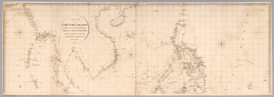
1812 Top sheet: Chart of the East India Islan … Chart Map (Top sheet of) Chart of the East India I … |

1812 Bottom sheet: Chart of the East India Is … Chart Map (Bottom sheet of) Chart of the East Indi … |

1812 Composite: Chart of the East India Islan … Chart Map (Composite of) Chart of the East India I … |

1897 China, Indo-China, Malaysia. World Atlas Rand, McNally & Co.'s new 14 x 21 map of … |

1751 Indes Orientales. World Atlas Les Indes Orientales, ou sont distingues … |