Browse All

1882 Cover: Richmond and Louisville R.R. Pocket Map (Covers to) Map of the Richmond and Loui … |

1880 Southern States Mining Atlas Southern States. (to accompany) Pocket M … |

1864 Covers: Military Map Of The Southern Sta … Pocket Map (Covers to) Phelps & Watson's Historical … |

1864 Military Map Of The Southern States Pocket Map Phelps & Watson's Historical And Militar … |

1864 Covers: Military Map Of The Southern Sta … Pocket Map (Covers to) Phelps & Watson's Historical … |

1864 Military Map Of The Southern States Pocket Map Phelps & Watson's Historical And Militar … |

1862 Covers: Historical War Map Pocket Map (Covers to) The Historical War Map. Ashe … |

1862 Historical War Map Pocket Map The Historical War Map. Asher & Co. Ente … |

1864 Covers: Map Of The Southern States Pocket Map (Covers to) J.H. Colton's Map Of The Sou … |

1864 Map Of The Southern States Pocket Map J.H. Colton's Map Of The Southern States … |

1864 Composite: Map Of The Southern States Pocket Map (Composite of) J.H. Colton's Map Of The … |
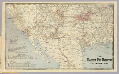
1888 Sante Fe Route and connections. Timetable Map Santa Fe Route. Official guide, main lin … |

1888 Cover: Sante Fe Route. Timetable Map (Covers to) Santa Fe Route. Official gui … |

1780 Le Nouveau Mexique, Avec La Partie Septe … World Atlas Le Nouveau Mexique, Avec La Partie Septe … |

1827 The coast of the United States from New … Chart Atlas The coast of the United States of North … |

1827 The coast of the United States from New … Chart Atlas (The coast of the United States of North … |

1827 The coast of the United States from New … Chart Atlas (The coast of the United States of North … |

1827 Composite: U.S. coast N.Y. to St. August … Chart Atlas (Composite of) The coast of the United S … |

1828 The coasts of West Florida, Alabama, Mis … Chart Atlas The coasts of West Florida, Alabama, Mis … |

1828 Cover: Atlas of 4 charts on 10 sheets) Chart Atlas (covers to) (Atlas of 4 charts on 10 she … |
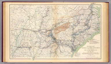
1895 Military map, W.T. Sherman. Military Atlas Military map of the marches of the Unite … |

1895 Army of the Cumberland campaigns. Military Atlas Map prepared to exhibit the campaigns in … |

1895 Colton's U.S. section. Military Atlas Section of G. Woolworth Colton's new gui … |

1895 Gen. map I. Military Atlas General topographical map. Sheet I. Juli … |

1895 Gen. map VII. Military Atlas General topographical map. Sheet VII. Ju … |

1864 Southern, Western States. School Atlas Southern and Western States. Designed to … |

1864 Eastern U.S. School Atlas Eastern division of the United States. D … |

1864 Southern U.S. School Atlas Southern division of the United States. … |

1830 Middle States. School Atlas The Middle States, Maryland & Virginia. … |

1817 S. United States. World Atlas Southern provinces of the United States. … |

1830 Middle States. School Atlas The Middle States, Maryland & Virginia. … |

1832 Southern States. School Atlas Southern States. Entered ... April 23d, … |

1883 E. United States 8. World Atlas Eastern United States. No. 8. Letts's po … |

1794 Southern dominions U.S. World Atlas A new and general map of the southern do … |

1837 Middle States. School Atlas Middle States. Entered according to act … |

1837 Southern States. School Atlas Southern States. Entered according to ac … |

1831 Middle & Southern States. World Atlas Middle States. Southern States. G. Boynt … |

1847 Middle States. School Atlas Map of the Middle States and part of the … |

1847 Southern States. School Atlas Map of the chief part of the Southern St … |

1929 Legend: 145-46. Ark., Tenn., La., Miss., … World Atlas (Legend to) Stati Uniti, United States o … |

1929 145-46. Ark., Tenn., La., Miss., Fla., A … World Atlas Stati Uniti, United States of America, A … |

1903 52. Center Negro population 1880-1900. Statistical Atlas Sketch map showing the position of the c … |

1903 54. White, Negro population, states, ea. … Statistical Atlas Percentage of white and Negro population … |

1813 Southern Section of the United States in … National Atlas Southern Section of the United States in … |

1875 Vereinigte Staaten Von Nord-Amerika In 6 … World Atlas Vereinigte Staaten Von Nord-Amerika In 6 … |

1875 Vereinigte Staaten Von Nord-Amerika In 6 … World Atlas Vereinigte Staaten Von Nord-Amerika In 6 … |

1890 Tourist through car line, Louisville & N … Timetable Map Tourist through car line, Louisville & N … |

1890 Cover: L&N winter resorts. Timetable Map (Covers to) L&N winter resorts. L&N Gulf … |

1890 Text Page: L&N winter resorts. Timetable Map (Text Page to) L&N winter resorts. L&N G … |

1863 Panorama Of The Mississippi Valley And I … Separate Map Panorama Of The Mississippi Valley And I … |