Browse All

1844 Carte De La Cote De L'Amerique. Exploration Book Carte De La Cote De L'Amerique Sur L'Oce … |

1863 Cover: Mexico & California. Pocket Map (Covers to) Map Of Mexico & California. … |

1863 Map Of Mexico & California. Pocket Map Map Of Mexico & California. Compiled fro … |

1845 Californias. National Atlas Map of the Californias by T.J. Farnham. … |

1845 Mexico, Central America. National Atlas Mexico. (with) Central America and Yucat … |

1842 Texas, Calif., N. Mexico. World Atlas Central America II. Texas, California an … |

1850 Map of the United States. Separate Map Map Of The United States And Their Terri … |

1846 Texas. World Atlas Texas. Nach den besten Quellen entw. u. … |

1845 Mexico. World Atlas Neueste Karte von Mexico. Nach den beste … |

1892 Cover: California, Texas, Mexico and Ari … Timetable Map (Covers to:) California, Texas, Mexico A … |

1892 California, Texas, Mexico and Arizona So … Timetable Map California, Texas, Mexico And Arizona So … |

1892 Railway, steamship lines, Southern Pacif … Timetable Map Correct map of the railway & steamship l … |

1846 Cover: Mapa de los Estados Unidos de Mej … Pocket Map (Covers to) Mapa de los Estados Unidos d … |

1846 Text Page: Mapa de los Estados Unidos de … Pocket Map (Text Page to) Mapa de los Estados Unido … |

1846 Mapa de los Estados Unidos De Mejico. Pocket Map Mapa de los Estados Unidos de Mejico, se … |

1825 Mexique. National Atlas Carte geographique, statistique et histo … |

1855 Mexico, Mittel-America, Texas. World Atlas Mexico, Mittel-America, Texas. Lithograp … |

1845 Mexico, Texas. World Atlas Mexico. (with) Texas. (Written and engra … |

1840 Etats-Unis Mexicains, Texas, Amerique Ce … World Atlas Carte generale des Etats-Unis Mexicains, … |

1832 Mexico. World Atlas Mexico, by J. Arrowsmith. (with) Mexico, … |

1861 Reduced section, general map, North Amer … Exploration Book Reduced section of a general map of Nort … |

1861 Reduced section, map of North America, 1 … Exploration Book Reduced section of map of North America … |

1861 Reduced section, territory west of Rocky … Exploration Book Reduced map of the territory west of the … |

1869 Western States, Mexico, Central America Pocket Map Watson's New Map Of The Western States, … |

1869 Covers: Western States, Mexico, Central … Pocket Map (Covers to) Watson's New Map Of The West … |
1888 Sante Fe Route and connections. Timetable Map Santa Fe Route. Official guide, main lin … |

1888 Cover: Sante Fe Route. Timetable Map (Covers to) Santa Fe Route. Official gui … |

1815 Amerique Septentrionale 3. World Atlas Carte encyprotype de l'Amerique Septentr … |

1830 Mexico, Guatimala. School Atlas Mexico and Guatimala. J.H. Young Sc. (Ph … |

1814 Spanish N. America. World Atlas Spanish North America. Drawn and engrave … |

1829 Mexique. World Atlas Carte des Etats-Unis du Mexique. (with) … |

1831 Mexico, Guatimala. World Atlas Mexico & Guatimala. Published by D. Liza … |

1883 U.S. West, Mexico North. World Atlas United States, West & Mexico, North. Let … |

1794 (North America south) World Atlas (A new map of North America, with the We … |

1794 Composite: North America. World Atlas (Composite of) A new map of North Americ … |

1804 Spanish dominions in North America. World Atlas Spanish dominions in North America. From … |

1812 Spanish dominions in North America. World Atlas Spanish Dominions in North America. From … |

1855 Mexico, Texas, Californien, C. America. World Atlas Mexico, Texas und Californien. (with) Di … |

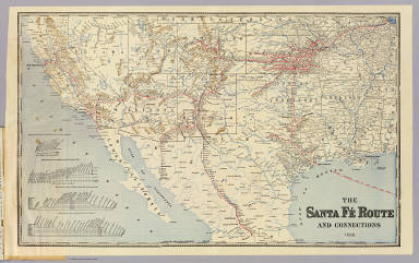
1904 Santa Fe. Timetable Map Santa Fe. Poole Bros., Chicago. |

1904 Cover: AT&SF Railway, connecting lines. Timetable Map (Covers to) Santa Fe. The Atchison, Tope … |

1810 Mexico 3. Regional Atlas (A new map of Mexico and adjacent provin … |

1810 Mexico 4. Regional Atlas (A new map of Mexico and adjacent provin … |

1810 Composite: Mexico. Regional Atlas (Composite of) A new map of Mexico and a … |

1891 Composite: (U.S. West) Railroad Map of t … Case Map (Composite Map of) (Western section of R … |

1879 U.S. West of Mississippi R. 4. Case Map Map of the Territory of the U.S. West of … |

1879 U.S. West of Mississippi R. 5. Case Map Map of the Territory of the U.S. West of … |

1879 U.S. West of Mississippi R. 6. Case Map Map of the Territory of the U.S. West of … |

1851 Mexico, California and Texas. World Atlas Mexico, California and Texas. The Illust … |

1810 Title Page: Account of expeditions to th … Exploration Book (Title Page to) An Account of Expedition … |

1810 Falls of St. Anthony. Exploration Book Falls of St. Anthony. |