Who What Where WhenREMOVE |
Author
[Johnson, A.J., Johnson, D. Griffing]
Full Title
Johnson's New Illustrated & Embellished County Map Of The Republics Of North America With The Adjacent Islands & Countries, Compiled Drawn & Engraved From U. States Land & Coast Surveys, British Admiralty & other Reliable Sources. By D. Griffing Johnson, New York & Washington. 1859. Entered ... 1856 by D.G. & A.J. Johnson ... New York. Map Designed by A.J. Johnson. Engraved by D.G. Johnson, J.H. Goldthwait, W.S. Barnard, Wm. Wright, G. Rae Smith, F.H. King, James Duthie, J.L. White. (inset) Johnson's Map Of The World on Mercator's Projection ...
Publisher
A.J. Johnson.
Author
Burr, David H., 1803-1875
Full Title
Map of the United States Of North America With parts of the Adjacent Countries, By David H. Burr. (Late Topographer to the Post Office.) Geographer to the House of Representatives of the U.S. John Arrowsmith. Entered ... July 10th, 1839, by David H. Burr ... District of Columbia.
Publisher
John Arrowsmith
Author
Colton, J. H.
Full Title
(Covers to) Map Of The United States The British Provinces Mexico &c. Showing the Routes of the U.S. Mail Steam Packets to California, & A Plan of the Gold Region. Published By J.H. Colton, 86 Cedar St. New York. 1849. Drawn & Engraved by J.M. Atwood. New York. Entered ... 1849 by J.H. Colton ... New York. (inset) Map Of The Gold Region. California. (untitled inset of South America).
Publisher
J.H. Colton
Author
Colton, J. H.
Full Title
Map Of The United States The British Provinces Mexico &c. Showing the Routes of the U.S. Mail Steam Packets to California, & A Plan of the Gold Region. Published By J.H. Colton, 86 Cedar St. New York. 1849. Drawn & Engraved by J.M. Atwood. New York. Entered ... 1849 by J.H. Colton ... New York. (inset) Map Of The Gold Region. California. (untitled inset of South America).
Publisher
J.H. Colton
Author
Ensigns & Thayer
Full Title
Ornamental Map Of The United States & Mexico. Map Of The United States And Mexico. Published by Ensign, Thayer & Co., 50 Ann St., New York, And 127 Main St., Buffalo. Entered ... 1848, by Ensigns & Thayer ... New York. Sowle & Ward, 43 Cornhill, Boston.
Publisher
Ensign, Thayer & Co.
Author
Humboldt, Alexander von, 1769-1859
Full Title
Carte Du Mexique et des Pays Limitrophes Situes Au Nord et a l'est Dressee d'apres la Grande Carte de la Nouvelle Espagne De Mr. A. De Humboldt et d'autres Materiaux par J.B. Poirson. 1811. 2. Grave par Barriere. et l'ecriture par L. Aubert. Se trouve a Paris chez F. Schoell, Libraire.
Publisher
F. Schoell
Author
G.W. & C.B. Colton & Co.
Full Title
(Covers to) Colton's Railroad And Military Map Of The United States, Mexico, The West Indies &c. Published By G.W. & C.B. Colton, 172 William St. New York. 1865. Printed by Cooper 117 Fulton St. N.Y. (inset) Colton's Map Of The Americas, Africa And A Portion Of Europe, Showing The Atlantic And Part Of The Pacific Oceans. (8 additional inset maps).
Publisher
G.W. & C.B. Colton
Author
G.W. & C.B. Colton & Co.
Full Title
Colton's Railroad And Military Map Of The United States, Mexico, The West Indies &c. Published By G.W. & C.B. Colton, 172 William St. New York. 1865. Printed by Cooper 117 Fulton St. N.Y. (inset) Colton's Map Of The Americas, Africa And A Portion Of Europe, Showing The Atlantic And Part Of The Pacific Oceans. (8 additional inset maps).
Publisher
G.W. & C.B. Colton
Author
Colton, G.W & C.B.
Full Title
(Covers to) Colton's Railroad And Military Map Of The United States, Mexico, The West Indies &c. By J.H. Colton, New York, 1862. Entered ... 1862, by J.H. Colton ... New York.
Publisher
G.W. & C.B. Colton.
Author
Colton, G.W & C.B.
Full Title
Colton's Railroad And Military Map Of The United States, Mexico, The West Indies &c. Published By G.W. & C.B. Colton, 172 William St. New York. 1865. Printed by Cooper 117 Fulton St. N.Y. (inset) Colton's Map Of The Americas, Africa And A Portion Of Europe, Showing The Atlantic And Part Of The Pacific Oceans. (8 additional inset maps).
Publisher
G.W. & C.B. Colton.
Author
Shell Oil Company
Full Title
(Covers to) Shell Atlas.
Publisher
Shell Oil Company
Author
Colton, J.H.
Full Title
(Covers to) Colton's Map Of The United States, Mexico, The West Indies, &c. By J.H. Colton, New York. 1861. Entered ... 1860 by J.H. Colton ... New York. (inset) Colton's Map Of The Americas, Africa And A Portion Of Europe, Showing The Atlantic And Part Of The Pacific Oceans.
Publisher
J.H. Colton.
Author
Colton, J.H.
Full Title
Colton's Map Of The United States, Mexico, The West Indies, &c. By J.H. Colton, New York. 1861. Entered ... 1860 by J.H. Colton ... New York. (inset) Colton's Map Of The Americas, Africa And A Portion Of Europe, Showing The Atlantic And Part Of The Pacific Oceans.
Publisher
J.H. Colton.
Author
Instituto Geographico di Agostini
Full Title
U.S.A. (insets) Chicago; Buffalo; New York; San Francisco; Pittsburgh; Baltimora; Filadelfia (Philadelphia); Boston; Niagara Falls; New Orleans. Messico.
Publisher
Instituto Geographico di Agostini
Author
Society for the Diffusion of Useful Knowledge (Great Britain)
Full Title
Central America II. Texas, California and the northern states of Mexico. Published under the superintendence of the Society for the Diffusion of Useful Knowledge. J. & C. Walker sculpt. Published by Chapman & Hall, 186 Strand, 15th. Oct. 1842. (1844)
Publisher
Chapman and Hall
Author
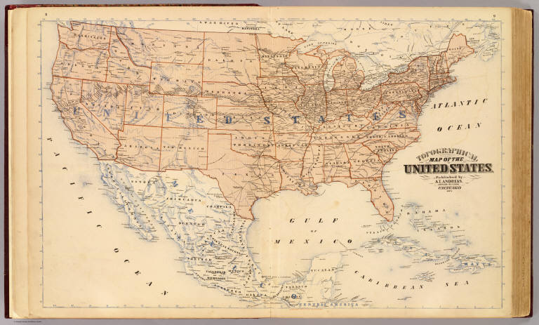
Andreas, A. T. (Alfred Theodore), 1839-1900
Full Title
Topographical map of the United States. Published by A.T. Andreas, Lakeside Building, Chicago, 1873. (Chas. Shober & Co. Proprietors of Chicago Lith. Co.)
Publisher
A.T. Andreas
Author
U.S. War Department, Topographical Engineers
Full Title
Map Of The United States And Their Territories Between The Mississippi and the Pacific Ocean And Of Part of Mexico. Compiled in the Bureau of the Corps of Topogl. Engs. under a Resolution of the U.S. Senate. From the best authorities which could be obtained. 1850. Engraved by Sherman and Smith, New-York.
Publisher
Sherman and Smith
Author
Southern Pacific Company
Full Title
(Covers to:) California, Texas, Mexico And Arizona Southern Pacific Co. "Sunset route" from New Orleans to the Pacific Coast ... January, 1892. American Bank Note Co., N.Y.
Publisher
Poole Brothers.
Author
Southern Pacific Company
Full Title
California, Texas, Mexico And Arizona Southern Pacific Co. "Sunset route" from New Orleans to the Pacific Coast ... January, 1892. American Bank Note Co., N.Y.
Publisher
Poole Brothers.
Author
Southern Pacific Company
Full Title
Correct map of the railway & steamship lines operated by the Southern Pacific Company [United States and Mexico]. Poole Bros., Map Engravers, Chicago. (inset) County map of Texas showing the Atlantic System of the Southern Pacific Company. (inset) San Francisco, California. (inset) Los Angeles, California. (inset) New Orleans. (inset) San Antonio, Texas.
Publisher
Poole Brothers.
Author
Phelps, Humphrey
Full Title
Ornamental Map Of The United States & Mexico. 1847. Phelps' Ornamental Map Of The United States And Mexico. Entered ... 1846, by Humphrey Phelps ... New York. Published by Phelps, Ensigns & Thayer, 36 Ann Street, New York. Barritt, Sc.
Publisher
H. Phelps
Author
Phelps, Humphrey
Full Title
Ornamental Map Of The United States & Mexico. 1846. Phelps' Ornamental Map Of The United States And Mexico. Entered ... 1846, by Humphrey Phelps ... New York. Published by H. Phelps No. 144 Fulton Street, near Broadway, New York. Barritt, Sc.
Publisher
H. Phelps
Author
Ensign, Bridgman & Fanning
Full Title
Ornamental Map Of The United States & Mexico. Map Of The United States And Mexico. Ensign, Bridgman & Fanning, Publishers, 156 William St. New York. Entered ... 1855, by Ensign, Bridgman & Fanning ... New York.
Publisher
Ensign, Bridgman & Fanning
Author
Ensigns & Thayer
Full Title
Ornamental Map Of The United States & Mexico. Map Of The United States And Mexico Including Oregon, Texas and the Californias. Entered ... 1848, by Ensigns & Thayer ... New York. Published by Ensign & Thayer, 50 Ann Street New York. And 12 Exchange St., Buffalo. Sowle & Ward, 43 Cornhill, Boston. Rufus Blanchard: Cincinatti.
Publisher
[Ensigns & Thayer ; Rufus Blanchard, Sowle & Ward]
Author
Magnus, Charles
Full Title
Map Of The United States of America, The British Provinces, Mexico, the West Indies and Central America. Published by Charles Magnus. New York. 1854. (inset map) Central America.
Publisher
Charles Magnus
Author
Colton, J.H.
Full Title
Map Of The United States The British Provinces Mexico &c. Showing the Routes of the U.S. Mail Steam Packets to California, and a Plan of the Gold Region. Published By J.H. Colton, 86 Cedar St. New York. 1849. Drawn & Engraved by J.M. Atwood. New York. Entered ... 1849, by J.H. Colton ... New York. (inset) Map Of The Gold Region. California. (untitled inset of South America; From New York to San Francisco via Cape Horn...).
Publisher
J.H. Colton
Author
Andriveau-Goujon, E.
Full Title
Carte Generale Des Etats - Unis Et Du Mexique, Comprenant L'Amerique Centrale Et Les Antilles. E. Andriveau-Goujon, Editeur. Paris, Rue Du Bac, 21. Nouvelle Edition. 1870. (with four inset maps).
Publisher
Andriveau-Goujon
Author
Andriveau-Goujon, E.
Full Title
Carte Generale Des Etats - Unis Et Du Mexique, Comprenant L'Amerique Centrale Et Les Antilles. E. Andriveau-Goujon, Editeur. Paris, Rue Du Bac, 4. Nouvelle Edition. 1876. (with four inset maps).
Publisher
Andriveau-Goujon
Author
Woodbridge, William C.
Full Title
Political Map Of The United States, Mexico And The British Provinces. Adapted To Woodbridge's Geography. Engraved by J. M. Atwood. N. York. Entered .. . 1845, by W.C. Woodbridge ... Massachusetts. Hartford. Published By Wm. Jas. Hamersley. (inset) Map of Railways & Canals In the Middle States. (inset map) Michigan, Wisconsin, Iowa, Minesota. (Inset map) District Of Columbia.
Publisher
Wm. Jas. Hamersley
Author
Houston And Texas Central Railway
Full Title
Texas and Mexico showing Houston and Texas Central system of railways. Rand, McNally & Co, Engr's, Chicago. (inset) Map of United States and Mexico reduced scale; showing the Houston and Texas Central Railway and connections. (1885)
Publisher
Rand McNally
Author
Woodbridge, William C.
Full Title
Political Map Of The United States, Mexico And The British Provinces. Adapted To Woodbridge's Geography. Engraved by J.M. Atwood. N. York. Entered ... 1845, by W.C. Woodbridge ... Massachusetts. Hartford. Published By Wm. Jas. Hamersley. (to accompany) Modern Atlas, Physical, Political And Statistical; Exhibiting On Separate Maps ... (inset) Map Of Railways & Canals In The Middle States. (inset map) Michigan, Wisconsin, & Iowa. (inset map) District of Columbia.
Publisher
Belknap and Hamersley
Author
Ruhle von Lilienstern, August
Full Title
Nordliches America. Berlin 1824 von R.v.L.
Publisher
C.G. Luderitz
Author
La Perouse, Jean-Francois de Galaup, comte de, 1741-1788
Full Title
(Two charts) Plan of the Port of S. Diego in California. Situate in in 32 degrees 39 minutes 0 seconds of Latitude North & 12 degrees, 4 minutes 0 seconds West of St. Blas from a Survey in 1782 .... Plan of the Port and Department of S. Blas, Situate 21 degrees 30 minutes of Latitude Nth. & 88 degrees 15 minutes 0 seconds _ West of Tenefriffe and 107 degrees 15 minutes 0 seconds _ West of Paris from a Survey in november 1877. Published as the Act directs Novr. 1st 1798, by G.G. & J. Robinson, Paternoster Row, London. S. Neele, sculpt., Strand. No. 35.
Publisher
G.G. & J. Robinson.
Author
Watson, Gaylord
Full Title
The American Republic and rail-road map of the United States, British Provinces, West-Indies, Mexico and Central America. Compiled from the latest official sources. Published by Gaylord Watson, 16 Beekman Street, New York. 1867. Entered ... 1866, by Gaylord Watson ... New York. Engraved by Fisk & Russell, N. York.
Publisher
Gaylord Watson
Author
Watson, Gaylord
Full Title
(Covers to) The American Republic and rail-road map of the United States, British Provinces, West-Indies, Mexico and Central America. Compiled from the latest official sources. Published by Gaylord Watson, 16 Beekman Street, New York. 1867. Entered ... 1866, by Gaylord Watson ... New York. Engraved by Fisk & Russell, N. York.
Publisher
Gaylord Watson
Author
Watson, Gaylord
Full Title
(Inside Covers to) The American Republic and rail-road map of the United States, British Provinces, West-Indies, Mexico and Central America. Compiled from the latest official sources. Published by Gaylord Watson, 16 Beekman Street, New York. 1867. Entered ... 1866, by Gaylord Watson ... New York. Engraved by Fisk & Russell, N. York.
Publisher
Gaylord Watson
Full Title
Etats-Unis d'Amerique. La lettre gravee par H. Mardelet, Rue St. Jacques No. 27, a Paris. Graves par (Auguste Francois?) Ales, Rue de Noyers, No. 50, a Paris. A Paris, chez J. Carez, Rue Haute-Feuille No. 18. (1825)
Publisher
J. Carez
Author
Flemming, Carl
Full Title
Mexico, Mittel-America, Texas. Lithographie, Druck u. Verlag von C. Flemming in Glogau. (1855)
Publisher
C. Flemming
Author
[Dower, John Nicaragua, Teesdale, Henry]
Full Title
Mexico and Guatimala. London: Published by Henry Teesdale & Co. Drawn & Engraved by J. Dower, Pentonville, London. (1844)
Publisher
Henry Teesdale & Co.
Author
Stein, Christ. Gottfr. Dan.
Full Title
Vereinigte Staaten von NordAmer(ika, nebst Mexico und Centralamerika. Westliche Theil). (with) San Francisco und Umgegend. (with) Die deutsche Colonie Wartburg, Staat Tennessee. (with) Die nordostlichen Staaten der Union. (with) Eisenbahnverbindung zwischen Chagres und Panama. (with) Isthmus von Panama. (with New York Bay). Entworfen von G. Heck, gestochen under s. Leitung. (Gestochen von R. Schmidt, H. Eberhardt u. J.L. v. Baehr). J.C. Hinrichs'sche Buchhandlung, Leipzig. (1865)
Publisher
J.C. Hinrichs'sche Buch- und Landkartenhandlung
Author
Stein, Christ. Gottfr. Dan.
Full Title
(Composite of) Vereinigte Staaten von NordAmerika, nebst Mexico und Centralamerika. (with) San Francisco und Umgegend. (with) Die deutsche Colonie Wartburg, Staat Tennessee. (with) Die nordostlichen Staaten der Union. (with) Eisenbahnverbindung zwischen Chagres und Panama. (with) Isthmus von Panama. (with New York Bay). (with) Plan von Boston. Entworfen von G. Heck, gestochen under s. Leitung. Gestochen von R. Schmidt, H. Eberhardt u. J.L. v. Baehr. J.C. Hinrichs'sche Buchhandlung, Leipzig. (1865)
Publisher
J.C. Hinrichs'sche Buch- und Landkartenhandlung
Author
Arrowsmith, John
Full Title
Mexico, by J. Arrowsmith. (with) Mexico, shewing the connection with the ports of Acapulco, Vera Cruz & Tampico. London, pubd. 15 Feby. 1832 by J. Arrowsmith, 35 Essex Street, Strand.
Publisher
John Arrowsmith
Author
Brue, Adrien Hubert, 1786-1832
Full Title
Carte generale des Etats-Unis Mexicains et des Provinces-Unies de l'Amerique Centrale. (with) Guatemala ou Provinces-Unies de l'Amerique Centrale. Redigee par Brue, Geographe. Paris, 1825. Chez l'Auteur, rue des Macons-Sorbonne, no. 9, et chez les principaux m(archan)ds de cartes geographiques.
Publisher
A. Brue
Author
Lucas, Fielding Jr.
Full Title
United States. Drawn & Published by F. Lucas Jr., Baltimore. B.T. Welch & Co. Sc. (1822)
Publisher
Fielding Lucas
Author
Malte-Brun, Conrad, 1775-1826
Full Title
Carte des Etats-Unis d'Amerique, 1835. No. 60. Grave par Thierry.
Publisher
Aime Andre.
Author
[Fremin, A.R., Monin, C.V., Montemont, A.]
Full Title
Republique des Etats Unis Du Mexique. Guatemala ou Provinces Unies de L'Amerique Centrale. Dressee par C.V. Monin. Paris. Armand Aubree, Editeur. Rue Taranne, 14. Grave sur Acier par L. Grenier, Rue des Noyers, No. 33. Imprimee par Mangeon. Ecrit par Benard, Rue du Foin, S.Jacques, 51. (1837)
Publisher
Armand Aubree.
Author
[Pacific Railroad Survey, Warren, Gouverneur Kemble, 1830-1882, Winterbotham, W.]
Full Title
Reduced section of a general map of North America. Drawn from the best surveys. 1795. To accompany Winterbotham's History. Published by John Reid, New York. Lith of J. Bien, 60 Fulton St., N.Y. U.S. Pacific R.R. Exp. & Surveys. Lt. Warren's Memoir Plate I. (1861)
Publisher
[A.O.P. Nicholson I-XI, T. Ford XII.]
Author
[Pacific Railroad Survey, Warren, Gouverneur Kemble, 1830-1882]
Full Title
Reduced section of map of North America including all the recent geographical discoveries. 1826. Lith of J. Bien, 60 Fulton St., N.Y. U.S. Pacific R.R. Exp. & Surveys. Lt. Warren's Memoir Plate III. (1861)
Publisher
[A.O.P. Nicholson I-XI, T. Ford XII.]
Author
[Bonneville, Benjamin Louis Eulalie de, Pacific Railroad Survey, Warren, Gouverneur Kemble, 1830-1882]
Full Title
Reduced map of the territory west of the Rocky Mountains. By Capt. B.L.E. Bonneville, U.S.A. 1837. Lith of J. Bien, 60 Fulton St., N.Y. U.S. Pacific R.R. Exp. & Surveys. Lt. Warren's Memoir Plate IV. (1861)
Publisher
[A.O.P. Nicholson I-XI, T. Ford XII.]
Author
[Cruchley, G., Laurie, Richard Holmes]
Full Title
Fredonia Or The United States of North America; Including Also Cabotia, Or The Canadian Provinces; The Western Territory To The Pacific Ocean; And the Northern Part of the Mexican States. 14th August, 1830. Additions 1833.
Publisher
G. Cruchley
|