Browse All

1875 Utah. [Commercial Reference Book, National Atl Asher & Adams' Utah. Entered according t … |

1878 (Map 10 - Texas, New Mexico, Indian Terr … Case Map (Map 10 - Texas, New Mexico, Indian Terr … |

1878 (Map 15 - California, Nevada, Utah, Idah … Case Map (Map 15 - California, Nevada, Utah, Idah … |

1879 Sketch of Black Rock and vicinity, Utah … Exploration Book Sketch of Black Rock and vicinity, Utah … |

1879 Comparative map of Great Salt Lake, Utah … Exploration Book Comparative map of Great Salt Lake, Utah … |

1878 Map of Utah territory : representing the … Exploration Book Map of Utah territory : representing the … |

1868 County map of Utah and Nevada World Atlas County map of Utah and Nevada. Drawn and … |

1868 County map of California. Map of the Set … World Atlas County map of California (inset maps) 52 … |

1927 Utah National Atlas Utah. (Copyrighted by) National Map Comp … |

1939 Rand McNally Road map: Nevada-Utah National Atlas Rand McNally Road map: Nevada - Utah. Co … |
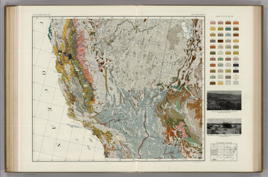
1931 Soil Map of the United States, Section 5 … National Atlas Soil Map of the United States by Curtis … |

1931 Soil Map of the United States, Section 6 … National Atlas Soil Map of the United States by Curtis … |

1924 Text Page: Industrial Statistics of the … National Atlas (Text Page) Industrial Statistics of the … |

1857 Territories of New Mexico and Utah (and … National Atlas Territories of New Mexico and Utah (and … |

1903 Text Page: Wyoming. Utah. National Atlas (Text Page) Rand, McNally Co.'s Wyoming. … |

1903 Text Page: Utah. National Atlas (Text Page) Rand, McNally Co.'s Utah. |

1903 Utah. National Atlas Rand, McNally & Co.'s Utah. |

1889 Text Page: Nevada. Utah. National Atlas (Text Page) Nevada. Utah. |

1889 Text Page: Utah. National Atlas (Text Page) Utah. |

1889 Utah. National Atlas Rand, McNally & Co.'s Utah. |