Who What Where WhenREMOVEWHATShow MoreWHO
WHEN |
Author
Asher & Adams
Full Title
Asher & Adams' geological map, United States and territories. Entered according to Act of Congress in the year 1874 by Asher & Adams ... at Washington. Drawn and engraved by W.H. Holmes. (New York, 1874)
Publisher
Asher and Adams
Author
Colton, G.W.
Full Title
Colton's United States of America. Published by G. W & C. B. Colton & Co., No. 172 William St. New York.
Publisher
G. W & C. B. Colton & Co.
Author
Asher & Adams
Full Title
Asher & Adams' United States and territories. Entered according to Act of Congress in the year 1874 by Asher & Adams ... at Washington. Drawn and engraved by W.H. Holmes. (New York, 1874)
Publisher
Asher and Adams
Author
Andreas, A. T. (Alfred Theodore), 1839-1900
Full Title
Population, United States Census, 1870: Density of population. Foreign population, Colored population, British American population, Swedish and Norwegian population. (Published by A.T. Andreas, Lakeside Building, Chicago, 1874. Chas. Shober & Co. Proprietors of Chicago Lith. Co.)
Publisher
A.T. Andreas
Author
Andreas, A. T. (Alfred Theodore), 1839-1900
Full Title
Agricultural productions colored by grades to show quantity raised in localities, from the ninth census: wheat, hay, corn, cotton, tobacco. (Published by A.T. Andreas, Lakeside Building, Chicago, 1874. Chas. Shober & Co. Proprietors of Chicago Lith. Co.)
Publisher
A.T. Andreas
Author
Andreas, A. T. (Alfred Theodore), 1839-1900
Full Title
Vital statistics, United Census, 1870: Deaths from consumption ... malarial diseases ... enteric cerebro-spinal and typhus fevers ... intestinal diseases. (Published by A.T. Andreas, Lakeside Building, Chicago, 1874. Chas. Shober & Co. Proprietors of Chicago Lith. Co.)
Publisher
A.T. Andreas
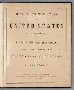
Author
Mitchell, Samuel Augustus Jr.
Full Title
(Title Page) Mitchell's New Atlas Of The United States And Territories, Together With Plans Of The Principal Cities. Designed To Accompany And Illustrate The Centennial Gazetteer Of The United States. Published By Ziegler & McCurdy, Philadelphia, Pa., Cincinnati, O., Chicago, Ill., St. Louis, Mo., And Springfield, Mass. Entered ... 1874, by S. Augustus Mitchell ... Washington.
Publisher
Ziegler & McCurdy
Author
Mitchell, Samuel Augustus Jr.
Full Title
Map of the United States, and Territories together with Canada &c. (inset) Island of Newfoundland. Entered ... 1874 by S. Augustus Mitchell ... Washington.
Publisher
Ziegler & McCurdy
Author
Chisholm, C.R.
Full Title
Chisholm's Railway Map Of The United States And Canada. Published By C.R. Chisholm & Bros., Railway General News Agents, 162 St. James Street, Montreal. Fisk & Russell, Engravers, New York. (inset) Eastern Part Of Massachusetts.
Publisher
C.R. Chisholm & Bros.
Author
Chisholm, C.R.
Full Title
(Verso to) Chisholm's Railway Map Of The United States And Canada. Published By C.R. Chisholm & Bros., Railway General News Agents, 162 St. James Street, Montreal. Fisk & Russell, Engravers, New York. (inset) Eastern Part Of Massachusetts.
Publisher
C.R. Chisholm & Bros.
Author
Nichols, Beach
Full Title
Map of the United States and Territories together with Canada &c. (inset) Island of Newfoundland.
Publisher
Pomeroy, Whitman & Co.
Author
Lake, D.J.
Full Title
The United States of America.
Publisher
Griffing, Stevenson & Co.
Author
Johnson, A.J.
Full Title
Johnson's North America. Published by A. J. Johnson, New York. 20. 21. Entered according to the Act of Congress, in the year 1867, by A.J. Johnson in the Clerk's Office of the District Court of the United States for the Southern District of New York.
Publisher
A.J. Johnson.
Author
Johnson, A.J.
Full Title
Johnson's Maine. Published by A. J. Johnson, New York. 30. 31. Entered according to the Act of Congress, in the year 1866, by A.J. Johnson in the Clerk's Office of the District Court of the United States for the Southern District of New York.
Publisher
A.J. Johnson.
Author
Johnson, A.J.
Full Title
Johnson's Vermont and New Hampshire. Published by A. J. Johnson, New York. 32. 33. Entered according to the Act of Congress, in the year 1867, by A.J. Johnson in the Clerk's Office of the District Court of the United States for the Southern District of New York.
Publisher
A.J. Johnson.
Author
Johnson, A.J.
Full Title
Johnson's Massachusetts, Connecticut, and Rhode Island. Published by A. J. Johnson, New York. 34. 35. Entered according to the Act of Congress, in the year 1864, by A.J. Johnson in the Clerk's Office of the District Court of the United States for the Southern District of New York.
Publisher
A.J. Johnson.
Author
Johnson, A.J.
Full Title
Johnson's United States. Published by A. J. Johnson, New York. 28. 29. Entered according to the Act of Congress, in the year 1864, by A.J. Johnson in the Clerk's Office of the District Court of the United States for the Southern District of New York.
Publisher
A.J. Johnson.
Author
Everts, L.H.
Full Title
Rail Road Map of the United States. Prepared Expecially for Evert's Illustrated Historical Atlas by H.H. Lloyd & Co..21 John St., N.Y.
Publisher
L.H. Everts
Author
Higgins, Belden & Co.
Full Title
General Railway Map of the United States and Canada, Engraved and Printed by Rand, McNally & Co., Chicago.
Publisher
Higgins, Belden & Co.
Author
Mitchell, Samuel Augustus Jr.
Full Title
Map Of The United States, And Territories. Together With Canada &c. Constructed & Engraved by W. Williams Philadelphia. (with) inset map Island Of Newfoundland. Entered ... 1874, by S. Augustus Mitchell ... Washington.
Publisher
S.A. Mitchell Jr.
Author
Beers, D.G.
Full Title
Map of the United States 1874. (inset) Alaska.
Publisher
D.G. Beers & Co.
Author
[United States. Census Office, Walker, Francis Amasa, 1840-1897]
Full Title
(Covers to) Statistical atlas of the United States based on the results of the ninth census 1870 with contributions from many eminent men of science and several departments of the government. Compiled under authority of Congress by Francis A. Walker, M.A., Superintendent of the 9th Census, professor of political economy and history, Sheffield Scientific School of Yale College. Julius Bien, Lith., 1874.
Publisher
U.S.
Author
[United States. Census Office, Walker, Francis Amasa, 1840-1897]
Full Title
(Title Page to) Statistical atlas of the United States based on the results of the ninth census 1870 with contributions from many eminent men of science and several departments of the government. Compiled under authority of Congress by Francis A. Walker, M.A., Superintendent of the 9th Census, professor of political economy and history, Sheffield Scientific School of Yale College. Julius Bien, Lith., 1874.
Publisher
U.S.
Author
[United States. Census Office, Walker, Francis Amasa, 1840-1897]
Full Title
(Index to) Statistical atlas of the United States based on the results of the ninth census 1870 with contributions from many eminent men of science and several departments of the government. Compiled under authority of Congress by Francis A. Walker, M.A., Superintendent of the 9th Census, professor of political economy and history, Sheffield Scientific School of Yale College. Julius Bien, Lith., 1874.
Publisher
U.S.
Author
[Steinwehr, A. von (Adolph), 1822-1877, United States. Census Office, Walker, Francis Amasa, 1840-1897]
Full Title
Map of the river systems of the United States compiled by A. von Steinwehr. To which are added certain statistics compiled from the returns of population and industry at the ninth census 1870 by Francis A. Walker. (Julius Bien, Lith., 1874)
Publisher
U.S.
Author
[Brewer, William H., United States. Census Office]
Full Title
Map showing in five degrees of density the distribution of woodland within the territory of the United States, 1873. Compiled by Wm. H. Brewer. (Julius Bien, Lith., 1874)
Publisher
U.S.
Author
[Henry, Joseph, 1797-1878, Schott, Charles A. (Charles Anthony), 1826-1901, United States. Census Office]
Full Title
Rain chart of the United States. Showing the distribution by isohyetal lines of the mean precipitation in rain and melted snow for the year. Constructed under the direction of Prof. Joseph Henry, Sec'y. Smithsonian Institution from materials collected and observations made for the Smithsonian Institution by Chas. A. Schott, Asst., U.S. Coast Survey, with additions to 1872. (Julius Bien, Lith., 1874)
Publisher
U.S.
Author
[United States. Army. Signal Service, United States. Census Office]
Full Title
U.S. Signal Service chart showing the frequency of storm centres. Number of storm centres passing over each point deduced from the average of the two years March 1871 to February 1873 inclusive. Compiled from data collected at the Office of the Chief Signal Officer of the Army. (Julius Bien, Lith., 1874)
Publisher
U.S.
Author
[Henry, Joseph, 1797-1878, Schott, Charles A. (Charles Anthony), 1826-1901, United States. Census Office]
Full Title
Temperature chart of the United States. Showing the distribution by isothermal lines of the mean temperature for the year. Constructed under the direction of Prof. Joseph Henry, Sec'y. Smithsonian Institution by Chas. A. Schott, Asst., U.S. Coast Survey in October, 1872. (Julius Bien, Lith., 1874)
Publisher
U.S.
Author
[United States. Army. Signal Service, United States. Census Office]
Full Title
U.S. Signal Service chart showing the mean temperature. At 4.35 P.M. of the hottest week of 1872, in red, and at 7.35 A.M. of the coldest week of 1872 and 1873, in blue. Compiled from data collected at the Office of the Chief Signal Officer of the Army. (Julius Bien, Lith., 1874)
Publisher
U.S.
Author
[United States. Army. Signal Service, United States. Census Office]
Full Title
U.S. Signal Service chart, showing annual means of barometer and total movement of air with resultants from June 1872 to May 1873 inclusive. Compiled from data collected at the Office of the Chief Signal Officer of the Army. (Julius Bien, Lith., 1874)
Publisher
U.S.
Author
[Guyot, A. (Arnold), 1807-1884, Schott, Charles A. (Charles Anthony), 1826-1901, United States. Census Office]
Full Title
Hypsometric sketch of the United States. The level curves of 400 and 800 feet of elevation constructed by A. Guyot. The level curves of 2000, 4000 and 8000 feet of elevation constructed by Chas. A. Schott, Asst., U.S. Coast Survey. (Julius Bien, Lith., 1874)
Publisher
U.S.
Author
[Hitchcock, Charles H. (Charles Henry), 1836-1919, United States. Census Office, Walker, Francis Amasa, 1840-1897]
Full Title
Map of the coal fields of the United States, compiled from state reports and data specially furnished by Prof. W.B. Rogers, E.T. Cox, A.H. Worthen, S.S. Lyon, Richard Owen, A.B. Roessler, R.P. Rothwell, Jas. MacFarlane, G.C. Swallow and W.C. Kerr, by Charles Hitchcock. To which are added the statistics of coal product for the years ending June 1st compiled from the statistics of industry, ninth census, 1870 by Francis A. Walker. (with) Map of the first and second anthracite coal fields of Pennsylvania. (Julius Bien, Lith., 1874)
Publisher
U.S.
Author
[Blake, William P. (William Phipps), 1826-1910, Hitchcock, Charles H. (Charles Henry), 1836-1919, United States. Census Office]
Full Title
Geological map of the United States compiled by C.H. Hitchcock and W.P. Blake from sources mentioned in the text. 1874. Lith. by J. Bien, N.Y.
Publisher
U.S.
Author
[Stocking, S. W., United States. Census Office]
Full Title
Map showing the acquisition of territory and its distribution among political divisions, 1776-1874. Compiled by S.W. Stocking. (with) Alaska. (Julius Bien, Lith., 1874)
Publisher
U.S.
Author
[United States. Census Office, Walker, Francis Amasa, 1840-1897]
Full Title
The progress of the nation, 1790-1820. Maps showing in five degrees of density the distribution within the territory east of the 100th meridian of the population of the United States, excluding Indians not taxed. Compiled from the returns of the population at the first, second, third and fourth censuses of the United States, 1790-1800-1810-1820 by Francis A. Walker. (Julius Bien, Lith., 1874)
Publisher
U.S.
Author
[United States. Census Office, Walker, Francis Amasa, 1840-1897]
Full Title
Map showing, in five degrees of density, the distribution, within the territory east of the 100th Meridian, of the population of the United States, excluding Indians not taxed. Compiled from the returns of population at the fifth census of the United States 1830 ... sixth census of the United States 1840, by Francis A. Walker. (Julius Bien, Lith., 1874)
Publisher
U.S.
Author
[United States. Census Office, Walker, Francis Amasa, 1840-1897]
Full Title
Map showing in five degrees of density, the distribution, within the territory east of the 100th Meridian, of the population of the United States, excluding Indians not taxed. Compiled from the returns of population at the seventh census by Francis A. Walker. (Julius Bien, Lith., 1874)
Publisher
U.S.
Author
[United States. Census Office, Walker, Francis Amasa, 1840-1897]
Full Title
Map showing in five degrees of density, the distribution, within the territory east of the 100th Meridian, of the population of the United States, excluding Indians not taxed. Compiled from the returns of population at the eighth census by Francis A. Walker. (Julius Bien, Lith., 1874)
Publisher
U.S.
Author
[United States. Census Office, Walker, Francis Amasa, 1840-1897]
Full Title
Map showing, in five degrees of density, the distribution, within the territory of the United States, of the constitutional population, i.e., excluding Indians not taxed. Compiled from the returns of population at the ninth census of the United States, 1870. By Francis A. Walker. To which is added a sketch of the principal Indian reservations and ranges from information furnished by the Office of Indian Affairs of date 1871. (Julius Bien, Lith., 1874)
Publisher
U.S.
Author
[United States. Census Office, Walker, Francis Amasa, 1840-1897]
Full Title
Chart showing the principal constitutional elements of the population of each state, as foreign, native, colored, and native white, and as born within or without the state of residence. Compiled from the returns of population at the ninth census 1870. By Francis A. Walker. (Julius Bien, Lith., 1874)
Publisher
U.S.
Author
[United States. Census Office, Walker, Francis Amasa, 1840-1897]
Full Title
Map showing in five degrees of density the distribution of the colored population within the territory of the United States east of the 100th Meridian. Compiled from the returns of population at the ninth census of the United States 1870, by Francis A. Walker. (Julius Bien, Lith., 1874)
Publisher
U.S.
Author
[United States. Census Office, Walker, Francis Amasa, 1840-1897]
Full Title
Map showing the proportion of the colored to the aggregate population. Compiled from the returns of population at the ninth census of the United States, 1870. By Francis A. Walker. (Julius Bien, Lith., 1874)
Publisher
U.S.
Author
[United States. Census Office, Walker, Francis Amasa, 1840-1897]
Full Title
Map showing, in five degrees of density, the distribution, within the territory of the United States east of the 100th Meridian, of that portion of the population which is, in whole, or in part, of foreign parentage, embracing i.e. all persons having father or mother or both foreign. Compiled from the returns of population at the ninth census of the United States, 1870. By Francis A. Walker. (Julius Bien, Lith., 1874)
Publisher
U.S.
Author
[United States. Census Office, Walker, Francis Amasa, 1840-1897]
Full Title
Map showing the proportion to the aggregate population, of persons having one or both parents of foreign birth. Compiled from the returns of population at the ninth census of the United States 1870. By Francis A. Walker. (Julius Bien, Lith., 1874)
Publisher
U.S.
Author
[United States. Census Office, Walker, Francis Amasa, 1840-1897]
Full Title
Map showing five degrees of density the distribution of the foreign population within the territory of the United States east of the 100th Meridian. Compiled from the returns of population at the ninth census of the United States 1870. By Francis A. Walker. (Julius Bien, Lith., 1874)
Publisher
U.S.
Author
[United States. Census Office, Walker, Francis Amasa, 1840-1897]
Full Title
Map showing the proportion of the foreign to the aggregate population. Compiled from the returns of population at the ninth census of the United States 1870. By Francis A. Walker. (Julius Bien, Lith., 1874)
Publisher
U.S.
Author
[United States. Census Office, Walker, Francis Amasa, 1840-1897]
Full Title
Maps showing the distribution, within the territory of the United States, east of the 100th Meridian, of certain foreign elements of the population. I. according to their number to the square mile, absolute. II. according to their proportion to the aggregate population, relative. Compiled from the returns of population at the ninth census 1870. By Francis A. Walker. (Julius Bien, Lith., 1874)
Publisher
U.S.
Full Title
(Maps showing the distribution, within the territory of the United States, east of the 100th Meridian, of certain foreign elements of the population. I. according to their number to the square mile, absolute. II. according to their proportion to the aggregate population, relative. Compiled from the returns of population at the ninth census 1870. By Francis A. Walker. Julius Bien, Lith., 1874)
Publisher
U.S.
Author
[United States. Census Office, Walker, Francis Amasa, 1840-1897]
Full Title
Map showing the illiteracy of the aggregate population. Compiled from the returns of population at the ninth census of the United States 1870. By Francis A. Walker. (Julius Bien, Lith., 1874)
Publisher
U.S.
|