Browse All

1861 United States E. World Atlas United States of North America, eastern … |

1843 Covers: Traveller's Guide Through The Un … Guide Book (Covers to) Mitchell's Traveller's Guide … |

1843 Title Page: Traveller's Guide Through Th … Guide Book (Title page to) Mitchell's Traveller's G … |

1843 Traveller's Guide Through The United Sta … Guide Book Mitchell's Travellers Guide Through The … |

1807 Map Of The Frontier Of British North Ame … Separate Map A Map Of The Frontier Of British North A … |

1812 Cover: United States. Case Map (Covers to)Map of the United States, Exh … |

1910 Mileage Map Of The United States Separate Map Black and White Mileage Map Of The Unite … |

1873 Map of the United States of America. State Atlas Map of the United States of America. Ent … |

1873 Topographical map of the United States. State Atlas Topographical map of the United States. … |

1874 Population, United States Census, 1870: … State Atlas Population, United States Census, 1870: … |

1874 Agricultural productions colored ... to … State Atlas Agricultural productions colored by grad … |

1874 Vital statistics, United Census, 1870: D … State Atlas Vital statistics, United Census, 1870: D … |

1853 A New Map of the United States of Americ … World Atlas A New Map of the United States of Americ … |

1850 Map of the United States. Separate Map Map Of The United States And Their Terri … |

1812 Map of the United States. Case Map Map of the United States, Exhibiting the … |
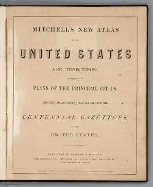
1874 Title Page: Mitchell's New Atlas Of The … National Atlas (Title Page) Mitchell's New Atlas Of The … |

1874 United States, and Territories together … National Atlas Map of the United States, and Territorie … |

1944 Outward From The U.S. World Atlas Outward From The U.S. (to accompany) Loo … |

1944 The U.S. From The Outside World Atlas The U.S. From The Outside. (to accompany … |

1824 Text Page: Tables Exhibiting The Commerc … School Atlas (Text Page to) Tables Exhibiting The Com … |

1824 United States School Atlas United States. Entered ... 1821, by Will … |

1852 New Map Of California Pocket Map A New Map Of California. By Charles Dray … |

1852 Covers: New Map Of California Pocket Map (Covers to) A New Map Of California. By … |

1864 Coats of Arms (of States) (continued) World Atlas Coats of Arms (of States) (continued). |

1861 New Military Map of the United States World Atlas Johnson's New Military Map of the United … |

1862 Amerique Boreale, Nlle. Bretagne, Canada … World Atlas Amerique Boreale, Nouvle. Bretagne & Can … |

1862 Etats-Unis de l'Amerique en 1855. World Atlas Etats-Unis de l'Amerique du Nord. Limite … |

1862 Etats-Unis de l'Amerique en 1860. World Atlas Etats-Unis de l'Amerique du Nord. Limite … |

1892 Cover: California, Texas, Mexico and Ari … Timetable Map (Covers to:) California, Texas, Mexico A … |

1892 California, Texas, Mexico and Arizona So … Timetable Map California, Texas, Mexico And Arizona So … |

1892 Railway, steamship lines, Southern Pacif … Timetable Map Correct map of the railway & steamship l … |

1854 Stati-Uniti dell'America Settentrionale. World Atlas Stati-Uniti dell'America Settentrionale … |

1869 Military Map of the United States Separate Map Office Of The Chief Of Engineers War Dep … |

1869 Military Map of the United States Separate Map Office Of The Chief Of Engineers War Dep … |

1869 Military Map of the United States Separate Map Office Of The Chief Of Engineers War Dep … |

1869 Military Map of the United States Separate Map Office Of The Chief Of Engineers War Dep … |

1869 Composite: Military Map of the United St … Separate Map (Composite of) Office Of The Chief Of En … |

1869 Military Map of the United States Separate Map Office Of The Chief Of Engineers War Dep … |

1869 Military Map of the United States Separate Map Office Of The Chief Of Engineers War Dep … |

1869 Military Map of the United States Separate Map Office Of The Chief Of Engineers War Dep … |

1869 Military Map of the United States Separate Map Office Of The Chief Of Engineers War Dep … |

1869 Composite: Military Map of the United St … Separate Map (Composite of) Office Of The Chief Of En … |

1817 United States World Atlas United States. Drawn by A. Arrowsmith. E … |

1877 Rand-McNally Official Railway Guide Map Separate Map The Rand-McNally Official Railway Guide … |

1877 Rand-McNally Official Railway Guide Map Separate Map Rand-McNally Official Railway Guide Map … |

1859 Railroad Map Of The United States and Ca … Separate Map Tunis' New Colored Railroad Map Of The U … |

1845 Unanimous Declaration Of The Thirteen Un … Separate Map The Unanimous Declaration Of The Thirtee … |

1847 Ornamental Map Of The United States & Me … Separate Map Ornamental Map Of The United States & Me … |

1846 Ornamental Map Of The United States and … Separate Map Ornamental Map Of The United States & Me … |

1846 Map Of The United States, Mexico, Oregon … Separate Map Map Of The United States And Mexico, Inc … |