Who What Where WhenREMOVEWHO
WHEN
|
Author
Brown & Parsons
Full Title
(Covers to) Map Of Maine New Hampshire And Vermont, From the most authentic Sources. Published by Brown & Parsons Hartford Ct. 1847. (inset) North Part of Maine.
Publisher
Brown & Parsons
Author
Brown & Parsons
Full Title
Map Of Maine New Hampshire And Vermont, From the most authentic Sources. Published by Brown & Parsons Hartford Ct. 1847. (inset) North Part of Maine.
Publisher
Brown & Parsons
Author
Bradford, Thomas G.
Full Title
Vermont. Entered ... 1838, by T.G. Bradford ... Massachusetts. Engraved by G.W. Boynton.
Publisher
[Weeks, Jordan & Co., Wiley and Putnam.]
Author
Finley, Anthony
Full Title
Map of Maine New Hampshire And Vermont, Compiled From the Latest Authorities. (with) North Part of Maine. D.H. Vance Del. J.H. Young Sc. Philadelphia Published by A. Finley 1826.
Publisher
Anthony Finley
Author
Leahy, J.F.
Full Title
(Index to) Leahy's Hotel Guide and Railway Distance Maps. Vermont.
Publisher
American Hotel register Co.
Author
Leahy, J.F.
Full Title
Leahy's Hotel Guide and Railway Distance Map of the State of Vermont. Published by American Hotel Register Company. Leahy Build., 228-234 W. Ontario St., Chicago, Ill. Copyrighted by J.F. Leahy, Jan., 1934.
Publisher
American Hotel register Co.
Author
W. & A.K. Johnston Limited
Full Title
Vermont, New Hampshire, Massachusetts, Rhode Island, & Connecticut.
Publisher
W. & A.K. Johnston Limited
Author
U.S. General Land Office
Full Title
(Map 4 - Maine, New Hampshire, Vermont, New York).
Publisher
Julius Bien
Author
Mitchell, Samuel Augustus
Full Title
New Hampshire & Vermont. Published By S. Augustus Mitchell. N.E. corner of Market & 7th. Streets. Philadelphia.
Publisher
S.A. Mitchell
Author
Mitchell, Samuel Augustus Jr.
Full Title
New Hampshire and Vermont. Drawn and Eng. by W.H. Gamble. Entered ... 1862 by S. Augustus Mitchell, Jr. ... Pennsylvania.
Publisher
S.A. Mitchell Jr.
Author
Colton, G.W. & C.B.
Full Title
(Covers to) Township Map Of The States Of New Hampshire And Vermont. Published by G.W. & C.B. Colton, & Co. New York, 1891.
Publisher
G.W. & C.B. Colton & Co.
Author
Colton, G.W. & C.B.
Full Title
Township Map Of The States Of New Hampshire And Vermont. Published by G.W. & C.B. Colton, & Co. New York, 1891.
Publisher
G.W. & C.B. Colton & Co.
Author
Jocelyn, N. & S.S.
Full Title
(Covers to) Map Exhibiting the Farmington, & Hampshire & Hampden Canals, Together with the Line of their proposed continuation through the Valley of the Connecticut River, to Canada. Engraved and published by N. & S.S. Jocelyn. New Haven, 1828. Entered ... August 1st 1828 by N. & S.S. Jocelyn ... Connt. (inset) Profile of the Canals. Surveys furnished by Davis Hurd Esqr. Chief Engineer.
Publisher
N. & S.S. Jocelyn
Author
Jocelyn, N. & S.S.
Full Title
Map Exhibiting the Farmington, & Hampshire & Hampden Canals, Together with the Line of their proposed continuation through the Valley of the Connecticut River, to Canada. Engraved and published by N. & S.S. Jocelyn. New Haven, 1828. Entered ... August 1st 1828 by N. & S.S. Jocelyn ... Connt. (inset) Profile of the Canals. Surveys furnished by Davis Hurd Esqr. Chief Engineer.
Publisher
N. & S.S. Jocelyn
Author
Kenyon Company
Full Title
(Covers to) Map of New England ... Copyright 1920 The Kenyon Company, Inc., Map Makers Des Moines, Iowa. Principal Automobile Highways Shown Thus ... (inset) Eastern Portion Of Massachusetts. (on verso) Index of New England States, With Official 1920 Census...
Publisher
The Kenyon Company, Inc.
Author
Kenyon Company
Full Title
(Text page to) Map of New England ... Copyright 1920 The Kenyon Company, Inc., Map Makers Des Moines, Iowa. Principal Automobile Highways Shown Thus ... (inset) Eastern Portion Of Massachusetts. (on verso) Index of New England States, With Official 1920 Census...
Publisher
The Kenyon Company, Inc.
Author
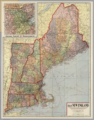
Kenyon Company
Full Title
Map of New England ... Copyright 1920 The Kenyon Company, Inc., Map Makers Des Moines, Iowa. Principal Automobile Highways Shown Thus ... (inset) Eastern Portion Of Massachusetts. (on verso) Index of New England States, With Official 1920 Census...
Publisher
The Kenyon Company, Inc.
Author
Mitchell, Samuel Augustus Jr.
Full Title
New Hampshire and Vermont. Entered ... 1874, by S. Augustus Mitchell ... Washington.
Publisher
S.A. Mitchell Jr.
Author
Mitchell, Samuel Augustus Jr.
Full Title
County and township map of the States of New Hampshire and Vermont. Entered ... 1877 by S. Augustus Mitchell, . ... Washington.
Publisher
S.A. Mitchell Jr.
Author
Mitchell, Samuel Augustus
Full Title
New Hampshire and Vermont.
Publisher
Thomas, Cowperthwait & Co.
Author
Mitchell, Samuel Augustus
Full Title
Map of New Hampshire & Vermont. Published by Charles Desilver. Entered ... 1856 by Charles Desilver ... Pennsylvania.
Publisher
Charles DeSilver
Author
Johnson, A.J.
Full Title
Johnson's New Hampshire And Vermont By Johnson & Browning. No. 16-17.
Publisher
Johnson and Browning
Author
Beers, Frederick W.
Full Title
Map of Vermont.
Publisher
Beers, Ellis & Soule
Author
National Map Company
Full Title
Vermont and New Hampshire. (Copyrighted by) National Map Company, Indianapolis. (to accompany) Official Paved Road and Commercial Survey of the United States.
Publisher
National Map Company
Author
Mitchell, Samuel Augustus Jr.
Full Title
New Hampshire and Vermont. Drawn & Eng'd. by W.H. Gamble. Entered ... 1867 by S. Augustus Mitchell, Jr. ... Pennsylvania.
Publisher
S.A. Mitchell Jr.
Author
[Confederate States of America. Army, Confederate States of America. Army. Corps of Engineers, United States. War Department]
Full Title
Sketch showing the positions of the Army on the battle-field of Chancellorsville, Va., May 1 to 5. E.F. Hoffmann, Lieut. 35th U.S. Inftry. ... Section of Map of Buckingham and Appomattox counties, Va. Surveyed under direction of A.H. Campbell ... D.V.N., by Charles E. Cassell, Lieut. Eng'rs. P.A.C.S. December 25th 1863. (with) Map of the battle-field of Wilson's Creek, Mo, Aug. 10, 1861. Wm. Hoelcke ... Hdqrs., Departmt. of the Mo., St. Louis, 1865. (with) Battle of Cedar Mountain, Va. Fought August 9th 1862. (with) Map of Hanover, Henrico and part of Chesterfield counties, Va. Section. Chief Engineer's Office, D.N.V., Col. J.F. Gilmer, Chief Engineer. Under the direction of A.H. Campbell ... 1864. Draughtsman, S.B. Linton. (with) Defenses of Macon, Ga., 1864. Julius Bien & Co., Lith., N.Y. (1891-1895)
Publisher
U.S. Government Printing Office
Author
[Hinton, Isaac Taylor, 1799-1847, Simpkin & Marshall]
Full Title
Map of Maine, New Hampshire and Vermont. London, published April 15, 1832 by I.T. Hinton & Simpkin & Marshall. Engraved & printed by Fenner Sears & Co. (1832)
Publisher
[Simpkin & Marshall, Thomas Wardle]
Full Title
New Hampshire & Vermont. Entered ... 1836, by Eleazer Huntington ... Connecticut.
Publisher
Reed & Barber
Full Title
Scythestone works of the Pike Manufacturing Co., Pike Station, N.H. (D.H. Hurd & Co., Boston. 1892)
Publisher
D.H. Hurd & Co.
Author
Lewis, Samuel
Full Title
Vermont. Drawn by S. Lewis. Engd. by D. Fairman. (Published by John Conrad & Co., Philadelphia. 1804)
Publisher
J. Conrad
Author
Lewis, Samuel
Full Title
Vermont. Drawn by S. Lewis. Engd. by D. Fairman. (Boston: Published by Thomas & Andrews. 1812)
Publisher
Thomas & Andrews
Author
Goodrich, S.G.
Full Title
New Hampshire. Vermont. G. Boynton Sc. Entered ... by S.G. Goodrich of Massachusetts. (Boston: Gray & Bowen ... 1831)
Publisher
Gray & Bowen
Full Title
County and township map of Vermont and New Hampshire. Copyright 1887 by Wm. M. Bradley & Bro. (1890)
Publisher
John Y. Huber & Co.
Full Title
Maine, New Hampshire and Vermont. N. & S.S. Jocelyn Sc. (New-Haven: N. & S.S. Jocelyn. 1823)
Publisher
N. & S.S. Jocelyn
Author
Greenleaf, Jeremiah
Full Title
Vermont And New Hampshire.
Publisher
G.R. French
Author
Mitchell, Samuel Augustus
Full Title
New Hampshire and Vermont. Drawn & engd. by W.H. Gamble. Entered ... 1870 by S. Augustus Mitchell, Jr. ... Pennsylvania.
Publisher
[R.A. Campbell, S.A. Mitchell, Jr.]
Full Title
County and township map of the states of New Hampshire and Vermont. (By S. Augustus Mitchell, 1880)
Publisher
S.A. Mitchell
Author
Carey, Mathew
Full Title
Vermont, from actual Survey. Engraved for M. Carey. Seymour fc.
Publisher
Lang and Ustick
Author
Carey, Mathew
Full Title
Vermont From actual Survey. Delineated & Engraved by Amos Doolittle N.H. Engraved for Carey's American Edition of Guthrie's Geography improved.
Publisher
Mathew Carey
Author
Carey, Mathew
Full Title
Vermont From actual Survey. Delineated & Engraved by Amos Doolittle N.H. Engraved for Carey's American Edition of Guthrie's Geography improved.
Publisher
Mathew Carey
Author
Mitchell, Samuel Augustus
Full Title
Map of New Hampshire & Vermont. Philadelphia, Published By Charles Desilver, No. 714 Chesnut Street. Entered according to Act of Congress in the year 1860 by Charles Desilver in the Clerk's office if the District Court of the Eastern District of Pennsylvania. 8.
Publisher
Charles Desilver.
Author
[Rand McNally and Company, State Farm Insurance Companies Travel Bureau]
Full Title
Rand McNally Road map, Maine, New Hampshire, Vermont. Copyright by Rand McNally & Company, Chicago, Ill. Lithographed in the U.S.A. (to accompany) State Farm Road Atlas: United States, Canada, Mexico,Central and South America. Copyright 1940 by Rand McNally & Company, Chicago, Ill.
Publisher
State Farm Insurance Companies Travel Bureau
Author
[Faden, William, 1750?-1836, Gerlach, P.,Deputy Quarter Master General]
Full Title
Plan of the action at Huberton under Brigadier Genl. Frazier, supported by Major Genl. Reidesel, on the 7th. July 1777. Drawn by P. Gerlach, Deputy Quarter Master General. Engraved by Wm. Faden. London, published as the Act directs Feby. 1st 1780, by W. Faden Charing Cross.
Publisher
William Faden
Author
Carey, Mathew
Full Title
Vermont From actual Survey. Delineated & Engraved Amos Doolittle N.H. Engraved for Carey's American Edition of Guthrie's Geography Improved.
Publisher
M. Carey
Author
Hillebrands, A.J.
Full Title
Atlas de Vereenigde Staten No. 2. Maine, New Hampshire, Vermont, Massachusetts en Connecticut.
Publisher
[J. Oomkens, J. Zoon]
Author
Bradstreet Company
Full Title
Vermont. (to accompany) Bradstreet's Pocket Atlas Of The United States. Published Exclusively for Macullar, Parker & Company, Boston, Massachusetts ... New York: The Bradstreet Company, 1885. (on verso) Entered ... 1879, by The Bradstreet Company ... Washington.
Publisher
Bradstreet Co.
Author
Montreal and Boston Air Line
Full Title
Map of the Montreal and Boston Air Line, Passumpsic, and South Eastern Railroads, and connections. Rand, Avery & Co., Eng's., Boston ... (inset) Map of Lake Memphremagog, Newport, Vt. Junction of Passumpsic and So. Eastern R.Rs.
Publisher
Rand Avery Supply Co.
Author
[Taylor, Frank J., White, Ruth Taylor]
Full Title
Vermont.
Publisher
Little, Brown, and Company
Author
Cram, George Franklin
Full Title
New Hampshire & Vermont.
Publisher
A.C. Shewey and Co.
Author
Bradford, Thomas G.
Full Title
New Hampshire & Vermont. (to accompany) A Comprehensive Atlas, Geographical, Historical & Commercial. By T.G. Bradford. William D. Ticknor, Boston. Wiley & Long, New-York. Entered ... 1835, by Thos. G. Bradford ... Massachusetts.
Publisher
[William D. Ticknor, Wiley & Long]
|