Browse All

1856 Delaware And Maryland. (with) District o … World Atlas Delaware And Maryland. (with) District o … |

1856 Georgetown And The City Of Washington. World Atlas Georgetown And The City Of Washington Th … |

1794 Plan of the City of Washington. Geography Book Plan of the City of Washington. Publishe … |

1795 Plan of the City of Washington. Separate Map Plan of the City of Washington in the Te … |

1956 Shell Washington D.C. and Vicinity. National Atlas Shell Map of Metropolitan Washington, D. … |

1956 Shell Central Washington (D.C.) National Atlas Shell Central Washington (D.C.) 12-DD-19 … |

1889 Baltimore (Md.). Washington D.C. World Atlas Map of Baltimore. Map of Washington (D.C … |

1886 Georgetown and the City of Washington. World Atlas Colton's Georgetown and the City of Wash … |

1874 Georgetown and Washington D.C.. World Atlas Colton's Georgetown and the City of Wash … |

1866 Georgetown and the City of Washington. World Atlas Colton's Georgetown and the City of Wash … |

1802 Road from Philadelphia to Washington. (M … Guide Book Road from Philadelphia to Washington. (M … |

1861 cf Stephenson 451.3 - illustrated p 205. Newspaper Map Of The Seat Of War In Virginia. Posi … |

1862 Map Of N. Eastern Virginia And Vicinity … Separate Map "Surveys For Military Defences" Map Of N … |

1864 Georgetown and the City of Washington World Atlas Johnson's Georgetown and the City of Was … |

1855 City of Washington World Atlas City of Washington. Published by Thomas, … |

1869 Map of the Region between Gettysburg, Pa … Military Atlas Map of the Region between Gettysburg, Pa … |

1845 Washington. World Atlas Plan von Washington. 1845. Aus der Geogr … |

1841 Washington. Louisville and Jeffersonvill … World Atlas Washington. Louisville and Jeffersonvill … |

1895 Defenses Washington. Military Atlas Defenses of Washington. Map of the groun … |

1895 N.E. Virginia, Washington 1. Military Atlas Surveys for military defenses. Map of no … |

1895 Washington, Richmond. Military Atlas Defenses of Washington. Extract of milit … |

1874 Washington (D.C.) and Georgetown. World Atlas Johnson's Washington (D.C.) and Georgeto … |

1848 City of Washington. World Atlas City of Washington. Published by S. Augu … |

1875 Delaware, Maryland, Virginia, West Virgi … [Commercial Reference Book, National Atl Asher & Adams' Delaware, Maryland, Virgi … |

1825 District de Colombie. National Atlas Carte geographique, statistique et histo … |

1872 Southern Ports & Harbours in the United … World Atlas Southern Ports & Harbours in the United … |

1824 Flyglarna af capitolen i Washington ar 1 … National Atlas Flyglarna af capitolen i Washington ar 1 … |

1824 Title Page: Atlas til Friherre Klinckows … National Atlas Title Page to: Atlas til Friherre Klinck … |

1807 Vue de la Ville de Washington, en 1800. Historical Atlas Vue de la Ville de Washington, en 1800. … |

1857 Delaware And Maryland. National Atlas Delaware and Maryland. No. 22. Published … |

1857 Georgetown And The City Of Washington. National Atlas Georgetown and the City of Washington, t … |

1909 Views Washington, D.C. State Atlas Views in the nation's capital, Washingto … |

1838 Washington. Louisville and Jeffersonvill … National Atlas Washington. Louisville and Jeffersonvill … |

1849 City of Washington World Atlas City of Washington. Published By S. Augu … |

1877 Plan of the city of Washington World Atlas Plan of the city of Washington. The capi … |

1857 City of Washington World Atlas City of Washington. Published by Charles … |

1873 Cover: Atlas, Maryland, District of Colu … State Atlas (Covers to) New topographical atlas of t … |

1873 Title Page: New topographical atlas, Mar … State Atlas (Title Page to) New topographical atlas … |

1873 Contents: New topographical atlas, Maryl … State Atlas (Contents to) New topographical atlas of … |

1873 Map of Maryland and the District of Colu … State Atlas Map of Maryland and the District of Colu … |

1873 Climatological map of the State of Maryl … State Atlas Climatological map of the State of Maryl … |

1873 New railroad map of the states of Maryla … State Atlas New railroad map of the states of Maryla … |

1873 Topographical atlas of Maryland: countie … State Atlas Topographical atlas of Maryland: countie … |

1873 Map of the District of Columbia, Washing … State Atlas Map of the District of Columbia includin … |

1890 Washington. World Atlas Plan of the city of Washington. The capi … |

1870 Washington. [State Atlas, World Atlas] Plan of the city of Washington, the capi … |

1880 Washington. World Atlas Plan of the city of Washington. The capi … |

1859 City of Washington. World Atlas City of Washington. Published By Charles … |

1940 City Maps. Washington, D.C. National Atlas City maps. Washington, D.C. Copyright by … |
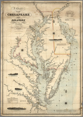
1862 A Chart of the Chesapeake And Delaware B … Chart Map A Chart of the Chesapeake And Delaware B … |