Browse All
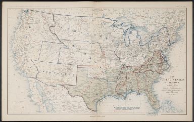
Map of the United States of America, sho … United States. War Dept Washington |

1856 Washington And Oregon. World Atlas Washington And Oregon. Published By J.H. … |

1844 Cover: Exploration du Territoire de L'Or … Exploration Book (Covers to) Exploration Du Territoire De … |

1844 Half Title: Exploration du Territoire de … Exploration Book (Half Title Page to) Exploration Du Terr … |

1844 Title Page: Exploration du Territoire de … Exploration Book (Title Page to) Exploration Du Territoir … |

1844 Index: Exploration du Territoire de l'Or … Exploration Book (Index to) Exploration Du Territoire De … |

1844 Carte De La Cote De L'Amerique. Exploration Book Carte De La Cote De L'Amerique Sur L'Oce … |

1844 Rio Colombia. Exploration Book Carte Du Rio Colombia Depuis Son Embouch … |

1846 Map Of The Road From Missouri To Oregon … Regional Atlas Topographical Map Of The Road From Misso … |

1865 California and the Western Territories. World Atlas California and the Western Territories. |

1874 Washington. National Atlas Asher & Adams' Washington. Entered accor … |

1956 Shell Highway Map of Washington. National Atlas Shell Map of Washington (cover title). S … |

1956 Various Regions and Cities in Washington … National Atlas Olympic National Park. Mount Rainier Nat … |

1828 Cote NO, l'Amerique 3. Chart Atlas Cote nord-ouest de l'Amerique. Reconnue … |

1911 Covers: Washington Pocket Map (Covers to) Washington. Hammond's Comple … |

1911 Covers: Washington Pocket Map (Text Page to) Washington. Hammond's Com … |

1911 Washington Pocket Map Washington. Hammond's Complete Map of Wa … |

1890 Covers: Seattle And Environs, Washington Pocket Map (Covers to) Whitney's Map Of Seattle And … |

1890 Seattle And Environs, Washington Pocket Map Whitney's Map Of Seattle And Environs, W … |

1919 Covers: Puget Sound Country Guide Book (Covers to) Kroll's Guide Map Of Puget S … |

1919 Puget Sound Country Guide Book Kroll's Guide Map Of Puget Sound Country … |

1827 Partie, Nouvelle Hanovre. Amer. Sep. 31. World Atlas Partie de la Nouvelle Hanovre. Amer. Sep … |

1889 Covers: Oregon Pocket Map (Covers to) J.K. Gill & Cos. Map of Oreg … |

1889 Oregon Pocket Map J.K. Gill & Cos. Map of Oregon. Portland … |

1827 Partie des Etats Unis. Amer. Sep. 38. World Atlas Partie des Etats Unis. Amer. Sep. no. 38 … |

1925 Cover: Washington, Oregon auto trails. Pocket Map (Covers to) Rand McNally Official 1925 A … |

1925 Rand McNally Official 1925 Auto Trails M … Pocket Map Rand McNally Official 1925 Auto Trails M … |

1889 Washington. World Atlas Railroad and County Map of Washington. G … |

1886 Oregon, Washington and Idaho. World Atlas Colton's Oregon, Washington, and Idaho. … |

1874 Oregon, Washington, Idaho, Montana, Brit … World Atlas Colton's Oregon, Washington, Idaho, Mont … |

1866 Oregon, and Washington Territory. World Atlas Colton's Map of Oregon, Washington, Idah … |

1884 Covers: Oregon And Washington Pocket Map (Covers to) J.K. Gill & Cos. Map of Oreg … |

1884 Oregon And Washington Pocket Map J.K. Gill & Cos. Map of Oregon & Washing … |

1878 Covers: Oregon and Washington Pocket Map (Covers to) J.K. Gill & Cos. Map of Oreg … |

1878 Oregon and Washington Pocket Map J.K. Gill & Cos. Map of Oregon & Washing … |

1878 Covers: Indexed Map Of Washington Pocket Map (Covers to) Rand McNally & Co.'s Washing … |

1878 Title Page: Indexed Map Of Washington Pocket Map (Title page to) Rand McNally & Co.'s Was … |

1878 Indexed Map Of Washington Pocket Map Rand McNally & Co.'s Washington. (with i … |

1891 Covers: Sectional Map Of Washington Pocket Map (Covers to) Rand, McNally & Co's Section … |

1891 Sectional Map Of Washington Pocket Map Rand, McNally & Co's Sectional Map Of Wa … |

1901 Washington. World Atlas Washington. |

1883 Washington Territory. 1883 Separate Map Department Of The Interior General Land … |

1828 National Road from Washington to Lake On … Separate Map Map of the Country Embracing the Several … |

1874 Map of Oregon, Washington, Idaho & Monta … National Atlas Map of Oregon, Washington, Idaho & Monta … |

1864 Washington, Oregon and Idaho World Atlas Johnson's Washington, Oregon and Idaho B … |

1853 Western Coast Of The United States Chart Map U.S. Coast Survey A.D. Bache, Superinten … |

1900 Strait of Georgia and Strait of Juan de … Chart Map Georgia Strait And Strait Of Juan De Fuc … |

1860 Map Showing the Routes travelled by the … Separate Map Map Showing the Routes travelled by the … |

1855 Map of a Part of the Territory of Washin … Separate Map Map of a Part of the Territory of Washin … |

1857 Map of a Part of the Territory of Washin … Separate Map Map of a Part of Washington Territory Ly … |