Who What Where WhenREMOVE |
REFINE
Browse All : Images of Western United States
1-15 of 15
Author
Schonberg & Co.
Full Title
California and the Western Territories.
Publisher
Schonberg & Co.
Author
Shell Oil Company
Full Title
Shell Map of Western and Central United States (cover title). Shell Highway Map of Western United States. 11-Y-1951-1.
Publisher
Shell Oil Company
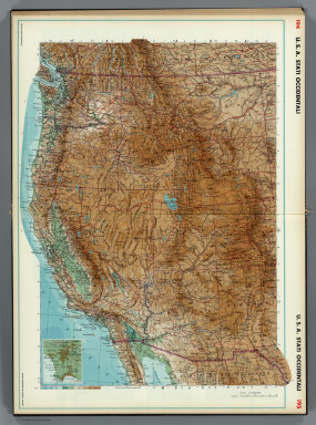
Author
Instituto Geographico di Agostini
Full Title
U.S.A. Stati Occidentali. (inset) Los Angeles.
Publisher
Instituto Geographico di Agostini
Author
[Bayer, Herbert, Container Corporation of America]
Full Title
Western U.S.A.
Publisher
Container Corporation of America
Author
[Bourquin, Frederick, Mitchell, Samuel Augustus, Tanner, Henry S.]
Full Title
Oregon, Upper California & New Mexico. Published by S. Augustus Mitchell, N.E. Corner of Market & 7th. Streets Philadelphia. 1849. Entered according to Act of Congress in the 1845 by H.N. Burroughs - in the Clerk's Office of the Eastern District of Penna. 36.
Publisher
S. Augustus Mitchell.
Author
Denoyer-Geppert Company
Full Title
Sectional Map of the United States, Southwestern/Northwestern United States.
Publisher
Denoyer-Geppert Company
Author
Blanchard, Rufus
Full Title
Cabinet Map Of The Western States And Territories On A Rectangular Projection Showing The Location Of Gold Silver And Other Minerals The Railroads And Principal Cities...Compiled From Government Maps And Published By Rufus Blanchard. 146 Lake St. Chicago, Ill. 1869. Entered ... 1868, by R. Blanchard ... Ill. Engraved by Jerome T. Gouget, at R. Blanchard's Map Establishment ... (inset) Map Of The World Showing the Great Throughfare Between Europe & Asia Through the United States.
Publisher
Rufus Blanchard
Author
Mitchell, Samuel Augustus
Full Title
A New Map of Kansas by W.H. Holmes. Published by C. Desilver. No. 714 Chesnut St., Philadelphia. Herline & Hensel, Philada. Entered according to Act of Congress in the year 1859 by C. Desilver in the Clerk's office if the District Court of the Eastern District of Pennsylvania.
Publisher
Charles Desilver.
Author
Mitchell, Samuel Augustus
Full Title
A New Map of Nebraska, Kansas, New Mexico, and Indian Territories. Published By Charles Desilver, Philadelphia. Entered according to Act of Congress in the year 1859 by Charles Desilver in the Clerk's office if the District Court of the Eastern District of Pennsylvania. 38.
Publisher
Charles Desilver.
Author
[Stieler, Adolf, Petermann, A.]
Full Title
Stieler's Hand-Atlas No. 79. West-Indien in 4 Blattern, Bl. 1.
Publisher
Justus Perthus
Author
[Thomas Bros., Thomas Brothers]
Full Title
Highways of the Western States.
Publisher
Thomas Bros.
Author
USSR (Union of Soviet Socialist Republics).
Full Title
209-210. United States of America, West. The World Atlas.
Publisher
USSR
Author
Polish Army Topography Service
Full Title
United States of America - West. Pergamon World Atlas. Pergamon Press, Ltd. & P.W.N. Poland 1967. Sluzba Topograficzna W.P.
Publisher
Pergamon Press
Author
Mitchell, Samuel Augustus
Full Title
A New Map of Nebraska, Kansas, New Mexico, and Indian Territories. Published By Charles Desilver, Philadelphia. Entered according to Act of Congress in the year 1856 by Charles Desilver in the Clerk's office if the District Court of the Eastern District of Pennsylvania. 38.
Publisher
Charles Desilver.
Author
Rand McNally and Company
Full Title
Rand - McNally Official Railway Map Of The Pacific Coast States Including Territory East To Denver ... Copyright, 1902, by Rand, McNally & Co., Chicago. Copyright, 1893 ... 1898 ...
Publisher
Rand McNally
1-15 of 15
|