Who What Where WhenREMOVEWHERE |
REFINE
Browse All : Case Map by A. Arrowsmith of United Kingdom
1-2 of 2
Author
Arrowsmith, Aaron
Full Title
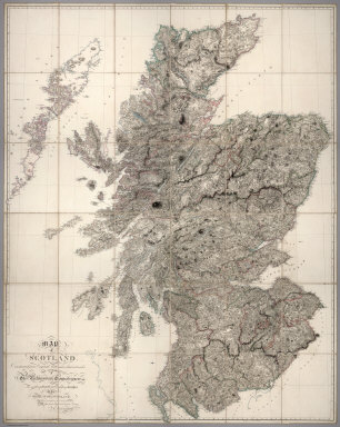
Map of Scotland Constructed from Original Materials Obtained under The Authority of The Parliamentary Commissioners For making Roads and building Bridges In the Highlands of Scotland With whose permission it is now published By Their most obliged and obedient Servant A.Arrowsmith Hydrographer to H.R.H. the Prince of Wales. London. Published June 25th. 1807 by A. Arrowsmith 10 Soho Square
Publisher
A. Arrowsmith
Author
Arrowsmith, Aaron
Full Title
Map of the Hills, Rivers, Canals, and Principal Roads of England and Wales, Upon a Scale of Six Miles to an Inch. Exhibiting Most of the Places Whose Situation has been ascertained by the Stations and Intersections of the Trigonometrical Survey, Compiled by A. Arrowsmith. London, Published 29th Septr 1813, by A. Arrowsmith, Hydrographer to His Majesty, No. 10 Soho Square. Additions & Corrections to 1814, -15,-19, -20. Scale of 30 English Miles. The distances on the Roads are from the following Standards....
Publisher
A. Arrowsmith
1-2 of 2
|