Browse All

1810 Covers: Map Exhibiting the Great Post Ro … Case Map (Covers to) Map Exhibiting the Great Pos … |

1810 (Northwest Section) Map Exhibiting the G … Case Map (Northwest Section) Map Exhibiting the G … |

1810 (Northeast Section) Map Exhibiting the G … Case Map (Northeast Section) Map Exhibiting the G … |
1810 (Southwest Section) Map Exhibiting the G … Case Map (Southwest Section) Map Exhibiting the G … |

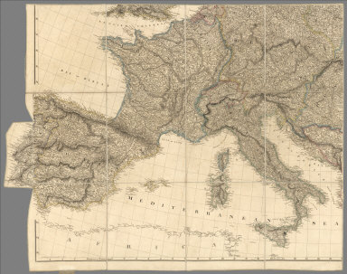
1810 (Southeast Section) Map Exhibiting the G … Case Map (Southeast Section) Map Exhibiting the G … |

1810 Composite Map: Map Exhibiting the Great … Case Map (Composite Map) Map Exhibiting the Great … |

1810 Cover: Mexico, adjacent provinces. Case Map (Covers to) A New Map of Mexico and Adja … |

1810 Mexico and Adjacent Provinces. Case Map A New Map of Mexico and Adjacent Provinc … |

1810 Mexico 1. Regional Atlas A new map of Mexico and adjacent provinc … |

1810 Mexico 2. Regional Atlas (A new map of Mexico and adjacent provin … |

1810 Mexico 3. Regional Atlas (A new map of Mexico and adjacent provin … |

1810 Mexico 4. Regional Atlas (A new map of Mexico and adjacent provin … |

1810 Composite: Mexico. Regional Atlas (Composite of) A new map of Mexico and a … |

1810 West Indies 1. Regional Atlas Chart of the West Indies and Spanish Dom … |

1810 West Indies 2. Regional Atlas (Chart of the West Indies and Spanish Do … |

1810 Composite: West Indies. Regional Atlas (Composite of) Chart of the West Indies … |