Browse All

1818 Map of the Countries Round the North Pol … Separate Map Map of the Countries Round the North Pol … |

1802 Plan of the Operations of the British & … Separate Map Plan of the Operations of the British & … |

1807 Map of Upper Egypt, drawn from various d … Separate Map Map of Upper Egypt, drawn from various d … |

1815 South Africa delineated from various doc … Separate Map South Africa delineated from various doc … |

1807 Upper Sheet: A Map of Lower Egypt from V … Separate Map (Upper Sheet to) A Map of Lower Egypt fr … |

1807 Lower Sheet: A Map of Lower Egypt from V … Separate Map (Lower Sheet to) A Map of Lower Egypt fr … |

1807 Composite: A Map of Lower Egypt from Var … Separate Map (Composite map of) A Map of Lower Egypt … |

1815 Composite: A Sketch of the Countries bet … Separate Map (Composite map of) A Sketch of the Count … |

1815 Upper Sheet: A Sketch of the Countries b … Separate Map (Upper Sheet to) A Sketch of the Countri … |

1815 Lower Sheet: A Sketch of the Countries b … Separate Map (Lower Sheet to) A Sketch of the Countri … |

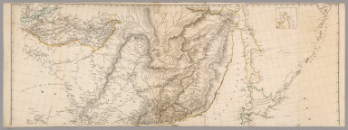
1813 Upper Sheet: Map of the Countries lying … Separate Map (Upper Sheet to) Map of the Countries ly … |

1813 Lower Sheet: Map of the Countries lying … Separate Map (Lower Sheet to) Map of the Countries ly … |
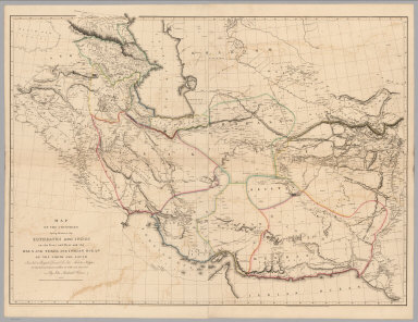
1813 Composite: Map of the Countries lying be … Separate Map (Composite Map of) Map of the Countries … |

1804 Composite: A Map of the Environs of Cons … Separate Map (Composite Map of) A Map of the Environs … |

1804 Upper Sheet: A Map of the Environs of Co … Separate Map (Upper Sheet to) A Map of the Environs o … |

1804 Lower Sheet: A Map of the Environs of Co … Separate Map (Lower Sheet to) A Map of the Environs o … |

1804 Lower Sheet: Map of India. Case Map (Lower Sheet to) To Mark Wood Esqr. M.P. … |

1804 Middle Sheet: Map of India. Case Map (Middle Sheet to) To Mark Wood Esqr. M.P … |

1804 Upper Sheet: Map of India. Case Map (Upper Sheet to) To Mark Wood Esqr. M.P. … |

1804 Covers: Map of India. Case Map (Covers to) To Mark Wood Esqr. M.P. colo … |

1804 Composite: Map of India. Case Map (Composite Map of) To Mark Wood Esqr. M. … |

1818 Composite: Map of the Island of Japan, K … Separate Map (Composite Map of) Map of the Island of … |
1818 Upper Sheet: Map of the Island of Japan, … Separate Map (Upper Sheet to) Map of the Island of Ja … |

1818 Lower Sheet: Map of the Island of Japan, … Separate Map (Lower Sheet to) Map of the Island of Ja … |

1804 Upper Sheets: Map of the Alpine Country … Separate Map (Upper Sheets to) Map of the Alpine Coun … |

1804 Lower Sheets: Map of the Alpine Country … Separate Map (Lower Sheets to) Map of the Alpine Coun … |

1804 Composite: Map of the Alpine Country in … Separate Map (Composite map of) Map of the Alpine Cou … |

1796 Composite: Map of Europe. Case Map (Composite map of) Map of Europe Drawn f … |

1796 Sheet 1: Map of Europe. Case Map (Sheet 1 of) Map of Europe Drawn from al … |

1796 Sheet 2: Map of Europe. Case Map (Sheet 2 of) Map of Europe Drawn from al … |

1796 Sheet 3: Map of Europe. Case Map (Sheet 3 of) Map of Europe Drawn from al … |

1796 Sheet 4: Map of Europe. Case Map (Sheet 4 of) Map of Europe Drawn from al … |

1802 Africa Case Map Africa. To the Committee and Members of … |

1801 Asia Case Map Asia. To Major James Rennell, Esq.r F.R. … |

1805 Map of The Island of Ceylon Separate Map Map of The Island of Ceylon Drawn by A. … |

1806 A Map of Part of the Viceroyalty of Buen … Separate Map A Map of Part of the Viceroyalty of Buen … |

1828 Covers: A Comparative Atlas of Ancient A … School Atlas (Covers to) Orbis Terrarum Veteribus Not … |

1828 Title Page: A Comparative Atlas of Ancie … School Atlas (Title Page to) Orbis Terrarum Veteribus … |

1828 Text Page: A Comparative Atlas of Ancien … School Atlas (Text Page to) Orbis Terrarum Veteribus … |

1828 Index Page: A Comparative Atlas of Ancie … School Atlas (Index Page to) Orbis Terrarum Veteribus … |

1828 Eastern Hemisphere. Orbis Veteribus notu … School Atlas Eastern Hemisphere. Orbis Veteribus notu … |

1828 Europe. Europa School Atlas Europe. Europa, Cum Insulis et Regionibu … |

1828 Asia School Atlas Asia. Asia, Veteribus Nota, eum Insulis. … |

1828 Africa School Atlas Africa. Africa, Cum Aegypto et Insulis. … |

1828 Great Britain and Ireland. Insulae Brita … School Atlas Great Britain and Ireland. Insulae Brita … |

1828 England and Wales. Engla Land School Atlas England and Wales. (Scale 1:2,000,000). … |

1828 Northern Germany. Germania School Atlas Northern Germany. Germania, Vel Regiones … |

1828 Southern Germany, with parts of Hungary, … School Atlas Southern Germany, with parts of Hungary, … |

1828 France and the Netherlands, with part of … School Atlas France and the Netherlands, with part of … |

1828 Spain and Portugal. Hispania et Insulae School Atlas Spain and Portugal. Hispania et Insulae. … |