Who What Where WhenREMOVE |
REFINE
Browse All : Images by Barnard, E.C.
1-7 of 7
Author
[USGS (U.S. Geological Survey), Walcott, Charles D., Barnard, E.C.]
Full Title
Plate CXXXVII. Fortymile Quadrangle, Alaska, Land Classification and Density of Standing Timber. Julis Bien & Co. Lith. N.Y.
Publisher
Government Printing Office
Author
[USGS (U.S. Geological Survey), Walcott, Charles D., Gannett, Henry]
Full Title
Plate CXXVII. Coos Bay Quadrangle, Oregon, Land Classification and Density of Standing Timber.
Publisher
Government Printing Office
Author
[USGS (U.S. Geological Survey), Walcott, Charles D., Gannett, Henry]
Full Title
Plate CXXVIII. Roseburg Quadrangle, Oregon, Land Classification and Density of Standing Timber.
Publisher
Government Printing Office
Author
[USGS (U.S. Geological Survey), Gannett, Henry, Walcott, Charles D.]
Full Title
Plate CXXIX. Tacoma Quadrangle, Washington, Land Classification and Density of Standing Timber.
Publisher
Government Printing Office
Author
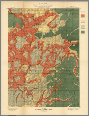
[USGS (U.S. Geological Survey), Walcott, Charles D., Leiberg, John B., Barnard, E.C., Searle, A.B.]
Full Title
Plate CXXXV. Sandpoint Quadrangle, (Kootenai Co) Idaho, Land Classification and Density of Standing Timber. Julis Bien & Co. Lith. N.Y.
Publisher
Government Printing Office
Author
[USGS (U.S. Geological Survey), Gannett, Henry, Walcott, Charles D.]
Full Title
Plate CXXXVI. Hamilton Quadrangle, Montana-Idaho, Land Classification and Density of Standing Timber. Julis Bien & Co. Lith. N.Y.
Publisher
Government Printing Office
Author
[Barnard, E.C., U.S. Geological Survey (USGS), Goode, R.U.]
Full Title
Map of Alaska. (insets) Aleutian Islands. (Areas of Geologic Mapping by the U.S.G.S.). Compiled under the Direction of R.U. Goode, Geographer, by E.C. Barnard and others. 1904. Contour Interval 1000 feet. U.S. Geological Survey. Professional Paper No. 45, Plate XXXIV.
Publisher
U.S. Geological Survey (USGS)
1-7 of 7
|