|
|
REFINE
Browse All : Forests and Atlas Map by Barnard, E.C. from 1900
1-6 of 6
Author
[USGS (U.S. Geological Survey), Walcott, Charles D., Barnard, E.C.]
Full Title
Plate CXXXVII. Fortymile Quadrangle, Alaska, Land Classification and Density of Standing Timber. Julis Bien & Co. Lith. N.Y.
Publisher
Government Printing Office
Author
[USGS (U.S. Geological Survey), Walcott, Charles D., Gannett, Henry]
Full Title
Plate CXXVII. Coos Bay Quadrangle, Oregon, Land Classification and Density of Standing Timber.
Publisher
Government Printing Office
Author
[USGS (U.S. Geological Survey), Walcott, Charles D., Gannett, Henry]
Full Title
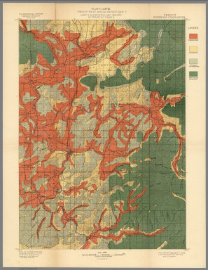
Plate CXXVIII. Roseburg Quadrangle, Oregon, Land Classification and Density of Standing Timber.
Publisher
Government Printing Office
Author
[USGS (U.S. Geological Survey), Gannett, Henry, Walcott, Charles D.]
Full Title
Plate CXXIX. Tacoma Quadrangle, Washington, Land Classification and Density of Standing Timber.
Publisher
Government Printing Office
Author
[USGS (U.S. Geological Survey), Walcott, Charles D., Leiberg, John B., Barnard, E.C., Searle, A.B.]
Full Title
Plate CXXXV. Sandpoint Quadrangle, (Kootenai Co) Idaho, Land Classification and Density of Standing Timber. Julis Bien & Co. Lith. N.Y.
Publisher
Government Printing Office
Author
[USGS (U.S. Geological Survey), Gannett, Henry, Walcott, Charles D.]
Full Title
Plate CXXXVI. Hamilton Quadrangle, Montana-Idaho, Land Classification and Density of Standing Timber. Julis Bien & Co. Lith. N.Y.
Publisher
Government Printing Office
1-6 of 6
|