Who What Where When |
REFINE
Browse All : Images by Blunt, Edmund M. (Edmund March), 1770-1862
1-34 of 34
Author
[Blunt, Edmund M. (Edmund March), 1770-1862, Hooker, William]
Full Title
To the Marine Society of the city of New York; this chart, extending from lat. 40¦15' N. long: 72¦15' W. to Lat. 22¦35" N. long: 80¦25' W. is respectfully dedicated, by their obedient servant, Edmund M. Blunt, 1820 ... Plans engraved by Hooker, N. York.
Publisher
Wm. Hooker.
Author
[Blunt, Edmund M. (Edmund March), 1770-1862, Hooker, William]
Full Title
Books and charts published by Edmund Blunt or William Hooker, 202 Water, corner of Fulton Street, New-York, November, 1819.
Publisher
Wm. Hooker.
Author
Blunt, Edmund M. (Edmund March), 1770-1862
Full Title
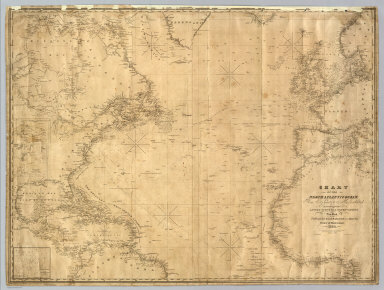
Chart Of The North Atlantic Ocean, From the Equator to 65° North Latitude. According to the Latest Surveys & Observations. New York, Published by E. & G.W. Blunt, 154 Water St. Corner of Maiden Lane. 1832. Entered ... 1832, by Edmund & George W. Blunt ... New York. Additions to 1835. Engraved by W. Hooker. Lettered by D.R. Harrison. (with) three inset maps listed in Notes.
Publisher
E. & G.W. Blunt.
Author
United States Coast Survey
Full Title
Map of New-York Bay And Harbor And The Environs. Founded upon a Trigonometrical Survey under the direction of F.R. Hassler Superintendent of the Survey Of The Coast Of The United States. Triangulation by James Ferguson and Edmund Blunt Assistants. The Hydrology ... Thomas R. Gedney ... Topography by C. Renard and T.A. Jenkins ... Published in 1844. Presented to The University of Vermont ... A.D. Bache Superintendent, Coast Survey.
Publisher
U.S.
Author
United States Coast Survey
Full Title
Coast Chart No. 20 New York Bay And Harbor, New York. From a Trigonometric Survey under the direction of A.D. Bache Superintendent of the Survey Of The Coast Of The United States ... Published in 1866. Verified J.E. Hilgard Assist. Coast Survey In charge of Office. Electrotype Copy No. 3 by G. Mathiot U.S.C.S. Redd. Drng. by E. Hergesheimer, M.H. McClery and A. Balbach. Engd. by J. Enthoffer, J. Knight, H.S. Barnard and J.C. Kondrup.
Publisher
U.S.
Author
[Bache, A. D., Hassler, F. R.]
Full Title
The Harbor of New London. Founded upon a trigonometrical survey under the direction of F.R. Hassler, Superintendent of the Survey of the Coast of the United States. Triangulation by E. Blunt assistant. Topography by F.H. Gerdes and J.B. Gluck assistants. Hydrography by the party under the command of G.S. Blake, Lieutenant, U.S. Navy. Published in 1848. A.D. Bache, Superintendent. Final reduction for engraving by J.B. Gluck, draughtsman. Topography engraved by A. Rolle. Lettering by J. Knight. Electrotyped by S. Siebert. Printed by H. Benner. Electrotype copy no. 2 by G. Mathiot, U.S.C.S. (with logo) U.S. Coast Survey Depot.
Publisher
U.S.
Author
[Bache, A. D., Hassler, F. R.]
Full Title
Mouth of Connecticut River. From a trigonometrical survey under the direction of F.R. Hassler and A.D. Bache, Superintendents of the Survey of the Coast of the United States. Triangulation by Capt. W.H. Swift, U.S.A. and E. Blunt, assistants. Topography by H.L. Whiting, assistant. Hydrography by the parties under the command of Lieuts. J.R. Goldsborough and M. Woodhull, U.S.N., assts. Published in 1853. A.D. Bache, Superintendent. Red(uce)d dr(awi)ng by A. Boschke. Eng(ravin)g by S. Siebert, O.A. Lawson & W. Smith. Electrotype copy no. 1 by G. Mathiot, U.S.C.S. (with logo) U.S. Coast Survey Office.
Publisher
U.S.
Author
[Bache, A. D., Hassler, F. R.]
Full Title
New Haven Harbor. Founded upon a trigonometrical survey under the direction of F.R. Hassler, Superintendent of the Survey of the Coast of the United States. Triangulation by James Ferguson and Edmund Blunt, assistants. Topography by C.M. Eakin, W.M. Boyce & J. Farley, assistants. Hydrography by the party under the command of G.S. Blake, Lieut., U.S. Navy. Published in 1846. A.D. Bache, Superintendent. Final reduction for engraving by Jno. B. Gluck, draughtsman. Engraved by Sherman & Smith, N.Y. Electrotype copy no. 3 by S. Siebert, U.S.C.S. (with logo) U.S. Coast Survey Depot.
Publisher
U.S.
Author
[Bache, A. D., Hassler, F. R.]
Full Title
Huntington Bay. Founded upon a trigonometrical survey under the direction of F.R. Hassler, Superintendent of the Survey of the Coast of the United States. Triangulation by E. Blunt, assistant. Topography by F.H. Gerdes, assist. Hydrography by the party under the command of G.S. Blake, Lieutenant, U.S. Navy. Published in 1849. A.D. Bache, Superintendent. Final reduction for engraving by J.B. Gluck, assistant. Engraved by Geo. G. Smith, Boston. Electrotype copy no. 1 by G. Mathiot, U.S.C.S. (with logo) U.S. Coast Survey Office.
Publisher
U.S.
Author
[Bache, A. D., Hassler, F. R.]
Full Title
Oyster or Syosset Bay. Founded upon a trigonometrical survey under the direction of F.R. Hassler, Superintendent of the Survey of the Coast of the United States. Triangulation by E. Blunt, assistant. Topography by A.D. Mackay, Lt. U.S.A. and F.H. Gerdes, assts. Hydrography by the party under the command of Lieutenant G.S. Blake, U.S. Navy. Published in 1847. A.D. Bache, Superintendent. Final reduction for engraving by Jno. B. Gluck, draughtsman. Engraved by Sherman & Smith, N.Y. Printed by H. Benner. Electrotype copy no. 1 by G. Mathiot, U.S.C.S. (with logo) U.S. Coast Survey Depot.
Publisher
U.S.
Author
[Bache, A. D., Hassler, F. R.]
Full Title
Hart & City Island. From a trigonometrical survey under the direction of F.R. Hassler, Superintendent of the Survey of the Coast of the United States. Triangulation by E. Blunt, assistant. Topography by T.W. Werner and H.L. Whiting, assistants. Hydrography by the parties under the command of Lieut. G.S. Blake & Lieut. J.R. Goldsborough, U.S.N. ... Sachem's Head Harbor. From a trigonometrical survey under the direction of F.R. Hassler, Superintendent of the Survey of the Coast of the United States. Triangulation by E. Blunt, assistant. Topography by W.M. Boyce, assistant. Hydrography by the party under the command of Lieutenant G.S. Blake, U.S. Navy. Published in 1851. A.D. Bache, Superintendent. Reduction for engraving by M. McClery, J. Lambert & J. Robertson. Eng. principally by R.T. Knight & S.T. Pettit. Electrotype copy no. 2 by G. Mathiot, U.S.C.S. (with logo) U.S. Coast Survey Office.
Publisher
U.S.
Author
[Bache, A. D., Hassler, F. R.]
Full Title
Hell Gate and its approaches. From a trigonometrical survey under the direction of F.R. Hassler and A.D. Bache, Superintendents of the Survey of the Coast of the United States. Triangulation by Edmund Blunt, assistant. Topography by H.L. Whiting, assistant. Hydrography by the parties under the command of D.D. Porter & M. Woodhull, Lts., U.S. Navy. Published in 1851. A.D. Bache, Superintendent. Reduction of topography for engraving by C. Mahon, of hydrography by J.R.P. Mechlin. Topography engraved by A. Rolle, F. Dankworth & G. McCoy; lettering by J. Knight. Electrotype copy no. 1 by G. Mathiot, U.S.C.S. (with logo) U.S. Coast Survey Office.
Publisher
U.S.
Author
[Bache, A. D., Hassler, F. R.]
Full Title
Map of New-York Bay and Harbor and the environs. From a trigonometrical survey under the direction of F.R. Hassler, Superintendent of the Survey of the Coast of the United States. Triangulation by James Ferguson and Edmund Blunt, assistants. The hydrography under the direction of Thomas R. Gedney, Lieutenant, U.S. Navy. The topography by C. Renard, T.A. Jenkins & B.F. Sands, assists. Published in 1845. A.D. Bache, Superintendent. Topography engraved by S. Siebert & A. Rolle, views engraved by O.A. Lawson. Engraving supervised & views of the coast drawn by J. Farley. Hydrography engraved by F. Dankworth, lettering by F. Dankworth & J. Knight. Electrotype copy no. 5 by G. Mathiot, U.S.C.S. (with logo) U.S. Coast Survey Depot.
Publisher
U.S.
Full Title
(Map of Delaware Bay and River). Sheet no. 1. (Founded upon a trigonometrical survey under the direction of F.R. Hassler and A.D. Bache, Superintendents of the Survey of the Coast of the United States. Triangulation by F.R. Hassler, assts. J. Ferguson, E. Blunt, C.M. Eakin, F.H. Gerdes, J.J.S. Hassler & J.E. Johnstone, Capt. Topl. Engrs. Topography by assistants W.M. Boyce, F.H. Gerdes, J.J.S. Hassler, H.L. Whiting, G.D. Wise & B.F. Sands, U.S.N. Hydrography by the party under the command of G.S. Blake, Lieutenant U.S. Navy. Soundings outside the capes under the direction of T.R. Gedney and G.M. Bache, Lieutenants U.S. Navy. Published in 1848. A.D. Bache, Superintendent). Final reduction for engraving of topography by W.M.C. Fairfax, asstist. & of hydrography by Lt. J.B. Dale, U.S.N. Engraved by F. Dankworth, assisted by O.A. Lawson. Views engraved by O.A. Lawson. Lettering by J. Knight. (Electrotype copy no. 4 by G. Mathiot, U.S.C.S.)
Publisher
U.S.
Author
[Bache, A. D., Hassler, F. R.]
Full Title
Map of Delaware Bay and River. Sheet no. 2. Founded upon a trigonometrical survey under the direction of F.R. Hassler and A.D. Bache, Superintendents of the Survey of the Coast of the United States. Triangulation by F.R. Hassler, assts. J. Ferguson, E. Blunt, C.M. Eakin, F.H. Gerdes, J.J.S. Hassler & J.E. Johnstone, Capt. Topl. Engrs. Topography by assistants W.M. Boyce, F.H. Gerdes, J.J.S. Hassler, H.L. Whiting, G.D. Wise & B.F. Sands, U.S.N. Hydrography by the party under the command of G.S. Blake, Lieutenant U.S. Navy. Soundings outside the capes under the direction of T.R. Gedney and G.M. Bache, Lieutenants U.S. Navy. Published in 1848. A.D. Bache, Superintendent. Final reduction for engraving of topography by W.M.C. Fairfax, asstist. & of hydrography by Lt. J.B. Dale, U.S.N. Engraved by F. Dankworth, assisted by O.A. Lawson. Views engraved by O.A. Lawson. Lettering by J. Knight. (with logo) U.S. Coast Survey Depot. (Electrotype copy no. 4 by G. Mathiot, U.S.C.S.)
Publisher
U.S.
Author
[Bache, A. D., Hassler, F. R.]
Full Title
(Map of Delaware Bay and River). Sheet no. 3. (Founded upon a trigonometrical survey under the direction of F.R. Hassler and A.D. Bache, Superintendents of the Survey of the Coast of the United States. Triangulation by F.R. Hassler, assts. J. Ferguson, E. Blunt, C.M. Eakin, F.H. Gerdes, J.J.S. Hassler & J.E. Johnstone, Capt. Topl. Engrs. Topography by assistants W.M. Boyce, F.H. Gerdes, J.J.S. Hassler, H.L. Whiting, G.D. Wise & B.F. Sands, U.S.N. Hydrography by the party under the command of G.S. Blake, Lieutenant U.S. Navy. Soundings outside the capes under the direction of T.R. Gedney and G.M. Bache, Lieutenants U.S. Navy. Published in 1848. A.D. Bache, Superintendent). Final reduction for engraving of topography by W.M.C. Fairfax, asstist. & of hydrography by Lt. J.B. Dale, U.S.N. & J.B. Gluck, assistant. Engraved by F. Dankworth, assisted by O.A. Lawson. Lettering by F. Dankworth & J. Knight. Electrotype copy no. 4 by G. Mathiot, U.S.C.S.
Publisher
U.S.
Author
[Bache, A. D., Hassler, F. R.]
Full Title
(Composite of) Map of Delaware Bay and River. Founded upon a trigonometrical survey under the direction of F.R. Hassler and A.D. Bache, Superintendents of the Survey of the Coast of the United States. Triangulation by F.R. Hassler, assts. J. Ferguson, E. Blunt, C.M. Eakin, F.H. Gerdes, J.J.S. Hassler & J.E. Johnstone, Capt. Topl. Engrs. Topography by assistants W.M. Boyce, F.H. Gerdes, J.J.S. Hassler, H.L. Whiting, G.D. Wise & B.F. Sands, U.S.N. Hydrography by the party under the command of G.S. Blake, Lieutenant U.S. Navy. Soundings outside the capes under the direction of T.R. Gedney and G.M. Bache, Lieutenants U.S. Navy. Published in 1848. A.D. Bache, Superintendent. Final reduction for engraving of topography by W.M.C. Fairfax, asstist. & of hydrography by Lt. J.B. Dale, U.S.N. Engraved by F. Dankworth, assisted by O.A. Lawson. Views engraved by O.A. Lawson. Lettering by J. Knight. (with logo) U.S. Coast Survey Depot. Electrotype copy no. 4 by G. Mathiot, U.S.C.S.
Publisher
U.S.
Author
Bache, A. D.
Full Title
Sea Coast of Delaware, Maryland and part of Virginia. From a trigonometrical survey under the direction of A.D. Bache, Superintendent of the Survey of the Coast of the United States. Triangulation by J. Farley, E. Blunt & J.E. Johnstone, Capt. Top. Engrs., assistants. Topography by J.J.S. Hassler & G.D. Wise, assts. & W.M. Johnson, sub. asst. Hydrography by the parties under the command of T.R. Gedney, Lieuts. G.M. Bache, S.P. Lee, R. Bache & J.J. Almy, U.S. Navy, assistants U.S. Coast Survey. Published in 1852.
Publisher
U.S.
Author
United States Coast Survey
Full Title
New York Bay and Harbor, New York. From a trigonometrical survey ... Survey of the Coast of the United States. Triangulation by J. Ferguson and E. Blunt, assistants. Topography by H.L. Whiting, S.A. Gilbert, A.M. Harrison, assts., F.W. Dorr, C. Rockwell and J. Mechan sub-assts. Hydrography by the parties under the command of Lieuts. Comdg. R. Wainwright and T.A. Craven, U.S.N. assists. Published in 1866. Edition of 1877. (Philadelphia, Woolman & Rose, 1878)
Publisher
Woolman & Rose
Author
[Blunt, Edmund M. (Edmund March), 1770-1862, Des Barres, Joseph F. W. (Joseph Frederick Wallet), 1722-1824]
Full Title
(The north eastern coast of North America from New York to Cape Canso including Sable Island by Edmund Blunt. East sheet. (with) Halifax Harbour and adjacent coast by J.F.W. Des Barres. Published & Sold by E. & G.W. Blunt, No. 154 Water Street, corner of Maiden Lane, New York. G. Ely Sct. Engd. by D.R. Harrison. Entered ... 22nd day of July 1828, by Edmund Blunt of the State of New York)
Publisher
E. & G.W. Blunt.
Author
Blunt, Edmund M. (Edmund March), 1770-1862
Full Title
The north eastern coast of North America from New York to Cape Canso including Sable Island by Edmund Blunt. Center sheet. Published & Sold by E. & G.W. Blunt, No. 154 Water Street, corner of Maiden Lane, New York. G. Ely Sct. Engd. by D.R. Harrison. Entered ... 22nd day of July 1828, by Edmund Blunt of the State of New York.
Publisher
E. & G.W. Blunt.
Author
[Blunt, Edmund M. (Edmund March), 1770-1862, Des Barres, Joseph F. W. (Joseph Frederick Wallet), 1722-1824, Taber, W. C., Wadsworth, A. S. (Alex. S.)]
Full Title
(The north eastern coast of North America from New York to Cape Canso including Sable Island by Edmund Blunt. West sheet. (with) Buzzards Bay drawn from the survey of Des Barres and information furnished by W.C. Taber ... (with) Boston Harbour from the survey of A.S. Wadsworth, U.S.N. and the chart of Des Barres. Published & Sold by E. & G.W. Blunt, No. 154 Water Street, corner of Maiden Lane, New York. G. Ely Sct. Engd. by D.R. Harrison. Entered ... 22nd day of July 1828, by Edmund Blunt of the State of New York)
Publisher
E. & G.W. Blunt.
Author
[Blunt, Edmund M. (Edmund March), 1770-1862, Des Barres, Joseph F. W. (Joseph Frederick Wallet), 1722-1824, Taber, W. C., Wadsworth, A. S. (Alex. S.)]
Full Title
(Composite of) The north eastern coast of North America from New York to Cape Canso including Sable Island by Edmund Blunt. (with) Halifax Harbour and adjacent coast by J.F.W. Des Barres. (with) Buzzards Bay drawn from the survey of Des Barres and information furnished by W.C. Taber ... (with) Boston Harbour from the survey of A.S. Wadsworth, U.S.N. and the chart of Des Barres. Published & Sold by E. & G.W. Blunt, No. 154 Water Street, corner of Maiden Lane, New York. G. Ely Sct. Engd. by D.R. Harrison. Entered ... 22nd day of July 1828, by Edmund Blunt of the State of New York.
Publisher
E. & G.W. Blunt.
Author
[Adams, D. P., Blunt, Edmund M. (Edmund March), 1770-1862]
Full Title
The harbour of New York surveyed by Edmund Blunt. (with) Entrance fo the Chesapeake Bay, reduced from the surveys made by D.P. Adams and others by order of the Navy Commissioners of the U.S. by E. Blunt. (with) Views of land between Cape Henlopen and Cape Charles. (insets on 1st sheet of : The coast of the United States of North America; from New York to St. Augustine drawn and regulated according the the latest surveys and astronomical observations by Edmund Blunt). New York: published and sold by E. & G.W. Blunt, 154 Water Street cor. of Maiden Lane. Engraved & printed by W. Hooker, 202 Water Street, New York, 1827.
Publisher
E. & G.W. Blunt.
Author
Blunt, Edmund M. (Edmund March), 1770-1862
Full Title
The coast of the United States of North America; from New York to St. Augustine (2nd sheet) drawn and regulated according the the latest surveys and astronomical observations by Edmund Blunt. New York: published by E. & G.W. Blunt, 154 Water Street, corner of Maiden Lane. Engraved & printed by W. Hooker, 202 Water Street, New York. Entered acording to Act of Congress the 3rd. day of April 1827 by E. & G.W. Blunt of the State of New York.
Publisher
E. & G.W. Blunt.
Author
Blunt, Edmund M. (Edmund March), 1770-1862
Full Title
(The coast of the United States of North America; from New York to St. Augustine. 3rd sheet. Drawn and regulated according the the latest surveys and astronomical observations by Edmund Blunt). New York: published by E. & G.W. Blunt, 154 Water Street, corner of Maiden Lane. Engraved & printed by W. Hooker, 202 Water Street, New York.
Publisher
E. & G.W. Blunt.
Author
Blunt, Edmund M. (Edmund March), 1770-1862
Full Title
(The coast of the United States of North America; from New York to St. Augustine. 4th sheet. Drawn and regulated according the the latest surveys and astronomical observations by Edmund Blunt). New York: published by E. & G.W. Blunt, 154 Water Street, corner of Maiden Lane. Engraved & printed by W. Hooker, 202 Water Street, New York.
Publisher
E. & G.W. Blunt.
Author
[Adams, D. P., Blunt, Edmund M. (Edmund March), 1770-1862]
Full Title
(Composite of) The coast of the United States of North America; from New York to St. Augustine drawn and regulated according the the latest surveys and astronomical observations by Edmund Blunt. D.R. Harrison sc. New York: published by E. & G.W. Blunt, 154 Water Street, corner of Maiden Lane. Engraved & printed by W. Hooker, 202 Water Street, New York. Entered acording to Act of Congress the 3rd. day of April 1827 by E. & G.W. Blunt of the State of New York.
Publisher
E. & G.W. Blunt.
Author
[Blunt, Edmund M. (Edmund March), 1770-1862, Gauld, George.]
Full Title
(The Bahama Banks and Gulf of Florida by Edmund Blunt, hydrographer. East sheet. Engd. by R.M. Gaw, N.Y. Entered according to Act of Congress , the 30th day of October 1826 by E. & G.W. Blunt, of the State of New York. New York: published by E. & G.W. Blunt, 1827)
Publisher
E. & G.W. Blunt.
Author
[Blunt, Edmund M. (Edmund March), 1770-1862, Gauld, George.]
Full Title
The Bahama Banks and Gulf of Florida by Edmund Blunt, hydrographer. (West sheet). (with) Chart of Key West by George Gauld. Engd. by R.M. Gaw, N.Y. Entered according to Act of Congress , the 30th day of October 1826 by E. & G.W. Blunt, of the State of New York. New York: published by E. & G.W. Blunt, 1827.
Publisher
E. & G.W. Blunt.
Author
[Blunt, Edmund M. (Edmund March), 1770-1862, Gauld, George.]
Full Title
(Composite of) The Bahama Banks and Gulf of Florida by Edmund Blunt, hydrographer. (with) Chart of Key West by George Gauld. Engd. by R.M. Gaw, N.Y. Entered according to Act of Congress , the 30th day of October 1826 by E. & G.W. Blunt, of the State of New York. New York: published by E. & G.W. Blunt, 1827.
Publisher
E. & G.W. Blunt.
Author
[Blunt, Edmund M. (Edmund March), 1770-1862, Gauld, George.]
Full Title
The coasts of West Florida, Alabama, Mississippi & Louisiana; drawn from the surveys of Gauld, and improved from other authorities. By Edmund Blunt. New-York, published by E. & G.W. Blunt. No. 154 Water Street, corner of Maiden Lane, 1828. Engraved & printed at W. Hooker's office, New York.
Publisher
E. & G.W. Blunt.
Author
United States Coast Survey
Full Title
Map of New - York Bay And Harbor And The Environs. Founded upon a Trigonometrical Survey under the direction of F.R. Hassler Superintendent of the Survey Of The Coast Of The United States. Triangulation by James Ferguson and Edmund Blunt Assistants. The Hydrography under the direction of Thomas R. Gedney Lieutenant U.S. Navy. The Topography by C. Renard, T.A. Jenkins & B.F. Sands Assists. Published in 1845. A.D. Bache Superintendent. Verified by Lieut. A.A. Humphreys ... Topography Engraved by S. Siebert & A. Rolle, Views Engraved by O.A. Lawson. Engraving supervised & Views of the Coast drawn by J. Farley. Hydrography Engraved by F. Dankworth, Lettering by F. Dankworth & J. Knight.
Publisher
U.S.
Author
United States Coast Survey
Full Title
(Covers to) Map of New - York Bay And Harbor And The Environs. Founded upon a Trigonometrical Survey under the direction of F.R. Hassler Superintendent of the Survey Of The Coast Of The United States. Triangulation by James Ferguson and Edmund Blunt Assistants. The Hydrography under the direction of Thomas R. Gedney Lieutenant U.S. Navy. The Topography by C. Renard, T.A. Jenkins & B.F. Sands Assists. Published in 1845. A.D. Bache Superintendent. Verified by Lieut. A.A. Humphreys ... Topography Engraved by S. Siebert & A. Rolle, Views Engraved by O.A. Lawson. Engraving supervised & Views of the Coast drawn by J. Farley. Hydrography Engraved by F. Dankworth, Lettering by F. Dankworth & J. Knight.
Publisher
U.S.
1-34 of 34
|