Who What Where WhenWHO
WHEN |
REFINE
Browse All : Book Map and Chart Map by Byron, John, 1723-1786
1-20 of 20
Author
[Byron, John, 1723-1786, Hawkesworth, John, 1715?-1773]
Full Title
Cordes Bay and Harbour. (with) Port Famine. (with) Woods Bay. (with) Port Gallant and Fortescue Bay. (London: printed for W. Strahan; and T. Cadell in the Strand, MDCCLXXIII)
Publisher
W. Strahan and T. Cadell
Author
[Byron, John, 1723-1786, Hawkesworth, John, 1715?-1773]
Full Title
Cape Providence with the bay and anchoring places to the N.N.E. of it. (with) St. David's Cove. (with) Island Bay. (with) Puzling Bay. (with) Cape Upright Bay. (with) Dolphin Bay. (London: printed for W. Strahan; and T. Cadell in the Strand, MDCCLXXIII)
Publisher
W. Strahan and T. Cadell
Author
[Byron, John, 1723-1786, Hawkesworth, John, 1715?-1773]
Full Title
From York Bay to Three Island Bay and Harbour. (with) Elizabeth Bay. (with) A bay under the islands opposite York Road. (with) St. Davids Bay. (London: printed for W. Strahan; and T. Cadell in the Strand, MDCCLXXIII)
Publisher
W. Strahan and T. Cadell
Author
[Byron, John, 1723-1786, Hawkesworth, John, 1715?-1773]
Full Title
A chart of Hawkins's Maidenland, discovered by Sr. Richard Hawkins in 1574 and Falkland Sound, so called by Capn. John Strong of the Farewell from London who sailed through it in 1689. Isa: Noual sculp. No. 23. [London: printed for W. Strahan; and T. Cadell in the Strand, MDCCLXXIII).
Publisher
W. Strahan and T. Cadell
Author
[Hawkesworth, John, 1715?-1773, Wallis, Samuel, 1728-1795]
Full Title
(Cocos Island called by C. Wallis Boscawen. Traitors Island called by C. Wallis Keppel. London: printed for W. Strahan; and T. Cadell in the Strand, MDCCLXXIII).
Publisher
W. Strahan and T. Cadell
Author
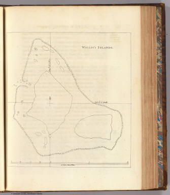
[Hawkesworth, John, 1715?-1773, Wallis, Samuel, 1728-1795]
Full Title
Wallis's Islands. (London: printed for W. Strahan; and T. Cadell in the Strand, MDCCLXXIII).
Publisher
W. Strahan and T. Cadell
Author
[Carteret, Philip, d. 1796, Hawkesworth, John, 1715?-1773]
Full Title
Queen Charlotte's Islands. Bayly sculpt. Jany. 1st, 1773. (London: printed for W. Strahan; and T. Cadell in the Strand, MDCCLXXIII).
Publisher
W. Strahan and T. Cadell
Author
[Carteret, Philip, d. 1796, Hawkesworth, John, 1715?-1773]
Full Title
A chart of Captn. Carteret's discoveries at New Britain, with part of Captn. Cooke's passage thro Endeavor Streights, & of Captn. Dampier's tract & discoveries in 1699, & 1700, at New Guinea and New Britain. Engraved by W. Whitchurch, Pleasant Row, Islington. (London: printed for W. Strahan; and T. Cadell in the Strand, MDCCLXXIII).
Publisher
W. Strahan and T. Cadell
Author
[Carteret, Philip, d. 1796, Hawkesworth, John, 1715?-1773]
Full Title
A dangerous shoal seen Septr. the 28, 1767. (with) Joseph Freewills Islands. (with) The south end of Mindanao. (London: printed for W. Strahan; and T. Cadell in the Strand, MDCCLXXIII).
Publisher
W. Strahan and T. Cadell
Author
[Carteret, Philip, d. 1796, Hawkesworth, John, 1715?-1773]
Full Title
A draught of Bonthain Bay situated about 30 leagues to the S.E. of Macassar in the Island of Celebes. Publish'd Novr. 4th, 1772. (London: printed for W. Strahan; and T. Cadell in the Strand, MDCCLXXIII).
Publisher
W. Strahan and T. Cadell
Author
[Cook, James, 1728-1779, Hawkesworth, John, 1715?-1773]
Full Title
A plan of Success Bay in Strait le Maire. A chart of the S.E. part of Terra del Fuego including Strait le Maire and part of Staten-land by Lieutenant J. Cook 1769. T. Bowen & J. Gibson sculp. (London: printed for W. Strahan; and T. Cadell in the Strand, MDCCLXXIII).
Publisher
W. Strahan and T. Cadell
Author
[Cook, James, 1728-1779, Hawkesworth, John, 1715?-1773]
Full Title
Chart of the island Otaheite, by Lieut. J. Cook, 1769. J. Cheevers sculp. (London: printed for W. Strahan; and T. Cadell in the Strand, MDCCLXXIII).
Publisher
W. Strahan and T. Cadell
Author
[Cook, James, 1728-1779, Hawkesworth, John, 1715?-1773]
Full Title
Chart of the Society Isles, discovered by Lieut. J. Cook, 1769. J. Cheevers sculpsit. (London: printed for W. Strahan; and T. Cadell in the Strand, MDCCLXXIII).
Publisher
W. Strahan and T. Cadell
Author
[Cook, James, 1728-1779, Hawkesworth, John, 1715?-1773]
Full Title
Matavia (i.e. Matavai) Bay in Otaheite. Owharre Harbour in Huaheine. Ohamaneno Harbour in Ulietea. Oopoa Harbour in Ulietea. J. Cheevers sculp. (London: printed for W. Strahan; and T. Cadell in the Strand, MDCCLXXIII).
Publisher
W. Strahan and T. Cadell
Author
[Cook, James, 1728-1779, Hawkesworth, John, 1715?-1773]
Full Title
Chart of New-Zealand, explored in 1769 and 1770 by Lieut. I: Cook, Commander of His Majesty's Bark Endeavour. Engrav'd by I. Bayly. Publish'd as the act directs 1st Jany. 1772. (London: printed for W. Strahan; and T. Cadell in the Strand, MDCCLXXIII).
Publisher
W. Strahan and T. Cadell
Author
[Cook, James, 1728-1779, Hawkesworth, John, 1715?-1773]
Full Title
River Thames and Mercury Bay in New Zealand. (with) Bay of Islands in New Zealand. (with) Tolaga Bay in New Zealand. (London: printed for W. Strahan; and T. Cadell in the Strand, MDCCLXXIII).
Publisher
W. Strahan and T. Cadell
Author
[Cook, James, 1728-1779, Hawkesworth, John, 1715?-1773]
Full Title
Chart of Cook's Strait in New Zealand. John Ryland sculp. (London: printed for W. Strahan; and T. Cadell in the Strand, MDCCLXXIII).
Publisher
W. Strahan and T. Cadell
Author
[Cook, James, 1728-1779, Hawkesworth, John, 1715?-1773]
Full Title
A chart of New South Wales, on the east coast of New-Holland. Discovered and explored by Lieutenant J: Cook, Commander of his Majesty's Bark Endeavour, in the year MDCCLXX. Engraved by W. Whitchurch, Bartholomew Lane, Royal Exchange. (London: printed for W. Strahan; and T. Cadell in the Strand, MDCCLXXIII).
Publisher
W. Strahan and T. Cadell
Author
[Cook, James, 1728-1779, Hawkesworth, John, 1715?-1773]
Full Title
Entrance of Endeavour River in New South Wales. Botany Bay in New South Wales. J. Gibson & T. Bowen sculp. (London: printed for W. Strahan; and T. Cadell in the Strand, MDCCLXXIII).
Publisher
W. Strahan and T. Cadell
Author
[Cook, James, 1728-1779, Hawkesworth, John, 1715?-1773]
Full Title
Chart of part of the coast of New South Wales, from Cape Tribulation to Endeavour Straits, by Lieut. J. Cook, 1770. J. Cheevers sculpt. (London: printed for W. Strahan; and T. Cadell in the Strand, MDCCLXXIII).
Publisher
W. Strahan and T. Cadell
1-20 of 20
|