Browse All

1875 California. National Atlas Cram's Rail Road & Township Map of Calif … |

1875 Wyoming. National Atlas Cram's Rail Road & Township Map of Wyomi … |

1875 Utah. National Atlas Cram's Rail Road & Township Map of Utah. … |

1875 Montana. National Atlas Cram's Rail Road & Township Map of Monta … |

1875 Washington. National Atlas Cram's Rail Road & Township Map of Washi … |

1875 Oregon. National Atlas Cram's Rail Road & Township Map of Orego … |

1875 New Railroad Map of the United States & … National Atlas New Railroad Map of the United States & … |

1875 Kansas. National Atlas Cram's Rail Road & Township Map of Kansa … |
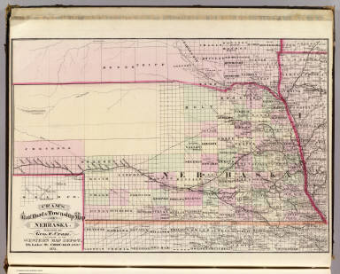
1875 Nebraska. National Atlas Cram's Rail Road & Township Map of Nebra … |

1875 Minnesota. National Atlas Cram's Rail Road & Township Map of Minne … |

1875 Dakota. National Atlas Cram's Rail Road & Township Map of Dakot … |

1875 Arkansas. National Atlas Cram's Rail Road & Township Map of Arkan … |

1875 Louisiana. National Atlas Cram's Rail Road & Township Map of Louis … |

1875 Texas. National Atlas Cram's Rail Road & Township Map of Texas … |

1875 Idaho. National Atlas Cram's Rail Road & Township Map of Idaho … |

1883 Covers: Cram's Unrivaled Family Atlas of … World Atlas (Covers to) Cram's Unrivaled Family Atla … |

1883 Title: Cram's Unrivaled Family Atlas of … World Atlas (Title Page) Cram's Unrivaled Family Atl … |

1883 Frontispiece and View: Diagram of the Pr … World Atlas (Frontispiece and View) Diagram of the P … |

1883 Index: Table of Contents. World Atlas (Index Page) Table of Contents. |

1883 Flags: Flags of Principal Countries. World Atlas (Flags) (Flags of Principal Countries). |

1883 View: Illustration of the Plant and Anim … World Atlas (View) (Illustration of the Plant and An … |

1883 Celestial Map: The Solar Sysem. World Atlas (Celestial Map) The Solar Sysem. |

1883 Hemispheres. World Atlas (Hemispheres). |

1883 Western Hemisphere. Eastern Hemisphere. World Atlas Western Hemisphere. Eastern Hemisphere. |

1883 Chart of the World in Mercator's Project … World Atlas Chart of the World in Mercator's Project … |

1883 Statistical Diagram: Comparative Diagram … World Atlas (Statistical Diagram) Comparative Diagra … |

1883 Statistical Table: 1880 Population of Ci … World Atlas (Statistical Table) Population of Cities … |

1883 Statistical Table: Air Line Distance Tab … World Atlas (Statistical Table) Air Line Distance Ta … |

1883 North America. World Atlas North America. |

1883 Nova Scotia and New Brunswick. World Atlas Nova Scotia and New Brunswick. (inset) N … |

1883 Part of Canada. World Atlas Part of Canada. |

1883 Map of the United States. World Atlas Map of the United States. |

1883 Maine. World Atlas Maine. |

1883 New Hampshire & Vermont. World Atlas New Hampshire & Vermont. |

1883 Massachusetts, Rhode Island, and Connect … World Atlas Massachusetts, Rhode Island, & Connectic … |

1883 New York. World Atlas New York. (inset) Long Islands. Vicinity … |

1883 Pennsylvania. World Atlas Pennsylvania. |

1883 Railroad and County Map of New Jersey. World Atlas Railroad and County Map of New Jersey. |

1883 New Rail Road and County Map of Deleware … World Atlas New Rail Road and County Map of Deleware … |

1883 New Rail Road and Count Map of North Car … World Atlas New Rail Road and Count Map of North Car … |

1883 New Rail Road and County Map of Alabama, … World Atlas New Rail Road and County Map of Alabama, … |

1883 New Rail Road and County Map of Kentucky … World Atlas New Rail Road and County Map of Kentucky … |

1883 New Rail Road and County Map of Missouri … World Atlas New Rail Road and County Map of Missouri … |

1883 New Rail Road and County Map of Arkansas … World Atlas New Rail Road and County Map of Arkansas … |

1883 Florida. World Atlas Florida. |

1883 Texas. World Atlas Texas. |

1883 Indian Territory (Oklahoma). World Atlas Indian Ty. |

1883 Ohio. World Atlas Ohio. |

1883 Indiana. World Atlas Indiana. |

1883 New Rail Road and County Map of Michigan … World Atlas New Rail Road and County Map of Michigan … |