Who What Where WhenREMOVEWHEREShow More |
REFINE
Browse All : Images by E. & G.W. Blunt. and Harrison, D. R.
1-6 of 6
Author
[Blunt, Edmund M. (Edmund March), 1770-1862, Des Barres, Joseph F. W. (Joseph Frederick Wallet), 1722-1824]
Full Title
(The north eastern coast of North America from New York to Cape Canso including Sable Island by Edmund Blunt. East sheet. (with) Halifax Harbour and adjacent coast by J.F.W. Des Barres. Published & Sold by E. & G.W. Blunt, No. 154 Water Street, corner of Maiden Lane, New York. G. Ely Sct. Engd. by D.R. Harrison. Entered ... 22nd day of July 1828, by Edmund Blunt of the State of New York)
Publisher
E. & G.W. Blunt.
Author
Blunt, Edmund M. (Edmund March), 1770-1862
Full Title
The north eastern coast of North America from New York to Cape Canso including Sable Island by Edmund Blunt. Center sheet. Published & Sold by E. & G.W. Blunt, No. 154 Water Street, corner of Maiden Lane, New York. G. Ely Sct. Engd. by D.R. Harrison. Entered ... 22nd day of July 1828, by Edmund Blunt of the State of New York.
Publisher
E. & G.W. Blunt.
Author
[Blunt, Edmund M. (Edmund March), 1770-1862, Des Barres, Joseph F. W. (Joseph Frederick Wallet), 1722-1824, Taber, W. C., Wadsworth, A. S. (Alex. S.)]
Full Title
(The north eastern coast of North America from New York to Cape Canso including Sable Island by Edmund Blunt. West sheet. (with) Buzzards Bay drawn from the survey of Des Barres and information furnished by W.C. Taber ... (with) Boston Harbour from the survey of A.S. Wadsworth, U.S.N. and the chart of Des Barres. Published & Sold by E. & G.W. Blunt, No. 154 Water Street, corner of Maiden Lane, New York. G. Ely Sct. Engd. by D.R. Harrison. Entered ... 22nd day of July 1828, by Edmund Blunt of the State of New York)
Publisher
E. & G.W. Blunt.
Author
[Blunt, Edmund M. (Edmund March), 1770-1862, Des Barres, Joseph F. W. (Joseph Frederick Wallet), 1722-1824, Taber, W. C., Wadsworth, A. S. (Alex. S.)]
Full Title
(Composite of) The north eastern coast of North America from New York to Cape Canso including Sable Island by Edmund Blunt. (with) Halifax Harbour and adjacent coast by J.F.W. Des Barres. (with) Buzzards Bay drawn from the survey of Des Barres and information furnished by W.C. Taber ... (with) Boston Harbour from the survey of A.S. Wadsworth, U.S.N. and the chart of Des Barres. Published & Sold by E. & G.W. Blunt, No. 154 Water Street, corner of Maiden Lane, New York. G. Ely Sct. Engd. by D.R. Harrison. Entered ... 22nd day of July 1828, by Edmund Blunt of the State of New York.
Publisher
E. & G.W. Blunt.
Author
[Adams, D. P., Blunt, Edmund M. (Edmund March), 1770-1862]
Full Title
(Composite of) The coast of the United States of North America; from New York to St. Augustine drawn and regulated according the the latest surveys and astronomical observations by Edmund Blunt. D.R. Harrison sc. New York: published by E. & G.W. Blunt, 154 Water Street, corner of Maiden Lane. Engraved & printed by W. Hooker, 202 Water Street, New York. Entered acording to Act of Congress the 3rd. day of April 1827 by E. & G.W. Blunt of the State of New York.
Publisher
E. & G.W. Blunt.
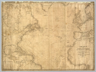
Author
Blunt, Edmund M. (Edmund March), 1770-1862
Full Title
Chart Of The North Atlantic Ocean, From the Equator to 65° North Latitude. According to the Latest Surveys & Observations. New York, Published by E. & G.W. Blunt, 154 Water St. Corner of Maiden Lane. 1832. Entered ... 1832, by Edmund & George W. Blunt ... New York. Additions to 1835. Engraved by W. Hooker. Lettered by D.R. Harrison. (with) three inset maps listed in Notes.
Publisher
E. & G.W. Blunt.
1-6 of 6
|