Who What Where WhenREMOVEWHATWHERE |
REFINE
Browse All : Images by E. & G.W. Blunt. and Harrison, D. R. from 1835
1-1 of 1
Author
Blunt, Edmund M. (Edmund March), 1770-1862
Full Title
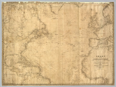
Chart Of The North Atlantic Ocean, From the Equator to 65° North Latitude. According to the Latest Surveys & Observations. New York, Published by E. & G.W. Blunt, 154 Water St. Corner of Maiden Lane. 1832. Entered ... 1832, by Edmund & George W. Blunt ... New York. Additions to 1835. Engraved by W. Hooker. Lettered by D.R. Harrison. (with) three inset maps listed in Notes.
Publisher
E. & G.W. Blunt.
1-1 of 1
|