Browse All

1875 Ohio. County Atlas New Map of Ohio Prepared Especially for … |

1875 Township of Stokes, Logan County, Ohio. County Atlas Map of the Township of Stokes, Parts of … |

1875 Bloomfield Township, Logan County, Ohio. County Atlas Map of Bloomfield Township, Parts of T.2 … |

1875 Miami Township, Logan County, Ohio. View … County Atlas Map of Miami Township, T. III. R. XIII. … |

1875 Pleasant Township, Logan County, Ohio. County Atlas Map of Pleasant Township. Compiled by M. … |

1875 Richland Township, Logan County, Ohio. County Atlas Map of Richland Township. Mapped and Com … |

1875 McArthur Township, Logan County, Ohio. County Atlas Map of McArthur Township. Compiled & Map … |

1875 Union Township, Logan County, Ohio. County Atlas Map of Union Township. Compiled by M. Gr … |

1875 Harrison Township, Logan County, Ohio. County Atlas Map of Harrison Township. |

1875 Jefferson Township, Logan County, Ohio. County Atlas Map of Jefferson Township. |

1875 Perry Township. (Portraits) Mr. and Mrs. … County Atlas Map of Perry Township, Logan County, Ohi … |

1875 Perry Township, Logan County, Ohio. (Por … County Atlas Map of Perry Township. Wm. M. Fisk. (Por … |

1875 Lake Township, Logan County, Ohio. Prope … County Atlas Map of Lake Township. Mapped by O.E. Wae … |

1875 Monroe Township, Logan County, Ohio. County Atlas Map of Monroe Township. |

1875 Zane Township, Logan County, Ohio. County Atlas Map of Zane Township. |

1875 Bokes Creek Township, Logan County, Ohio … County Atlas Map of Bokes Creek Township. Mapped and … |

1875 Rush Creek Township, Logan County, Ohio. County Atlas Map of Rush Creek Township. |

1875 Huntsville, Richland, Zanesfield, and De … County Atlas Huntsville, Oliver F. Waegon. Richland, … |

1875 Bellefontaine, Logan County, Ohio. County Atlas Map of Bellefontaine, Logan Co. Compiled … |

1875 West Liberty, Logan County, Ohio. 1874. County Atlas West Liberty. 1874. Oliver F. Waegon C.E … |
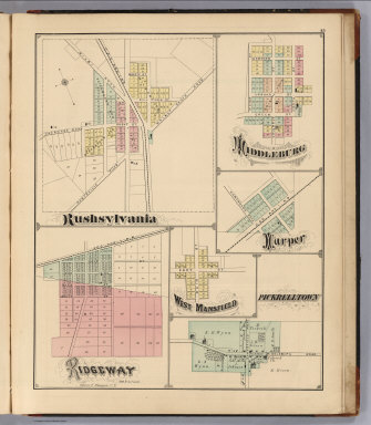
1875 Rushsylvania, Ridgeway, Middleburg, Harp … County Atlas Rushsylvania. Ridgeway, Oliver F. Waegon … |

1875 Last Liberty. Logansville. Northwood. Ch … County Atlas Last Liberty. Logansville. Northwood. Ch … |

1875 Washington Township, Logan County, Ohio. … County Atlas Map of Washington Township. (View) M.E. … |

1876 New York. County Atlas New York. (insets) Map of the Hudson Riv … |

1876 Yates County, New York. County Atlas Map of Yates County, New York. |

1876 Eddytown. Starkey. Rock Stream, Yates Co … County Atlas Eddytown. Starkey. Rock Stream. |

1876 Penn Yan, Yates County, New York. County Atlas Map of Penn Yan by Cyrus Wheelock C.E. |

1876 Benton Township, Yates County, New York. … County Atlas Map of Benton. Rushville. |

1876 Potter Township, Yates County, New York. County Atlas Map of Potter Township. |

1876 Branchport. Dresden, Yates County, New Y … County Atlas Branchport. Dresden. |

1876 Middlesex Township, Yates County, New Yo … County Atlas Map of Middlesex Township. |

1876 Middlesex Center. Himrods Corner, Yates … County Atlas Middlesex Center. Himrods Corner. |

1876 Italy Township, Yates County, New York. County Atlas Map of the Italy Township. |

1876 Jerusalem Township, Yates County, New Yo … County Atlas Map of Jerusalem Township. |

1876 Milo Township, Yates County, New York. P … County Atlas Map of Milo Township. Potter Center. Ben … |

1876 Milo Center. Belona Village. Italy Hollo … County Atlas Milo Center. Belona Village. Italy Hollo … |

1876 Torrey Township, Yates County, New York. County Atlas Map of Torrey Township. |

1876 Starkey Township, Yates County, New York … County Atlas Map of Starkey Township. |

1876 Dundee Township, Yates County, New York. County Atlas Map of Dundee Township. |

1876 Barrington Township, Yates County, New Y … County Atlas Map of Barrington Township. Compiled by … |

1874 Sectional Map of Illinois ... Compiled . … County Atlas Sectional Map of Illinois ... Compiled . … |

1872 Eagle Point Township, Ogle County Illino … County Atlas Map of Eagle Point Township. (View) Res. … |

1872 Brookville Township, Ogle County, Illino … County Atlas Map of Brookville Township. (View) Res. … |

1872 Forreston Township, Ogle County, Illinoi … County Atlas Map of Forreston Township. |

1872 Haldane Township, Ogle County, Illinois. County Atlas Map of Haldane Township. |

1872 Buffalo Township, Ogle County, Illinois. County Atlas Map of Buffalo Township. |

1872 Grand de Tour Township, Ogle County, Ill … County Atlas Map of Grand de Tour Township. Res. & Mi … |

1872 Pine Creek Township, Ogle County, Illino … County Atlas Map of Pine Creek Township. |

1872 Mount Morris Township, Ogle County, Illi … County Atlas Map of Mount Morris Township. |

1872 Maryland Township, Ogle County, Illinois … County Atlas Map of Maryland Township. |