Who What Where WhenWHERE
WHOShow More |
Author
[Great Britain. Ordnance Survey, Tucker, Henry]
Full Title
Sheet 1: York. Surveyed in 1850, by Captain Tucker; R.E. Engraved in 1851, under the direction of Captain Yolland, R.E. at the Ordnance Map Office, Southampton, and Published by Lt. Colonel Hall R.E. Superintendent, 1st. Sept., 1852.
Publisher
Ordnance Survey Map Office
Author
[Great Britain. Ordnance Survey, Tucker, Henry]
Full Title
Sheet 2: York. Surveyed in 1850, by Captain Tucker; R.E. Engraved in 1851, under the direction of Captain Yolland, R.E. at the Ordnance Map Office, Southampton, and Published by Lt. Colonel Hall R.E. Superintendent, 1st. Sept., 1852.
Publisher
Ordnance Survey Map Office
Author
[Great Britain. Ordnance Survey, Tucker, Henry]
Full Title
Sheet 3: York. Surveyed in 1850, by Captain Tucker; R.E. Engraved in 1851, under the direction of Captain Yolland, R.E. at the Ordnance Map Office, Southampton, and Published by Lt. Colonel Hall R.E. Superintendent, 1st. Sept., 1852.
Publisher
Ordnance Survey Map Office
Author
[Great Britain. Ordnance Survey, Tucker, Henry]
Full Title
Sheet 4: York. Surveyed in 1850, by Captain Tucker; R.E. Engraved in 1851, under the direction of Captain Yolland, R.E. at the Ordnance Map Office, Southampton, and Published by Lt. Colonel Hall R.E. Superintendent, 1st. Sept., 1852.
Publisher
Ordnance Survey Map Office
Author
[Great Britain. Ordnance Survey, Tucker, Henry]
Full Title
Sheet 5: York. Surveyed in 1850, by Captain Tucker; R.E. Engraved in 1851, under the direction of Captain Yolland, R.E. at the Ordnance Map Office, Southampton, and Published by Lt. Colonel Hall R.E. Superintendent, 1st. Sept., 1852.
Publisher
Ordnance Survey Map Office
Author
[Great Britain. Ordnance Survey, Tucker, Henry]
Full Title
Sheet 6: York. Surveyed in 1850, by Captain Tucker; R.E. Engraved in 1851, under the direction of Captain Yolland, R.E. at the Ordnance Map Office, Southampton, and Published by Lt. Colonel Hall R.E. Superintendent, 1st. Sept., 1852.
Publisher
Ordnance Survey Map Office
Author
[Great Britain. Ordnance Survey, Tucker, Henry]
Full Title
Sheet 7: York. Surveyed in 1850, by Captain Tucker; R.E. Engraved in 1851, under the direction of Captain Yolland, R.E. at the Ordnance Map Office, Southampton, and Published by Lt. Colonel Hall R.E. Superintendent, 1st. Sept., 1852.
Publisher
Ordnance Survey Map Office
Author
[Great Britain. Ordnance Survey, Tucker, Henry]
Full Title
Sheet 8: York. Surveyed in 1850, by Captain Tucker; R.E. Engraved in 1851, under the direction of Captain Yolland, R.E. at the Ordnance Map Office, Southampton, and Published by Lt. Colonel Hall R.E. Superintendent, 1st. Sept., 1852.
Publisher
Ordnance Survey Map Office
Author
[Great Britain. Ordnance Survey, Tucker, Henry]
Full Title
Sheet 9: York. Surveyed in 1850, by Captain Tucker; R.E. Engraved in 1851, under the direction of Captain Yolland, R.E. at the Ordnance Map Office, Southampton, and Published by Lt. Colonel Hall R.E. Superintendent, 1st. Sept., 1852.
Publisher
Ordnance Survey Map Office
Author
[Great Britain. Ordnance Survey, Tucker, Henry]
Full Title
Sheet 10: York. Surveyed in 1850, by Captain Tucker; R.E. Engraved in 1851, under the direction of Captain Yolland, R.E. at the Ordnance Map Office, Southampton, and Published by Lt. Colonel Hall R.E. Superintendent, 1st. Sept., 1852.
Publisher
Ordnance Survey Map Office
Author
[Great Britain. Ordnance Survey, Tucker, Henry]
Full Title
Sheet 11: York. Surveyed in 1850, by Captain Tucker; R.E. Engraved in 1851, under the direction of Captain Yolland, R.E. at the Ordnance Map Office, Southampton, and Published by Lt. Colonel Hall R.E. Superintendent, 1st. Sept., 1852.
Publisher
Ordnance Survey Map Office
Author
[Great Britain. Ordnance Survey, Tucker, Henry]
Full Title
Sheet 12: York. Surveyed in 1850, by Captain Tucker; R.E. Engraved in 1851, under the direction of Captain Yolland, R.E. at the Ordnance Map Office, Southampton, and Published by Lt. Colonel Hall R.E. Superintendent, 1st. Sept., 1852.
Publisher
Ordnance Survey Map Office
Author
[Great Britain. Ordnance Survey, Tucker, Henry]
Full Title
Sheet 13: York. Surveyed in 1850, by Captain Tucker; R.E. Engraved in 1851, under the direction of Captain Yolland, R.E. at the Ordnance Map Office, Southampton, and Published by Lt. Colonel Hall R.E. Superintendent, 1st. Sept., 1852.
Publisher
Ordnance Survey Map Office
Author
[Great Britain. Ordnance Survey, Tucker, Henry]
Full Title
Sheet 14: York. Surveyed in 1850, by Captain Tucker; R.E. Engraved in 1851, under the direction of Captain Yolland, R.E. at the Ordnance Map Office, Southampton, and Published by Lt. Colonel Hall R.E. Superintendent, 1st. Sept., 1852.
Publisher
Ordnance Survey Map Office
Author
[Great Britain. Ordnance Survey, Tucker, Henry]
Full Title
Sheet 15: York. Surveyed in 1850, by Captain Tucker; R.E. Engraved in 1851, under the direction of Captain Yolland, R.E. at the Ordnance Map Office, Southampton, and Published by Lt. Colonel Hall R.E. Superintendent, 1st. Sept., 1852.
Publisher
Ordnance Survey Map Office
Author
[Great Britain. Ordnance Survey, Tucker, Henry]
Full Title
Sheet 16: York. Surveyed in 1850, by Captain Tucker; R.E. Engraved in 1851, under the direction of Captain Yolland, R.E. at the Ordnance Map Office, Southampton, and Published by Lt. Colonel Hall R.E. Superintendent, 1st. Sept., 1852.
Publisher
Ordnance Survey Map Office
Author
[Great Britain. Ordnance Survey, Tucker, Henry]
Full Title
Sheet 17: York. Surveyed in 1850, by Captain Tucker; R.E. Engraved in 1851, under the direction of Captain Yolland, R.E. at the Ordnance Map Office, Southampton, and Published by Lt. Colonel Hall R.E. Superintendent, 1st. Sept., 1852.
Publisher
Ordnance Survey Map Office
Author
[Great Britain. Ordnance Survey, Tucker, Henry]
Full Title
Sheet 18: York. Surveyed in 1850, by Captain Tucker; R.E. Engraved in 1851, under the direction of Captain Yolland, R.E. at the Ordnance Map Office, Southampton, and Published by Lt. Colonel Hall R.E. Superintendent, 1st. Sept., 1852.
Publisher
Ordnance Survey Map Office
Author
[Great Britain. Ordnance Survey, Tucker, Henry]
Full Title
Sheet 19: York. Surveyed in 1850, by Captain Tucker; R.E. Engraved in 1851, under the direction of Captain Yolland, R.E. at the Ordnance Map Office, Southampton, and Published by Lt. Colonel Hall R.E. Superintendent, 1st. Sept., 1852.
Publisher
Ordnance Survey Map Office
Author
[Great Britain. Ordnance Survey, Tucker, Henry]
Full Title
Sheet 20: York. Surveyed in 1850, by Captain Tucker; R.E. Engraved in 1851, under the direction of Captain Yolland, R.E. at the Ordnance Map Office, Southampton, and Published by Lt. Colonel Hall R.E. Superintendent, 1st. Sept., 1852.
Publisher
Ordnance Survey Map Office
Author
[Great Britain. Ordnance Survey, Tucker, Henry]
Full Title
Sheet 21: York. Surveyed in 1850, by Captain Tucker; R.E. Engraved in 1851, under the direction of Captain Yolland, R.E. at the Ordnance Map Office, Southampton, and Published by Lt. Colonel Hall R.E. Superintendent, 1st. Sept., 1852.
Publisher
Ordnance Survey Map Office
Author
[Great Britain. Ordnance Survey, Tucker, Henry]
Full Title
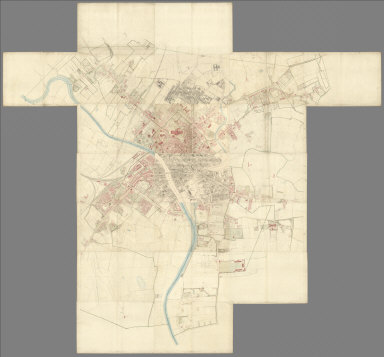
(Composite to) (Sheets 1 - 21) York. Surveyed in 1850, by Captain Tucker; R.E. Engraved in 1851, under the direction of Captain Yolland, R.E. at the Ordnance Map Office, Southampton, and Published by Lt. Colonel Hall R.E. Superintendent, 1st. Sept., 1852.
Publisher
Ordnance Survey Map Office
Author
[Great Britain. Ordnance Survey, James, Henry]
Full Title
Plan of the Ordnance Survey Office ; Southampton. (to accompany) Report on the Ordnance Survey of the United Kingdom for 1855-56. (with) Ordnance Survey. Treasury minute, dated 18 May 1855, and previous papers, relating to the Ordnance Survey. Session 1856.
Publisher
Ordnance Survey
Author
[Great Britain. Ordnance Survey, James, Henry]
Full Title
Plan (colored) of the Ordnance Survey Office ; Southampton. (to accompany) Report on the Ordnance Survey of the United Kingdom for 1855-56. (with) Ordnance Survey. Treasury minute, dated 18 May 1855, and previous papers, relating to the Ordnance Survey. Session 1856.
Publisher
Ordnance Survey
Author
[Great Britain. Ordnance Survey, James, Henry]
Full Title
Plan of the Ordnance Survey Office; Phoenix Park. (to accompany) Report on the Ordnance Survey of the United Kingdom for 1855-56. (with) Ordnance Survey. Treasury minute, dated 18 May 1855, and previous papers, relating to the Ordnance Survey. Session 1856.
Publisher
Ordnance Survey
Author
[Great Britain. Ordnance Survey, James, Henry]
Full Title
Index to the Ordnance Survey of England and Wales ; on the scale of six inches to a mile and larger scales. Showing the state of publication on the 31st May 1857. (to accompany) Report on the Ordnance Survey of the United Kingdom for 1855-56. (with) Ordnance Survey. Treasury minute, dated 18 May 1855, and previous papers, relating to the Ordnance Survey. Session 1856.
Publisher
Ordnance Survey
Author
[Great Britain. Ordnance Survey, James, Henry]
Full Title
Index to the Ordnance Survey of Scotland ; on the scale of six inches to a mile and larger scales. Showing the state of publication on the 31st May 1857. (to accompany) Report on the Ordnance Survey of the United Kingdom for 1855-56. (with) Ordnance Survey. Treasury minute, dated 18 May 1855, and previous papers, relating to the Ordnance Survey. Session 1856.
Publisher
Ordnance Survey
Author
[Great Britain. Ordnance Survey, James, Henry]
Full Title
Index to the Ordnance Survey of Ireland ; on the scale of six inches to a mile and larger scales. Showing the state of publication on the 31st May 1857. (to accompany) Report on the Ordnance Survey of the United Kingdom for 1855-56. (with) Ordnance Survey. Treasury minute, dated 18 May 1855, and previous papers, relating to the Ordnance Survey. Session 1856.
Publisher
Ordnance Survey
Author
[Great Britain. Ordnance Survey, James, Henry]
Full Title
A specimen of part of a 1/500 plan ; colored for reduction by photography. South Shields, sheet 36. (to accompany) Report on the Ordnance Survey of the United Kingdom for 1855-56. (with) Ordnance Survey. Treasury minute, dated 18 May 1855, and previous papers, relating to the Ordnance Survey. Session 1856.
Publisher
Ordnance Survey
Author
[Great Britain. Ordnance Survey, James, Henry]
Full Title
Part of the plan of South Shields, Co. Durham. Reduced from 10 feet to 25 inches to a mile by photography. (with) Part of the plan of South Shields, Co. Durham. Reduced from 10 feet to six inches to a mile by photography. (to accompany) Report on the Ordnance Survey of the United Kingdom for 1855-56. (with) Ordnance Survey. Treasury minute, dated 18 May 1855, and previous papers, relating to the Ordnance Survey. Session 1856.
Publisher
Ordnance Survey
Author
[Great Britain. Ordnance Survey, James, Henry]
Full Title
Specimen of part of a 1/2,500 plan ; colored for reduction by photography. Darlington. Co. Durham. Sheet LV. 6. (to accompany) Report on the Ordnance Survey of the United Kingdom for 1855-56. (with) Ordnance Survey. Treasury minute, dated 18 May 1855, and previous papers, relating to the Ordnance Survey. Session 1856.
Publisher
Ordnance Survey
Author
[Great Britain. Ordnance Survey, James, Henry]
Full Title
Part of the Parish of Darlington. Co. Durham. Reduced from 1/2,500 of 25, 34-4 inches to 6 inches to a mile by photography. (to accompany) Report on the Ordnance Survey of the United Kingdom for 1855-56. (with) Ordnance Survey. Treasury minute, dated 18 May 1855, and previous papers, relating to the Ordnance Survey. Session 1856.
Publisher
Ordnance Survey
Author
[Great Britain. Ordnance Survey, James, Henry]
Full Title
Specimen of part of a 6 inch sheet. Hills sketched for reduction ay photography. Yorkshire. sheet 47. (to accompany) Report on the Ordnance Survey of the United Kingdom for 1855-56. (with) Ordnance Survey. Treasury minute, dated 18 May 1855, and previous papers, relating to the Ordnance Survey. Session 1856.
Publisher
Ordnance Survey
Author
[Great Britain. Ordnance Survey, James, Henry]
Full Title
Hill sketching reduced from six inch to one inch to a mile by photography for the engraver. (to accompany) Report on the Ordnance Survey of the United Kingdom for 1855-56. (with) Ordnance Survey. Treasury minute, dated 18 May 1855, and previous papers, relating to the Ordnance Survey. Session 1856.
Publisher
Ordnance Survey
Author
[Great Britain. Ordnance Survey, James, Henry]
Full Title
Geometrical projection of two third of the sphere by Lieut. Colonel H. James, R.E., F.R.S. M.R.I.A. &c. ... Engraved at the Ordnance Survey Map Office Southampton, 1857 from a reduction made by photography. (insets) Projection of Central Station ; Projection of Central Meridian Station. (to accompany) Report on the Ordnance Survey of the United Kingdom for 1855-56. (with) Ordnance Survey. Treasury minute, dated 18 May 1855, and previous papers, relating to the Ordnance Survey. Session 1856.
Publisher
Ordnance Survey
Author
[Great Britain. Ordnance Survey, James, Henry]
Full Title
Edinburghshire : From the original plate. (with) Edinburghshire : From an electrotype. Sheet 2. Scale six inches to a mile. (to accompany) Report on the Ordnance Survey of the United Kingdom for 1855-56. (with) Ordnance Survey. Treasury minute, dated 18 May 1855, and previous papers, relating to the Ordnance Survey. Session 1856.
Publisher
Ordnance Survey
Author
[Great Britain. Ordnance Survey, James, Henry]
Full Title
Specimen by the Anastatic process transferred from a tracing. (with) Specimen by the Anastatic process, from plate, reproduced from an Anastatic impression. (to accompany) Report on the Ordnance Survey of the United Kingdom for 1855-56. (with) Ordnance Survey. Treasury minute, dated 18 May 1855, and previous papers, relating to the Ordnance Survey. Session 1856.
Publisher
Ordnance Survey
Author
[Great Britain. Ordnance Survey, James, Henry]
Full Title
Specimen by Lithography, transferred from a tracing. (with) Specimen reproduced by the Anastatic process, from a Lithograph. (to accompany) Report on the Ordnance Survey of the United Kingdom for 1855-56. (with) Ordnance Survey. Treasury minute, dated 18 May 1855, and previous papers, relating to the Ordnance Survey. Session 1856.
Publisher
Ordnance Survey
Author
[Great Britain. Ordnance Survey, James, Henry]
Full Title
Specimen by Zinography, transferred from a tracing. (with) Specimen reproduced by the Anastatic process, from a Zinograph. (to accompany) Report on the Ordnance Survey of the United Kingdom for 1855-56. (with) Ordnance Survey. Treasury minute, dated 18 May 1855, and previous papers, relating to the Ordnance Survey. Session 1856.
Publisher
Ordnance Survey
Author
[Great Britain. Ordnance Survey, James, Henry]
Full Title
Specimen by the Anastatic process, transferred from a tracing. (to accompany) Report on the Ordnance Survey of the United Kingdom for 1855-56. (with) Ordnance Survey. Treasury minute, dated 18 May 1855, and previous papers, relating to the Ordnance Survey. Session 1856.
Publisher
Ordnance Survey
Author
[Great Britain. Ordnance Survey, James, Henry]
Full Title
Co. Wicklow : Ornament engraved. Sheet 40. (with) Fifeshire : Ornament punched. Sheet 30. (to accompany) Report on the Ordnance Survey of the United Kingdom for 1855-56. (with) Ordnance Survey. Treasury minute, dated 18 May 1855, and previous papers, relating to the Ordnance Survey. Session 1856.
Publisher
Ordnance Survey
Author
[Great Britain. Ordnance Survey, James, Henry]
Full Title
Yorkshire : Specimen with hills engraved. Sheet 95 S.W. (to accompany) Report on the Ordnance Survey of the United Kingdom for 1855-56. (with) Ordnance Survey. Treasury minute, dated 18 May 1855, and previous papers, relating to the Ordnance Survey. Session 1856.
Publisher
Ordnance Survey
Author
[Great Britain. Ordnance Survey, James, Henry]
Full Title
Edinburghshire : Specimen in outline. Sheet 32. (with) Co. Dublin : Specimen in outline. Sheet 31. S.E. (to accompany) Report on the Ordnance Survey of the United Kingdom for 1855-56. (with) Ordnance Survey. Treasury minute, dated 18 May 1855, and previous papers, relating to the Ordnance Survey. Session 1856.
Publisher
Ordnance Survey
Author
[Great Britain. Ordnance Survey, James, Henry]
Full Title
Lewis (Ross Shire) : Specimen in outline. Sheet 4. (to accompany) Report on the Ordnance Survey of the United Kingdom for 1855-56. (with) Ordnance Survey. Treasury minute, dated 18 May 1855, and previous papers, relating to the Ordnance Survey. Session 1856.
Publisher
Ordnance Survey
Author
[Great Britain. Ordnance Survey, James, Henry]
Full Title
Wigtonshire : Specimen with hills engraved. Sheet 3. (to accompany) Report on the Ordnance Survey of the United Kingdom for 1855-56. (with) Ordnance Survey. Treasury minute, dated 18 May 1855, and previous papers, relating to the Ordnance Survey. Session 1856.
Publisher
Ordnance Survey
Author
[Great Britain. Ordnance Survey, James, Henry]
Full Title
Co. Donegal : Specimen with hills engraved. Sheet 2. N.E. (to accompany) Report on the Ordnance Survey of the United Kingdom for 1855-56. (with) Ordnance Survey. Treasury minute, dated 18 May 1855, and previous papers, relating to the Ordnance Survey. Session 1856.
Publisher
Ordnance Survey
Author
[Great Britain. Ordnance Survey, James, Henry, 1803-1877]
Full Title
Plate I: (Diagram of triangulation). (to accompany) Extension of the triangulation of the Ordnance Survey into France and Belgium ... 1863.
Publisher
George Edward Eyre and William Spottiswoode
Author
[Colby, Thomas, Mudge, William]
Full Title
Plate I. Plan of the principal triangles in England & Wales and part of Scotland. (to accompany) An account of the trigonometrical survey : carried on by order of the Master-General of his Majesty's Ordnance, in the years 1800. 1801, 1803, 1804, 1805, 1806, 1807, 1808, and 1809. By Lieutenant-Colonel William Mudge, ... Vol. III. ... 1811.
Publisher
W. Bulmer and Co.
Author
[Colby, Thomas, Mudge, William]
Full Title
Plate II. Triangles for the survey of the Eastern part of Devon. (to accompany) An account of the trigonometrical survey : carried on by order of the Master-General of his Majesty's Ordnance, in the years 1800. 1801, 1803, 1804, 1805, 1806, 1807, 1808, and 1809. By Lieutenant-Colonel William Mudge, ... Vol. III. ... 1811.
Publisher
W. Bulmer and Co.
Author
[Colby, Thomas, Mudge, William]
Full Title
Plate III. Triangles for the survey of the Western part of Devon. (to accompany) An account of the trigonometrical survey : carried on by order of the Master-General of his Majesty's Ordnance, in the years 1800. 1801, 1803, 1804, 1805, 1806, 1807, 1808, and 1809. By Lieutenant-Colonel William Mudge, ... Vol. III. ... 1811.
Publisher
W. Bulmer and Co.
|