Who What Where WhenWHERE
|
REFINE
Browse All : Images by Bellin, Jacques Nicolas, 1703-1772 of Martigues (France)
1-23 of 23
Author
[Hall, Wm. Ham. (William Hammond), California Department of Engineering]
Full Title
(Detail Irrigation Map); Crafton Sheet. Wm. Ham. Hall, State Engineer. Irrigation Data 1888. Scale 1 1/2 Inches to One Mile. Outlne Map of the Irrigation region of Los Angeles and San Bernadino Counties, California. To Accompany Report on Irrigation and Water Supply. Wm. Ham. Hall, State Engineer, 1888. George Sandow, Draughtsman.
Publisher
California Department of Engineering
Author
[Hall, Wm. Ham. (William Hammond), California Department of Engineering]
Full Title
California State Engineering Department. Detail Irrigation Map. Santa Monica Sheet. Wm. Ham. Hall, State Engineer. Irrigation Data 1888. Scale 1 1/2 Inches to One Mile. George Sandow, Draughtsman.
Publisher
California Department of Engineering
Author
[Hall, Wm. Ham. (William Hammond), California Department of Engineering]
Full Title
California State Engineering Department. Detail Irrigation Map. Los Angeles Sheet. Wm. Ham. Hall, State Engineer. Irrigation Data 1888. Scale 1 1/2 Inches to One Mile. George Sandow, Draughtsman.
Publisher
California Department of Engineering
Author
[Hall, Wm. Ham. (William Hammond), California Department of Engineering]
Full Title
California State Engineering Department. Detail Irrigation Map. Monrovia Sheet. Wm. Ham. Hall, State Engineer. Irrigation Data 1888. Scale 1 1/2 Inches to One Mile. George Sandow, Draughtsman.
Publisher
California Department of Engineering
Author
[Hall, Wm. Ham. (William Hammond), California Department of Engineering]
Full Title
California State Engineering Department. Detail Irrigation Map. Ontario Sheet. Wm. Ham. Hall, State Engineer. Irrigation Data 1888. Scale 1 1/2 Inches to One Mile. George Sandow, Draughtsman.
Publisher
California Department of Engineering
Author
[Hall, Wm. Ham. (William Hammond), California Department of Engineering]
Full Title
California State Engineering Department. Detail Irrigation Map. Pomona Sheet. Wm. Ham. Hall, State Engineer. Irrigation Data 1888. Scale 1 1/2 Inches to One Mile. George Sandow, Draughtsman.
Publisher
California Department of Engineering
Author
[Hall, Wm. Ham. (William Hammond), California Department of Engineering]
Full Title
California State Engineering Department. Detail Irrigation Map. San Bernadino Sheet. Wm. Ham. Hall, State Engineer. Irrigation Data 1888. Scale 1 1/2 Inches to One Mile. George Sandow, Draughtsman.
Publisher
California Department of Engineering
Author
[Hall, Wm. Ham. (William Hammond), California Department of Engineering]
Full Title
California State Engineering Department. Detail Irrigation Map. Riverside Sheet. Wm. Ham. Hall, State Engineer. Irrigation Data 1888. Scale 1 1/2 Inches to One Mile. George Sandow, Draughtsman.
Publisher
California Department of Engineering
Author
[Hall, Wm. Ham. (William Hammond), California Department of Engineering]
Full Title
California State Engineering Department. Detail Irrigation Map. Compton Sheet. Wm. Ham. Hall, State Engineer. Irrigation Data 1888. Scale 1 1/2 Inches to One Mile. George Sandow, Draughtsman.
Publisher
California Department of Engineering
Author
[Hall, Wm. Ham. (William Hammond), California Department of Engineering]
Full Title
California State Engineering Department. Detail Irrigation Map. Downey Sheet. Wm. Ham. Hall, State Engineer. Irrigation Data 1888. Scale 1 1/2 Inches to One Mile. George Sandow, Draughtsman.
Publisher
California Department of Engineering
Author
[Hall, Wm. Ham. (William Hammond), California Department of Engineering]
Full Title
California State Engineering Department. Detail Irrigation Map. Anaheim Sheet. Wm. Ham. Hall, State Engineer. Irrigation Data 1888. Scale 1 1/2 Inches to One Mile. George Sandow, Draughtsman.
Publisher
California Department of Engineering
Author
[Hall, Wm. Ham. (William Hammond), California Department of Engineering]
Full Title
California State Engineering Department. Detail Irrigation Map. Santa Ana Sheet. Wm. Ham. Hall, State Engineer. Irrigation Data 1888. Scale 1 1/2 Inches to One Mile. George Sandow, Draughtsman.
Publisher
California Department of Engineering
Author
[Hall, Wm. Ham. (William Hammond), California Department of Engineering]
Full Title
(Composite of) California State Engineering Department. Detail Irrigation Map(s), Los Angeles and San Bernadino Counties, California. To Accompany Report on Irrigation and Water Supply. Wm. Ham. Hall, State Engineer, 1888. George Sandow, Draughtsman.Wm. Ham. Hall, State Engineer. Irrigation Data 1888. Scale 1 1/2 Inches to One Mile.
Publisher
California Department of Engineering
Author
Hall, Wm. Ham. (William Hammond)
Full Title
Map of the West Side Irrigation District and Tulare Lake to Accompany the Report of the Board of Commissioners of the District to His Excellency, William Irwin, Governor of California. ... Wm. Ham. Hall, Chief Engineer. March 1st, 1877.
Publisher
Britton, Rey & Co.
Author
[Hall, Wm. Ham. (William Hammond), California State Engineering Department]
Full Title
California State Engineering Department. Topographical And Irrigation Map Of The San Joaquin Valley. Sheet No. 1. Wm. Ham. Hall, State Engineer, 1886. Note. This Topographical and Irrigation Map of San Joaquin Valley is published in four sheets, as follows: Sheet No. 1, from Tp. 4 N. to 1st Standard South. Sheet No. 2, from 1st to 3d Standard South. Sheet No. 3, from 3d to 5th Standard South. Sheet No. 4, from 5th to 8th Standard South. It is intended as a general illustration of the present extent of irrigation, and a means of studying its future possible development ...
Publisher
California State Engineering Department
Author
[Hall, Wm. Ham. (William Hammond), California State Engineering Department]
Full Title
California State Engineering Department. Topographical And Irrigation Map Of The San Joaquin Valley. Sheet No. 2. Wm. Ham. Hall, State Engineer, 1886. Note. This Topographical and Irrigation Map of San Joaquin Valley is published in four sheets, as follows: Sheet No. 1, from Tp. 4 N. to 1st Standard South. Sheet No. 2, from 1st to 3d Standard South. Sheet No. 3, from 3d to 5th Standard South. Sheet No. 4, from 5th to 8th Standard South. It is intended as a general illustration of the present extent of irrigation, and a means of studying its future possible development ...
Publisher
California State Engineering Department
Author
[Hall, Wm. Ham. (William Hammond), California State Engineering Department]
Full Title
California State Engineering Department. Topographical And Irrigation Map Of The San Joaquin Valley. Sheet No. 3. Wm. Ham. Hall, State Engineer, 1886. Note. This Topographical and Irrigation Map of San Joaquin Valley is published in four sheets, as follows: Sheet No. 1, from Tp. 4 N. to 1st Standard South. Sheet No. 2, from 1st to 3d Standard South. Sheet No. 3, from 3d to 5th Standard South. Sheet No. 4, from 5th to 8th Standard South. It is intended as a general illustration of the present extent of irrigation, and a means of studying its future possible development ...
Publisher
California State Engineering Department
Author
[Hall, Wm. Ham. (William Hammond), California State Engineering Department]
Full Title
California State Engineering Department. Topographical And Irrigation Map Of The San Joaquin Valley. Sheet No. 4. Wm. Ham. Hall, State Engineer, 1886. Note. This Topographical and Irrigation Map of San Joaquin Valley is published in four sheets, as follows: Sheet No. 1, from Tp. 4 N. to 1st Standard South. Sheet No. 2, from 1st to 3d Standard South. Sheet No. 3, from 3d to 5th Standard South. Sheet No. 4, from 5th to 8th Standard South. It is intended as a general illustration of the present extent of irrigation, and a means of studying its future possible development ...
Publisher
California State Engineering Department
Author
[Hall, Wm. Ham. (William Hammond), California State Engineering Department]
Full Title
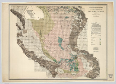
(Composite of) California State Engineering Department. Topographical And Irrigation Map Of The San Joaquin Valley. (Sheets Nos. 1-4). Wm. Ham. Hall, State Engineer, 1886. Note. This Topographical and Irrigation Map of San Joaquin Valley is published in four sheets, as follows: Sheet No. 1, from Tp. 4 N. to 1st Standard South. Sheet No. 2, from 1st to 3d Standard South. Sheet No. 3, from 3d to 5th Standard South. Sheet No. 4, from 5th to 8th Standard South. It is intended as a general illustration of the present extent of irrigation, and a means of studying its future possible development ...
Publisher
California State Engineering Department
Author
[Hall, Wm. Ham. (William Hammond), California State Engineering Department.]
Full Title
Rainfall Distribution Map to Accompany Report on Irrigation and Water Supply in California. Wm. Ham. Hall, State Engineer. On this Map the areas in the State, over which the average annual precipitation ranges between 5 and 10, 10 and 20, 20 and 30, 30 and 40, 40 and 50, 50 and 60, 60 and 70, and 70 and 80 inches, respectively, are approximately outlined and distinctively shaded. And the average rainfall at the several stations of observation is figured for each.
Publisher
California State Engineering Department.
Author
[Hall, Wm. Ham. (William Hammond), California State Engineering Department]
Full Title
Drainage Area Map to Accompany Report on Irrigation and Water Supply in California. Wm. Ham. Hall, State Engineer. On this Map are outlined in red the areas from which the more important streams in the state drain their waters. They are arranged and tinted in five groups, as elsewhere explained, and separately identified by number.
Publisher
California State Engineering Department
Author
[Hall, Wm. Ham. (William Hammond), California State Engineering Department]
Full Title
California State Engineering Department. Topographical and Irrigation Map of the Great Central Valley of California. Embracing The Sacramento, San Joaquin, Tulare and Kern Valleys and the Bordering Foothills.
Publisher
California State Engineering Department
1-23 of 23
|