|
|
REFINE
Browse All : Atlas Map by Jefferys, Thomas from 1775
1-49 of 49
Author
Jefferys, Thomas
Full Title
An index map to the following sixteen sheets, being a compleat chart of the West Indies, with letters in the margin to direct the placing the different sheets in their proper places. London, printed for Robt. Sayer, Map & Printseller, no. 53 in Fleet Street, as the Act directs 20th. Feby. 1775.
Publisher
Sayer and Bennett
Author
Jefferys, Thomas
Full Title
The Western Coast of Louisiana and the Coast of New Leon. By Thos. Jefferys, Geographer to His Majesty. London, printed for Robt. Sayer, Map & Printseller, no. 53 Fleet Street, as the Act directs 20th Feby. 1775.
Publisher
Sayer and Bennett
Author
Jefferys, Thomas
Full Title
The Coast of West Florida and Louisiana. By Thos. Jefferys, Geographer to His Majesty. (London, printed for Robt. Sayer, Map & Printseller, no. 53 Fleet Street, as the Act directs 20th Feby. 1775)
Publisher
Sayer and Bennett
Author
Jefferys, Thomas
Full Title
The Peninsula and Gulf of Florida or Channel of Bahama with the Bahama Islands. By Thos. Jefferys, Geographer to His Majesty. London, printed for Robt. Sayer, Map & Printseller, no. 53 in Fleet Street, as the Act directs 20 Feby. 1775.
Publisher
Sayer and Bennett
Author
Jefferys, Thomas
Full Title
The coast of Mexico from Laguna de Esmotes to Punta Brava. By Thos. Jefferys, Geographer to His Majesty. London, printed for Robt. Sayer, Map & Printseller, no. 53 in Fleet Street, as the Act directs 20 Feby. 1775.
Publisher
Sayer and Bennett
Author
Jefferys, Thomas
Full Title
The coast of Yucatan from Campeche to Bahia del Ascension; with the west end of Cuba. By Thos. Jefferys, Geographer to His Majesty. London, printed for Robt. Sayer, Map & Printseller, no. 53 Fleet Street, as the Act directs 20th. Feby. 1775.
Publisher
Sayer and Bennett
Author
Jefferys, Thomas
Full Title
The Island of Cuba with part of the Bahama Banks & the Martyrs. By Thos. Jefferys, Geographer to his Majesty. London, printed for Robt. Sayer, Map & Printseller, no. 53 in Fleet Street, as the Act directs 20 Feby. 1775.
Publisher
Sayer and Bennett
Author
Jefferys, Thomas
Full Title
The Windward Passage, with the several passages, from the east end of Cuba, and the north part of St. Domingo. By Thos. Jefferys, Geographer to his Majesty. London, printed for Robt. Sayer, Map & Printseller, no. 53 Fleet Street, as the Act directs 20th Feby. 1775.
Publisher
Sayer and Bennett
Author
Jefferys, Thomas
Full Title
The Coast of New Spain from Neuva (i.e., Nueva) Vera Cruz to Triste Island. By Thos. Jeffreys, Geographer to His Majesty. London, printed for Robt. Sayer, Map & Printseller, no. 53 Fleet Street, as the Act directs 20th Feby. 1775.
Publisher
Sayer and Bennett
Author
Jefferys, Thomas
Full Title
The Bay of Honduras. By Thos. Jeffreys, Geographer to His Majesty. London, printed for Robt. Sayer, Map & Printseller, no. 53 in Fleet Street, as the Act directs 20 Feby. 1775.
Publisher
Sayer and Bennett
Author
Jefferys, Thomas
Full Title
The island of Jamaica and Cape Gracias a Dios with the banks. By Thos. Jefferys, Geographer to His Majesty. London, printed for Robt. Sayer, Map and Printseller, no. 53 in Fleet Street, as the Act directs 20 Feby. 1775.
Publisher
Sayer and Bennett
Author
Jefferys, Thomas
Full Title
South part of St. Domingo, or Hispaniola. By Thos. Jefferys, Geographer to his Majesty. London, printed for Robt. Sayer, Map and Printseller, no. 53 in Fleet Street, as the Act directs, 20 Feby. 1775.
Publisher
Sayer and Bennett
Author
Jefferys, Thomas
Full Title
The Caribbee Islands, the Virgin Islands, and the Isle of Porto Rico. By Thomas Jefferys, Geographer to His Majesty. London, printed for Robt. Sayer, Map and Printseller, no. 53 in Fleet Street, as the Act directs, 20 Feby. 1775.
Publisher
Sayer and Bennett
Author
Jefferys, Thomas
Full Title
Part of the provinces of Costa Rica and Nicaragua with the lagunas. By Thos. Jefferys, Geographer to his Majesty. London, printed for Robt. Sayer, Map & Printseller, no. 53 in Fleet Street, as the Act directs, 20 Feby. 1775.
Publisher
Sayer and Bennett
Author
Jefferys, Thomas
Full Title
The Isthmus of Panama with the coast from Great River on the Moskito Shore to Cartagena. By Thos. Jefferys, Geographer to His Majesty. London, printed for Robt. Sayer, Map & Printseller, no. 53 in Fleet Street, as the Act directs, 20th Feby. 1775.
Publisher
Sayer and Bennett
Author
Jefferys, Thomas
Full Title
The coast of Tierra Firma from Cartagena to Golfo Triste. By Thomas Jefferys, Geographer to His Majesty. London, printed for Robt. Sayer, Map and Printseller, no. 53 in Fleet Street, as the Act directs, 20. Feby. 1775.
Publisher
Sayer and Bennett
Author
Jefferys, Thomas
Full Title
The coast of Caracas, Cumana, Parla and the mouths of Rio Orinoco, with the islands of Trinidad, Margarita, Tobago, Granada, St. Vincent &ca. By Thos. Jefferys, Geographer to His Majesty. London, printed for Robt. Sayer, Map & Printseller, no. 53 Fleet Street, as the Act directs, 20th. Feby. 1775.
Publisher
Sayer and Bennett
Author
Jefferys, Thomas
Full Title
Jamaica from the latest surveys; improved and engraved by Thomas Jefferys, Geographer to the King. London, printed for Robt. Sayer, Map & Printseller, no. 53 in Fleet Street, as the Act directs 20th Feby. 1775.
Publisher
Sayer and Bennett
Author
Jefferys, Thomas
Full Title
Ruatan or Rattan, surveyed by Lieutenant Henry Barnsley, with improvements by Thomas Jefferys, Geographer to the King. London, printed for Robt. Sayer, Map and Printseller, no. 53 in Fleet Street, as the Act directs 20 Feby. 1775.
Publisher
Sayer and Bennett
Author
Jefferys, Thomas
Full Title
The Virgin Islands from English and Danish surveys, by Thomas Jefferys, Geographer to the King. London, printed for Robt. Sayer, Map & Printseller, no. 53 in Fleet Street, as the Act directs 20th Feby. 1775.
Publisher
Sayer and Bennett
Author
Jefferys, Thomas
Full Title
Antigua, surveyed by Robert Baker, Surveyor General of that Island, engraved and improved by Thomas Jefferys, Geographer to the King. (London, printed for Robt. Sayer, 1775)
Publisher
Sayer and Bennett
Author
Jefferys, Thomas
Full Title
Guadaloupe, done from actual surveys and observations of the English whilst the Island was in their possession, with improvements by Thomas Jefferys, Geographer to the King. London, printed for Robt. Sayer, Map and Printseller, no. 53 in Fleet Street, as the Act directs, 20 Feby. 1775.
Publisher
Sayer and Bennett
Author
Jefferys, Thomas
Full Title
Dominica from an actual survey compleated in the year 1773. (By Thomas Jefferys). London, printed for Robt. Sayer, Map and Printseller, no. 53 in Fleet Street, as the Act directs, 20 Feby. 1775.
Publisher
Sayer and Bennett
Author
Jefferys, Thomas
Full Title
Martinico, done from actual surveys and observations, made by English engineers whilst the Island was in their possession, by Thomas Jefferys, Geographer to the King. London, printed for Robt. Sayer, Map and Printseller, no. 53 in Fleet Street, as the Act directs, 20 Feby. 1775.
Publisher
Sayer and Bennett
Author
Jefferys, Thomas
Full Title
St. Lucia; done from surveys and observations made by the English whilst in their possession, by Thomas Jefferys, Geographer to the King. London, printed for Robt. Sayer, Map & Printseller, no. 53 in Fleet Street, as the Act directs 20th Feby 1775.
Publisher
Sayer and Bennett
Author
Jefferys, Thomas
Full Title
Barbadoes, surveyed by William Mayo, engraved and improved by Thomas Jefferys, Geographer to the Kind. London, printed for Robt. Sayer, Map & Printseller, no. 53 in Fleet Street as the Act directs 20 Feby 1775.
Publisher
Sayer and Bennett
Author
Jefferys, Thomas
Full Title
St. Vincent; from an actual survey made in the year 1773 after the Treaty with the Caribs (by Thomas Jefferys). London, printed for Robt. Sayer, Map and Printseller, no. 53 in Fleet Street, as the Act directs, 20th Feby. 1775.
Publisher
Sayer and Bennett
Author
Jefferys, Thomas
Full Title
Bequia or Becouya, the northernmost of the Granadilles, surveyed in 1763. (By Thomas Jefferys). London, printed for Robt. Sayer, Map & Printseller, no. 53 in Fleet Street, as the Act directs, 20 Feby. 1775
Publisher
Sayer and Bennett
Author
Jefferys, Thomas
Full Title
Carte de l'Isle de la Grenade, cedee a la Grande Bretagne par le dernier Traite de Paix. Grenada divided into its parishes, surveyed by order of his excellency Governor Scott, and engraved by Thomas Jefferys, Geographer to the King. London, printed for Robt. Sayer, Map & Printseller, no. 53 in Fleet Street, as the Act directs, 20 Feby. 1775
Publisher
Sayer and Bennett
Author
[Jefferys, Thomas, Ross, David]
Full Title
Tobago from actual surveys and observations, by Thomas Jefferys, Geographer to the King. London, printed for Robt. Sayer, Map and Printseller, no. 53 in Fleet Street, as the Act directs, 20 Feby. 1775.
Publisher
Sayer and Bennett
Author
Jefferys, Thomas
Full Title
Turks Islands, from a survey made in 1753, by the sloops l'Aigle and l'Emeraude, by order of the French Governor of Hispaniola, with improvements from observations made in 1770, in the Sr. Edward Hawke Kings schooner. (By Thomas Jefferys). London, printed for Robt. Sayer, Map & Printseller, no. 53 Fleet Street, as the Act directs, 20 Feby. 1775.
Publisher
Sayer and Bennett
Author
[Jefferys, Thomas, Keulen, Gerard van]
Full Title
Curacao, from the Dutch originals of Gerard Van Keulen, regulated by astronomical observations. (By Thomas Jefferys). London, printed for Robt. Sayer, Map & Printseller, no. 53 in Fleet Street, as the Act directs 20 Feby. 1775.
Publisher
Sayer and Bennett
Author
Ravell, Anthony
Full Title
St. Christophers, or St. Kitts, surveyed by Anthony Ravell Esqr., Surveyor General of the islands of St. Christopher, Nevis & Montserrat. Engraved by Thomas Jefferys, Geographer to the King. London, printed for Robt. Sayer, Map & Printseller, no. 53 in Fleet Street, as the Act directs 20th Feby. 1775.
Publisher
Sayer and Bennett
Author
[Faden, William, 1750?-1836, Jefferys, Thomas]
Full Title
Europe. Engraved by Jefferys and Faden, Geographers to the King. London, publish'd according to Act of Parliament, 29th May, 1775, by Jefferys & Faden, Corner of St. Martin's Lane, Charing Cross.
Publisher
William Faden
Author
[Faden, William, 1750?-1836, Jefferys, Thomas]
Full Title
Europe. London, published by Jefferys and Faden, Corner of St. Martin's Lane, Charing Cross. (1775?)
Publisher
William Faden
Author
[Faden, William, 1750?-1836, Jefferys, Thomas]
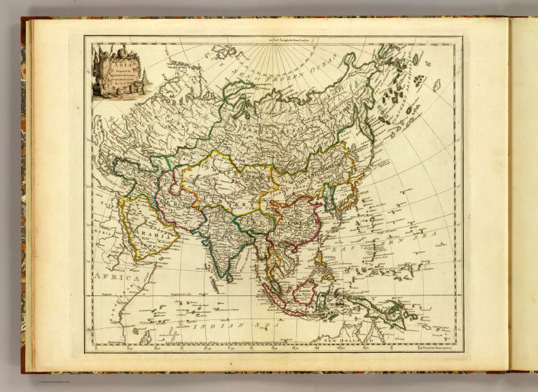
Full Title
Asia. Engraved by Jefferys & Faden, Geographers to the King. London, published as the Act directs, 29th May, 1775, by Jefferys & Faden, St. Martin's Lane, Charing Cross.
Publisher
William Faden
Author
[Faden, William, 1750?-1836, Jefferys, Thomas]
Full Title
Asia. London, publish'd by Jefferys & Faden, Corner of St. Martin's Lane, Charing Cross. (1775?)
Publisher
William Faden
Author
[Faden, William, 1750?-1836, Jefferys, Thomas]
Full Title
Africa. Engraved by Faden and Jefferys, Geographer to the King. London: publish'd according to Act of Parliament, 29th May, 1775 by Faden & Jefferys, Corner of St. Martin's Lane, Charing Cross.
Publisher
William Faden
Author
[Faden, William, 1750?-1836, Jefferys, Thomas]
Full Title
Africa. London, publish'd by Jefferys and Faden, Corner of St. Martin's Lane, Charing Cross. (1775?)
Publisher
William Faden
Author
[Faden, William, 1750?-1836, Jefferys, Thomas]
Full Title
Western Hemisphere. Engraved by Faden and Jefferys, Geographer to the King. London, publish'd according to Act of Parliament, 28th February 1775 by Jefferys and Faden, the Corner of St. Martin's Lane.
Publisher
William Faden
Author
[Faden, William, 1750?-1836, Jefferys, Thomas]
Full Title
Western Hemisphere. London, publish'd by Jefferys & Faden, Corner of St. Martin's Lane, Charing Cross. (1775?)
Publisher
William Faden
Author
[Faden, William, 1750?-1836, Jefferys, Thomas]
Full Title
Northern Hemisphere. Engraved by Faden and Jefferys, Geographer to the King. London: publish'd according to Act of Parliament, 29th May, 1775, by Jefferys & Faden, the Corner of St. Martin's Lane, Charing Cross.
Publisher
William Faden
Author
[Faden, William, 1750?-1836, Jefferys, Thomas]
Full Title
(Nor)thern Hemisphere. London, publish'd by Jefferys & Faden, Corner of St. Martin's Lane, Charing Cross. (1775?)
Publisher
William Faden
Author
[Faden, William, 1750?-1836, Jefferys, Thomas]
Full Title
Southern Hemisphere. Engraved by Faden & Jefferys, Geographer to the King. London, publish'd according to Act of Parliament, 29th May 1775, by Jefferys & Faden, the Corner of St. Martin's Lane, Charing Cross.
Publisher
William Faden
Author
[Faden, William, 1750?-1836, Jefferys, Thomas]
Full Title
(Sou)thern Hemisphere. London, publish'd by Jefferys & Faden, Corner of St. Martin's Lane, Charing Cross. (1775?)
Publisher
William Faden
Author
[Faden, William, 1750?-1836, Jefferys, Thomas]
Full Title
A chart of the World upon Mercator's projection. Describing the tracks of Capt. Cook in the year 1768, 69, 70, 71, and in 1772, 73, 74, 75, with the new discoveries. London, publish'd according to Act of Parliament by Jefferys & Faden, Corner of St. Martin's Lane, Charing Cross. 1775.
Publisher
William Faden
Author
[Faden, William, 1750?-1836, Jefferys, Thomas]
Full Title
A chart of the World upon Mercator's projection. London, published by Jefferys & Faden, Corner of St. Martin's Lane, Charing Cross. (1775?).
Publisher
William Faden
Author
Jefferys, Thomas
Full Title
(Facsimile) Jefferys - 1775. 41. S Doc 9a 55 2. Part of a Chart of the Coast of Guiana by Thomas Jefferys, London, 1775. Reproduced from Original (in his West-India Atlas, London, 1788, Pl. A1. 17,) in Library of Congress, Washington, D.C.. Photo.Lith. by A. Hoen & Co., Baltimore, MD.
Publisher
United States of America
Author
Jefferys, Thomas
Full Title
An exact chart of the River St. Laurence, from Fort Frontenac to the Island of Anticosti, shewing the soundings, rocks, shoals &c. with views of the lands and all necessary instructions for navigating that river to Quebec. To the Rt. Honble. Jno. Montagu, El. of Sandwich, First Lord Commissioner, to the other Honble. Commissioners for executing the office of Lord High Admiral of Great Britain, this chart is most humbly inscribed by their most obedient, most devoted, humble servt. Thos. Jefferys. London, printed for Robt. Sayer, Map & Printseller, no. 53, Fleet Street, as the Act directs, 25 May 1775.
Publisher
Robert Sayer
1-49 of 49
|