|
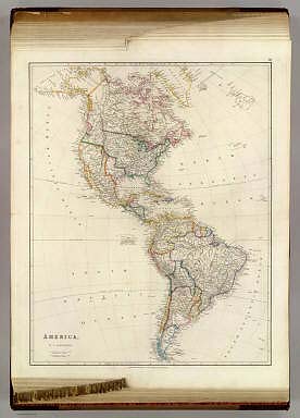
Author
Arrowsmith, John
Full Title
America, By J. Arrowsmith. (Map) 39. London, Pubd. 15 Feby. 1844, by J. Arrowsmith, 10 Soho Square.
Publisher
John Arrowsmith
Author
Arrowsmith, John
Full Title
British North America. By Permission Dedicated to The Honble. Hudsons Bay Company; Containing the latest information which their documents furnish. By their Obedient Servant J. Arrowsmith. (Map) 40. London, Pubd. 25 April 1844, by J. Arrowsmith, 10 Soho Square.
Publisher
John Arrowsmith
Author
Arrowsmith, John
Full Title
Upper Canada &c. By J. Arrowsmith. (Map) 41. London, Pubd. 15 Feby. 1842, by J. Arrowsmith, 10 Soho Square.
Publisher
John Arrowsmith
Author
Arrowsmith, John
Full Title
Lower Canada, New Brunswick, Nova Scotia, Prince Edwards Id., Newfoundland, and a large portion of the United States. By J. Arrowsmith. (with) inset map of Newfoundland. (Map) 42. London, Pubd. 15 Feby. 1842, by J. Arrowsmith, 10 Soho Square.
Publisher
John Arrowsmith
Author
Arrowsmith, John
Full Title
United States, By J. Arrowsmith. (Map) 43. London, Pubd. 15 Feby. 1842, by J. Arrowsmith, 10 Soho Square.
Publisher
John Arrowsmith
Author
Arrowsmith, John
Full Title
Mexico, By J. Arrowsmith. (with) Mexico, Shewing its connection with the Ports of Acapulco, Vera Cruz, & Tampico; on double the scale of the Map. (Map) 44. London, Pubd. 15 Feby. 1842, by J. Arrowsmith, 10 Soho Square.
Publisher
John Arrowsmith
Author
Arrowsmith, John
Full Title
West Indies, By J. Arrowsmith. (with) inset map of the northern section of Guatimala (sic) (Map) 45. London, Pubd. 15 Feby. 1842, by J. Arrowsmith, 10 Soho Square.
Publisher
John Arrowsmith
Author
Arrowsmith, John
Full Title
South America. From Original Documents, including The survey by the officers of H.M. Ships Adventure and Beagle. Dedicated to Captain R. Fitz Roy, R.N., by J. Arrowsmith. (with) inset maps of Galapagos Islands, Port San Carlos, Falkland Islands, and Patagonia. (Map) 46. London, Pubd. 18th May. 1842, by J. Arrowsmith, 10 Soho Square.
Publisher
John Arrowsmith
Author
Arrowsmith, John
Full Title
Colombia, Dedicated to Colonel Belford Hinton Wilson, late Aid de Camp to the Liberator Simon Bolivar, By his Obliged Servant J. Arrowsmith. (Map) 47. London, Pubd. 15 Feby. 1842, by J. Arrowsmith, 10 Soho Square.
Publisher
John Arrowsmith
Author
Arrowsmith, John
Full Title
Peru & Bolivia, By J. Arrowsmith. (Map) 48. London, Pubd. 15 Feby. 1842, by J. Arrowsmith, 10 Soho Square.
Publisher
John Arrowsmith
Author
Arrowsmith, John
Full Title
Brazil, By J. Arrowsmith. (Map) 49. London, Pubd. 15 Feby. 1842, by J. Arrowsmith, 10 Soho Square.
Publisher
John Arrowsmith
Author
[Arrowsmith, John, Parish, Woodbine]
Full Title
The Provinces of La Plata, The Banda Oriental del Uruguay and Chile, Chiefly from M.S. documents by Sir Woodbine Parish, K.C.H. Late H.M. Charge d'Affaires &c. at Buenos Ayres. by J. Arrowsmith. (with) map of the lower tip of Patagonia. (Map) 50. London, Pubd. 4th June 1842, by J. Arrowsmith, 10 Soho Square.
Publisher
John Arrowsmith
Author
Arrowsmith, John
Full Title
Sketch of the Acquisitions of Russia since the Accession of Peter 1st. to the Throne. London, John Arrowsmith, 10 Soho Square, 1842.
Publisher
John Arrowsmith
Author
Arrowsmith, John
Full Title
Map of the Ionian Islands and Malta compiled from surveys & original documents in the colonial office, the ordnance department &c by John Arrowsmith. (with) Map of the Maltese Islands from actual survey. (with) inset map of Cerigo (with) inset map of sea and land routes from England to Alexandria. London, Pubd. 8th August 1842, by John Arrowsmith, 10 Soho Square.
Publisher
John Arrowsmith
Author
Arrowsmith, John
Full Title
Map of the West Coast of Africa comprising Guinea, and the British Possessions at Sierra Leone, on the Gambia and the Gold Coast, together with the countries within the courses of the Rivers Senegal, Gambia & Kowara, Compiled from official documents, By John Arrowsmith. 1843. London, Publishd. 17th April 1843, by John Arrowsmith, 10 Soho Square.
Publisher
John Arrowsmith
Author
Arrowsmith, John
Full Title
The River Niger Shewing the Course of the Expedition under Captain Trotter in 1841. (with) The Lower Course of the River Niger as far as it was ascended in the Expedition under Captn. Trotter R.N. 1841. London, Pubd. 17 April 1843, by John Arrowsmith, 10 Soho Square.
Publisher
John Arrowsmith
Author
Arrowsmith, John
Full Title
Map of Asia Minor to illustrate the Journeys of W. I. Hamilton Esqr. 1836-1837. Compiled from Original Documents By John Arrowsmith. London, Pubd. Novr. 1st 1842, by John Arrowsmith, 10 Soho Square.
Publisher
John Arrowsmith
Author
Arrowsmith, John
Full Title
The Caspian Sea, Khivah, and the Surrounding Country Compiled from the best Sources By John Arrowsmith. London, Pubd. Jany. 1st 1841, by John Arrowsmith, 10 Soho Square.
Publisher
John Arrowsmith
Author
Arrowsmith, John
Full Title
Australia from surveys made by order of the British Government combined with those of D'entrecasteaux, Baudin, Freycinet &c.&c. By John Arrowsmith. 1842. (with) inset map of the Eastern Hemisphere. London, Pubd. 1st May 1842, by John Arrowsmith, 10 Soho Square.
Publisher
John Arrowsmith
Author
Arrowsmith, John
Full Title
Eastern Portion of Australia By John Arrowsmith. (with) with inset map of the Torres Strait. (with) Van Diemens Land on the same scale as the Map. London, Pubd. 1st May 1842, by John Arrowsmith, 10 Soho Square.
Publisher
John Arrowsmith
Author
Arrowsmith, John
Full Title
The Maritime Portion of South Australia, from Captn. Flinders & from more recent Surveys made by the Survr. Genl. of the Colonies By John Arrowsmith. (with) inset map of the Gulf of St. Vincent. (with) The City of Adelaide, with the Acre Allotments numbered. Surveyed by Col. Light. (with) Sketch of Nepean Bay, and Kingscote Harbour, by Wm. Chesser. (with) Sketch of Encounter Bay by Col. Light & B.T. Finniss Esqr. 1838. London, Published Feby. 5th 1840, by John Arrowsmith, 10 Soho Square.
Publisher
John Arrowsmith
Author
Arrowsmith, John
Full Title
Map of the Colony of New Zealand: From Official Documents. By John Arrowsmith. 1843. (with) map of the world on Mercators Projection. London, Pubd. 2nd Jan. 1843 by John Arrowsmith, 10 Soho Square.
Publisher
John Arrowsmith
Author
Arrowsmith, John
Full Title
Map of Texas, compiled from Surveys recorded in the Land Office of Texas, and other Official Surveys, By John Arrowsmith. Soho Square, London. (with) Plan of Galveston Bay from a M.S. (with) inset map of the Western United States, Texas and Mexico. London, Pubd. 8th June, 1843, by John Arrowsmith, 10 Soho Square.
Publisher
John Arrowsmith
Author
Arrowsmith, John
Full Title
Map of Jamaica compiled chiefly from manuscripts in the Colonial Office and Admiralty by John Arrowsmith. 35 Essex St. London, Pubd. 22nd April 1842 by John Arrowsmith, 10 Soho Square.
Publisher
John Arrowsmith
Author
Arrowsmith, John
Full Title
Map of The Leeward Islands; Comprising Antigua, Montserrat, Barbuda, St. Christopher, Nevis, Anguilla, Virgin Islands & Dominica. under the Administration of Lieut. Colonel Sir Wm. M.G. Colebrooke, K.C.H. Compiled principally from documents in the Colonial Office and Admiralty. By John Arrowsmith. London, Published July 8th, 1842, by J. Arrowsmith, 10 Soho Square.
Publisher
John Arrowsmith
Author
Arrowsmith, John
Full Title
Map of the Windward Islands; Comprising Barbados, St. Vincent, Grenada, Tobago, St. Lucia & Trinidad. under the Administration of Major Genl. Sir E.I. Murray MacGregor Bart. K.C.B. & K.C.H. Compiled principally from documents in the Colonial Office and Admiralty. By John Arrowsmith. London, Published July 8th 1842, by John Arrowsmith, 10 Soho Square.
Publisher
John Arrowsmith
Author
Arrowsmith, John
Full Title
Map of British Guiana From the latest Surveys of Schomburgk, Owen, Hilhouse, & others; & Those of Hancock, Van-Cooten, Bouchenroeder, & Bercheyck ... Respectfully dedicated To His Excellency Henry Light Esqr. Governor in & over said Colony By His Excellency's Very Obedient Humble Servant J. Hadfield, Crown Surveyor. George Town Demerara, 1st Augt. 1838. John Arrowsmith. London, Published Augt. 1st 1842, by John Arrowsmith, 10 Soho Square.
Publisher
John Arrowsmith
|