Who What Where WhenREMOVEWHEREShow More |
REFINE
Browse All : Images by Julius Bien of New Jersey
1-34 of 34
Author
U.S. General Land Office
Full Title
(Map 3 - Virginia, West Virginia, Ohio, Pennsylvania, Maryland, Delaware, New Jersey, New York, Rhode Island, Massachusetts, Connecticut).
Publisher
Julius Bien
Author
[Bien, Joseph Rudolf, Vermeule, C. C. (Cornelius Clarkson), 1858-1950]
Full Title
Index map showing the area covered by this atlas, and boundaries and numbers of the various maps. Copyrighted by Julius Bien & Co., 1890. (1891)
Publisher
Julius Bien
Author
[Bien, Joseph Rudolf, Vermeule, C. C. (Cornelius Clarkson), 1858-1950]
Full Title
City and county of New York. Copyrighted by Julius Bien & Co., 1890. (1891)
Publisher
Julius Bien
Author
[Bien, Joseph Rudolf, Vermeule, C. C. (Cornelius Clarkson), 1858-1950]
Full Title
Brooklyn, New York Bay, Jersey City, Hoboken, Bayonne and Newark Bay. Copyrighted by Julius Bien & Co., 1890. (1891)
Publisher
Julius Bien
Author
[Bien, Joseph Rudolf, Vermeule, C. C. (Cornelius Clarkson), 1858-1950]
Full Title
Richmond County, Staten Island. Copyrighted by Julius Bien & Co., 1890. (1891)
Publisher
Julius Bien
Author
[Bien, Joseph Rudolf, Vermeule, C. C. (Cornelius Clarkson), 1858-1950]
Full Title
Newark, Elizabeth, the Oranges and vicinity. Copyrighted by Julius Bien & Co., 1890. (1891)
Publisher
Julius Bien
Author
[Bien, Joseph Rudolf, Vermeule, C. C. (Cornelius Clarkson), 1858-1950]
Full Title
Newark to Paterson East. Copyrighted by Julius Bien & Co., 1890. (1891)
Publisher
Julius Bien
Author
[Bien, Joseph Rudolf, Vermeule, C. C. (Cornelius Clarkson), 1858-1950]
Full Title
Westchester County, Yonkers to Dobbs Ferry, east to state line. Copyrighted by Julius Bien & Co., 1890. (1891)
Publisher
Julius Bien
Author
[Bien, Joseph Rudolf, Vermeule, C. C. (Cornelius Clarkson), 1858-1950]
Full Title
(Contents to) Atlas of the Metropolitan District and adjacent country comprising the counties of New York, Kings, Richmond, Westchester and part of Queens in the state of New York, the County of Hudson and parts of the counties of Bergen, Passaic, Essex and Union in the state of New Jersey ... From original surveys by J.R. Bien and C.C. Vermeule, the U.S. Coast and Geodetic Survey and the Geological Survey of New Jersey. Published by Julius Bien & Co. New York. 1891.
Publisher
Julius Bien
Author
[Bien, Joseph Rudolf, Vermeule, C. C. (Cornelius Clarkson), 1858-1950]
Full Title
(Covers to) Atlas of the Metropolitan District and adjacent country comprising the counties of New York, Kings, Richmond, Westchester and part of Queens in the state of New York, the County of Hudson and parts of the counties of Bergen, Passaic, Essex and Union in the state of New Jersey ... From original surveys by J.R. Bien and C.C. Vermeule, the U.S. Coast and Geodetic Survey and the Geological Survey of New Jersey. Published by Julius Bien & Co. New York. 1891.
Publisher
Julius Bien
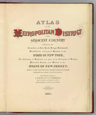
Author
[Bien, Joseph Rudolf, Vermeule, C. C. (Cornelius Clarkson), 1858-1950]
Full Title
(Title Page to) Atlas of the Metropolitan District and adjacent country comprising the counties of New York, Kings, Richmond, Westchester and part of Queens in the state of New York, the County of Hudson and parts of the counties of Bergen, Passaic, Essex and Union in the state of New Jersey ... From original surveys by J.R. Bien and C.C. Vermeule, the U.S. Coast and Geodetic Survey and the Geological Survey of New Jersey. Published by Julius Bien & Co. New York. 1891.
Publisher
Julius Bien
Author
Geological Survey of New Jersey
Full Title
(Covers to) Atlas of New Jersey. Geological Survey of New Jersey. Julius Bien & Co., New York. (1888)
Publisher
Julius Bien
Author
Geological Survey of New Jersey
Full Title
(Title Page to) Atlas of New Jersey. Geological Survey of New Jersey. Julius Bien & Co., New York. (1888)
Publisher
Julius Bien
Author
Geological Survey of New Jersey
Full Title
(Text Page to) Atlas of New Jersey. Geological Survey of New Jersey. Julius Bien & Co., New York. (1888)
Publisher
Julius Bien
Author
[Cook, George Hammell, 1818-1889, Geological Survey of New Jersey, Vermeule, C. C. (Cornelius Clarkson), 1858-1950]
Full Title
The state of New Jersey. George H. Cook, State Geologist, C.C.Vermeule, topographer. 1883. Geological Survey of New Jersey. State map. Julius Bien & Co., Lith. (1888)
Publisher
Julius Bien
Author
[Cook, George Hammell, 1818-1889, Geological Survey of New Jersey, Vermeule, C. C. (Cornelius Clarkson), 1858-1950]
Full Title
New Jersey. George H. Cook, State Geologist, C.C.Vermeule, topographer. 1888. Geological Survey of New Jersey. Relief map. Julius Bien & Co., Lith. (1888)
Publisher
Julius Bien
Author
[Cook, George Hammell, 1818-1889, Geological Survey of New Jersey, Vermeule, C. C. (Cornelius Clarkson), 1858-1950]
Full Title
A topographical map of Kittatinny Valley and Mountain in Sussex County and the northern part of Warren. George H. Cook, State Geologist, C.C.Vermeule, topographer. 1886. Geological Survey of New Jersey. Atlas sheet no. 1, Kittatinny. Julius Bien & Co., Lith. (1888)
Publisher
Julius Bien
Author
[Cook, George Hammell, 1818-1889, Geological Survey of New Jersey, Smock, John Conover, Vermeule, C. C. (Cornelius Clarkson), 1858-1950]
Full Title
A topographical map of the Southwestern Highlands with the southwest portion of Kittatinny Valley. George H. Cook, State Geologist, John C. Smock, assistant geologist, C.C.Vermeule, topographer. 1885. Geological Survey of New Jersey. Atlas sheet no. 2, Southwestern Highlands. Julius Bien & Co., Lith. (1888)
Publisher
Julius Bien
Author
[Cook, George Hammell, 1818-1889, Geological Survey of New Jersey, Smock, John Conover, Vermeule, C. C. (Cornelius Clarkson), 1858-1950]
Full Title
A topographical map of the Central Highlands including all of Morris County west of Boonton and Sussex County south and east of Newton. George H. Cook, State Geologist, John C. Smock, assistant geologist, C.C.Vermeule, topographer. 1884. Geological Survey of New Jersey. Atlas sheet no. 3, Central Highlands. Julius Bien & Co., Lith., N.Y. (1888)
Publisher
Julius Bien
Author
[Cook, George Hammell, 1818-1889, Geological Survey of New Jersey, Smock, John Conover, Vermeule, C. C. (Cornelius Clarkson), 1858-1950]
Full Title
A topographical map of the Northeastern Highlands including the country lying between Deckertown, Dover, Paterson and Suffern. George H. Cook, State Geologist, John C. Smock, assistant geologist, C.C.Vermeule, topographer. 1884. Geological Survey of New Jersey. Atlas sheet no. 4, Northeastern Highlands. Julius Bien & Co., Lith., N.Y. (1888)
Publisher
Julius Bien
Author
[Cook, George Hammell, 1818-1889, Geological Survey of New Jersey, Vermeule, C. C. (Cornelius Clarkson), 1858-1950]
Full Title
A topographical map of the vicinity of Flemington from Somerville and Princeton westward to the Delaware. George H. Cook, State Geologist, C.C.Vermeule, topographer. 1887. Geological Survey of New Jersey. Atlas sheet no. 5, southwestern red sandstone. Julius Bien & Co., Lith. (1888)
Publisher
Julius Bien
Author
[Cook, George Hammell, 1818-1889, Geological Survey of New Jersey, Smock, John Conover, Vermeule, C. C. (Cornelius Clarkson), 1858-1950]
Full Title
A topographical map of the valley of the Passaic with the country eastward to Newark and southward to the Raritan River. George H. Cook, State Geologist, John C. Smock, assistant geologist, C.C.Vermeule, topographer. 1885. Geological Survey of New Jersey. Atlas sheet no. 6, central red sandstone. Julius Bien & Co., Lith. (1888)
Publisher
Julius Bien
Author
[Cook, George Hammell, 1818-1889, Geological Survey of New Jersey, Smock, John Conover, Vermeule, C. C. (Cornelius Clarkson), 1858-1950]
Full Title
A topographical map of the counties of Bergen, Hudson and Essex, with parts of Passaic and Union. George H. Cook, State Geologist, John C. Smock, assistant geologist, C.C.Vermeule, topographer. 1884. Geological Survey of New Jersey. Atlas sheet no. 7, northeastern red sandstone. Julius Bien & Co., Lith., N.Y. (1888)
Publisher
Julius Bien
Author
[Cook, George Hammell, 1818-1889, Geological Survey of New Jersey, Vermeule, C. C. (Cornelius Clarkson), 1858-1950]
Full Title
A topographical map of the vicinity of Trenton, New Brunswick and Bordentown. George H. Cook, State Geologist, C.C.Vermeule, topographer. 1887. Geological Survey of New Jersey. Atlas sheet no. 8, Trenton. Julius Bien & Co., Lith. (1888)
Publisher
Julius Bien
Author
[Cook, George Hammell, 1818-1889, Geological Survey of New Jersey, Vermeule, C. C. (Cornelius Clarkson), 1858-1950]
Full Title
A topographical map of the Monmouth shore with the interior from Metuchen to Lakewood. George H. Cook, State Geologist, C.C.Vermeule, topographer. 1886. Geological Survey of New Jersey. Atlas sheet no. 9, Monmouth shore. Julius Bien & Co., Lith. (1888)
Publisher
Julius Bien
Author
[Cook, George Hammell, 1818-1889, Geological Survey of New Jersey, Vermeule, C. C. (Cornelius Clarkson), 1858-1950]
Full Title
A topographical map of the vicinity of Salem from Woodbury and Bridgeton westward to the Delaware River. George H. Cook, State Geologist, C.C.Vermeule, topographer. 1887. Geological Survey of New Jersey. Atlas sheet no. 10, Lower Delaware. Julius Bien & Co., Lith. (1888)
Publisher
Julius Bien
Author
[Cook, George Hammell, 1818-1889, Geological Survey of New Jersey, Vermeule, C. C. (Cornelius Clarkson), 1858-1950]
Full Title
A topographical map of the vicinity of Camden to Burlington, Winslow, Elmer and Swedesboro. George H. Cook, State Geologist, C.C.Vermeule, topographer. 1887. Geological Survey of New Jersey. Atlas sheet no. 11, Camden. Julius Bien & Co., Lith. (1888)
Publisher
Julius Bien
Author
[Cook, George Hammell, 1818-1889, Geological Survey of New Jersey, Vermeule, C. C. (Cornelius Clarkson), 1858-1950]
Full Title
A topographical map of the vicinity of Mount Holly from Bordentown southward to Winslow and Woodmansie. George H. Cook, State Geologist, C.C.Vermeule, topographer. 1887. Geological Survey of New Jersey. Atlas sheet no. 12, Mount Holly. Julius Bien & Co., Lith. (1888)
Publisher
Julius Bien
Author
[Cook, George Hammell, 1818-1889, Geological Survey of New Jersey, Vermeule, C. C. (Cornelius Clarkson), 1858-1950]
Full Title
A topographical map of the vicinity of Barnegat Bay with the greater part of Ocean County. George H. Cook, State Geologist, C.C.Vermeule, topographer. 1886. Geological Survey of New Jersey. Atlas sheet no. 13, Barnegat. Julius Bien & Co., Lith. (1888)
Publisher
Julius Bien
Author
[Cook, George Hammell, 1818-1889, Geological Survey of New Jersey, Vermeule, C. C. (Cornelius Clarkson), 1858-1950]
Full Title
A topographical map of the vicinity of Bridgeton from Alloway, Elmer and Newfield southward to the Delaware Bay shore. George H. Cook, State Geologist, C.C.Vermeule, topographer. 1887. Geological Survey of New Jersey. Atlas sheet no. 14, Delaware Bay. Julius Bien & Co., Lith. (1888)
Publisher
Julius Bien
Author
[Cook, George Hammell, 1818-1889, Geological Survey of New Jersey, Vermeule, C. C. (Cornelius Clarkson), 1858-1950]
Full Title
A topographical map of the southern interior from Millville to Atco and Egg Harbor City. George H. Cook, State Geologist, C.C.Vermeule, topographer. 1887. Geological Survey of New Jersey. Atlas sheet no. 15, southern interior. Julius Bien & Co., Lith. (1888)
Publisher
Julius Bien
Author
[Cook, George Hammell, 1818-1889, Geological Survey of New Jersey, Smock, John Conover, Vermeule, C. C. (Cornelius Clarkson), 1858-1950]
Full Title
A topographical map of Egg Harbor and vicinity including the Atlantic shore from Barnegat to Great Egg Harbor. George H. Cook, State Geologist, John C. Smock, assistant geologist, C.C.Vermeule, topographer. 1885. Geological Survey of New Jersey. Atlas sheet no. 16, Egg Harbor. Julius Bien & Co., Lith. (1888)
Publisher
Julius Bien
Author
[Cook, George Hammell, 1818-1889, Geological Survey of New Jersey, Vermeule, C. C. (Cornelius Clarkson), 1858-1950]
Full Title
A topographical map of the peninsula of Cape Bay with the country westward to Maurice River. George H. Cook, State Geologist, C.C.Vermeule, topographer. 1886. Geological Survey of New Jersey. Atlas sheet no. 17, Cape May. Julius Bien & Co., Lith. (1888)
Publisher
Julius Bien
1-34 of 34
|