Browse All

1876 Cordilleras. Geologic Atlas Cordilleras. |

1878 A topographical map of the State of New … Geologic Atlas A topographical map of the State of New … |

1878 Map of New Hampshire. 1816. Geologic Atlas Map of New Hampshire by Philip Carrigain … |

1878 (General geological map of New Hampshire … Geologic Atlas (General geological map of New Hampshire … |

1878 (General geological map of New Hampshire … Geologic Atlas (General geological map of New Hampshire … |

1878 (General geological map of New Hampshire … Geologic Atlas (General geological map of New Hampshire … |

1878 (General geological map of New Hampshire … Geologic Atlas (General geological map of New Hampshire … |

1878 (General geological map of New Hampshire … Geologic Atlas (General geological map of New Hampshire … |

1878 (General geological map of New Hampshire … Geologic Atlas (General geological map of New Hampshire … |

1878 Composite: New Hampshire general geologi … Geologic Atlas (Composite of General geological map of … |

1878 (Topographic and glacial feature map of … Geologic Atlas (Topographic and glacial feature map of … |

1878 (Topographic and glacial feature map of … Geologic Atlas (Topographic and glacial feature map of … |

1878 (Topographic and glacial feature map of … Geologic Atlas (Topographic and glacial feature map of … |

1878 (Topographic and glacial feature map of … Geologic Atlas (Topographic and glacial feature map of … |

1878 (Topographic and glacial feature map of … Geologic Atlas (Topographic and glacial feature map of … |

1878 Map of the Ammonoosuc Mining District. Geologic Atlas Map of the Ammonoosuc Mining District. ( … |

1876 Green River from the Union Pacific Rail … Geologic Atlas Green River from the Union Pacific Rail … |

1876 Green River from the Union Pacific Rail … Geologic Atlas Green River from the Union Pacific Rail … |

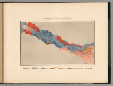
1876 Structure sections through the Uinta Mou … Geologic Atlas Structure sections through the Uinta Mou … |

1876 Displacement diagrams ... through the Ui … Geologic Atlas Displacement diagrams derived from the S … |

1876 Stereogram of the displacements of the U … Geologic Atlas Stereogram of the displacements of the e … |

1876 Bird's-eye view of a part of the Uinta U … Geologic Atlas Bird's-eye view of a part of the Uinta U … |

1876 Stereogram of the displacements of the U … Geologic Atlas Stereogram of the displacements of the Y … |

1876 Structure sections, displacement diagram … Geologic Atlas No. 1. Structure section through the Asp … |

1870 Plate 1. Part of the U.S. Engineer Depar … Geologic Atlas Plate 1. Part of the U.S. Engineer Depar … |

1870 Plate 2. Geological Map of the Washoe Mi … Geologic Atlas Plate 2. Geological Map of the Washoe Mi … |

1870 Plate 3. Horizontal Map Gold Hill Mines … Geologic Atlas Plate 3. Horizontal Map Gold Hill Mines … |

1870 Plate 4. Horizontal Map Virginia Mines W … Geologic Atlas Plate 4. Horizontal Map Virginia Mines W … |
1870 Plate 13. Geological Map of the Toyabe ( … Geologic Atlas Plate 13. Geological Map of the Toyabe ( … |

1870 Plate 14. Geological Map of the White Pi … Geologic Atlas Plate 14. Geological Map of the White Pi … |

1870 Plate 5. Horizontal Map North Virginia M … Geologic Atlas Plate 5. Horizontal Map North Virginia M … |

1876 Rocky Mountains. (Geological) Geologic Atlas Rocky Mountains. Map I. (Geological) |

1876 Green River Basin. (Geological) Geologic Atlas Green River Basin. Map II. (Geological) |

1876 Utah Basin. (Geological) Geologic Atlas Utah Basin. Map III. (Geological) |

1876 Nevada Plateau. (Geological) Geologic Atlas Nevada Plateau. Map IV. (Geological) |

1876 Nevada Basin. (Geological) Geologic Atlas Nevada Basin. Map V. (Geological) |

1876 General Sections. Geologic Atlas General Sections. |

1876 Rocky Mountains. (Topographical) Geologic Atlas Rocky Mountains. Map I. (Topographical) |

1876 Green River Basin. (Topographical) Geologic Atlas Green River Basin. Map II. (Topographica … |

1876 Utah Basin. (Topographical) Geologic Atlas Utah Basin. Map III. (Topographical) |

1876 Nevada Plateau. (Topographical) Geologic Atlas Nevada Plateau. Map IV. (Topographical) |

1876 Nevada Basin. (Topographical) Geologic Atlas Nevada Basin. Map V. (Topographical) |