Browse All

1878 (Map 3 - West Virginia, Ohio, Pennsylvan … Case Map (Map 3 - Virginia, West Virginia, Ohio, … |

1891 Index map. City Atlas Index map showing the area covered by th … |

1891 New York City, County. City Atlas City and county of New York. Copyrighted … |

1891 Brooklyn, N.Y. Bay, Jersey City, Hoboken … City Atlas Brooklyn, New York Bay, Jersey City, Hob … |

1891 Richmond Co., Staten Island. City Atlas Richmond County, Staten Island. Copyrigh … |

1891 Newark, Elizabeth, the Oranges. City Atlas Newark, Elizabeth, the Oranges and vicin … |

1891 Newark-Paterson. City Atlas Newark to Paterson East. Copyrighted by … |

1891 Westchester Co., Yonkers-state line. City Atlas Westchester County, Yonkers to Dobbs Fer … |

1891 Contents: Atlas Metropolitan District. City Atlas (Contents to) Atlas of the Metropolitan … |

1891 Cover: Atlas Metropolitan District. City Atlas (Covers to) Atlas of the Metropolitan Di … |
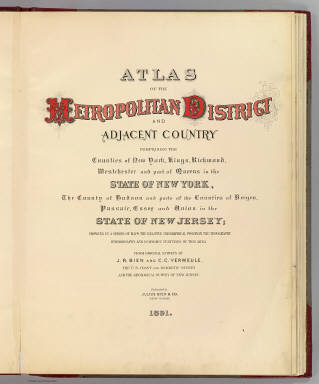
1891 Title Page: Atlas Metropolitan District. City Atlas (Title Page to) Atlas of the Metropolita … |

1888 Cover: Atlas New Jersey. State Atlas (Covers to) Atlas of New Jersey. Geologi … |

1888 Title Page: Atlas New Jersey. State Atlas (Title Page to) Atlas of New Jersey. Geo … |

1888 Text Page: Atlas New Jersey. State Atlas (Text Page to) Atlas of New Jersey. Geol … |

1888 N.J. state map. State Atlas The state of New Jersey. George H. Cook, … |

1888 N.J. relief map. State Atlas New Jersey. George H. Cook, State Geolog … |

1888 1 Kittatinny Valley, Mtn. State Atlas A topographical map of Kittatinny Valley … |

1888 2 SW Highlands. State Atlas A topographical map of the Southwestern … |

1888 3 Central Highlands. State Atlas A topographical map of the Central Highl … |

1888 4 NE Highlands. State Atlas A topographical map of the Northeastern … |

1888 5 SW red sandstone. State Atlas A topographical map of the vicinity of F … |

1888 6 Central red sandstone. State Atlas A topographical map of the valley of the … |

1888 7 NE red sandstone. State Atlas A topographical map of the counties of B … |

1888 8 Trenton. State Atlas A topographical map of the vicinity of T … |

1888 9 Monmouth shore. State Atlas A topographical map of the Monmouth shor … |

1888 10 Lower Delaware. State Atlas A topographical map of the vicinity of S … |

1888 11 Camden. State Atlas A topographical map of the vicinity of C … |

1888 12 Mt. Holly. State Atlas A topographical map of the vicinity of M … |

1888 13 Barnegat. State Atlas A topographical map of the vicinity of B … |

1888 14 Delaware Bay. State Atlas A topographical map of the vicinity of B … |

1888 15 Southern interior. State Atlas A topographical map of the southern inte … |

1888 16 Egg Harbor. State Atlas A topographical map of Egg Harbor and vi … |

1888 17 Cape May. State Atlas A topographical map of the peninsula of … |

1893 Westchester Co., Yonkers-state line. County Atlas Westchester County, Yonkers to Dobbs Fer … |