Browse All

1881 Sud-Amerika in 6 Blattern, Bl. 4 (South … World Atlas Stieler's Hand-Atlas No. 93. Sud-Amerika … |

1881 Sud-Amerika in 6 Blattern, Bl. 5 (South … World Atlas Stieler's Hand-Atlas No. 94. Sud-Amerika … |

1881 Sud-Amerika in 6 Blattern, Bl. 6 (South … World Atlas Stieler's Hand-Atlas No. 95. Sud-Amerika … |

1880 Karte No. 1. Karte des Mittellandischen … World Atlas Petermanns Mittelmeer_Karte No. 1. Karte … |

1880 Karte No. 2. Karte des Mittellandischen … World Atlas Petermanns Mittelmeer_Karte No. 2. Karte … |

1880 Karte No. 3. Karte des Mittellandischen … World Atlas Petermanns Mittelmeer_Karte No. 3. Karte … |

1880 Karte No. 4. Karte des Mittellandischen … World Atlas Petermanns Mittelmeer_Karte No. 4. Karte … |

1880 Karte No. 5. Karte des Mittellandischen … World Atlas Petermanns Mittelmeer_Karte No. 5. Karte … |

1880 Karte No. 6. Karte des Mittellandischen … World Atlas Petermanns Mittelmeer_Karte No. 6. Karte … |

1880 Karte No. 7. Karte des Mittellandischen … World Atlas Petermanns Mittelmeer_Karte No. 7. Karte … |

1880 Karte No. 8. Karte des Mittellandischen … World Atlas Petermanns Mittelmeer_Karte No. 8. Karte … |

1880 Composite: Karte des Mittellandischen Me … World Atlas (Composite of) Karte des Mittellandische … |

1882 Chart of the World. (South Atlantic Sect … World Atlas Chart of the World. (South Atlantic Sect … |

1879 Composite: Sud-West Deutchland und Schwe … World Atlas (Composite of) Stieler's Hand-Atlas No. … |

1882 Composite: Osterreich_Ungarn, World Atlas (Composite of) Stieler's Hand-Atlas No. … |

1880 Composite: Italien. (Italy). World Atlas (Composite of) Stieler's Hand-Atlas No. … |

1879 Composite: Frankreich in 4 Blattern, Bla … World Atlas (Composite of) Stieler's Hand-Atlas No. … |

1879 Composite: Spanien und Portugal in IV Bl … World Atlas (Composite of) Stieler's Hand-Atlas No. … |

1880 Composite:Grossbritannien, Ireland. World Atlas (Composite of) Stieler's Hand-Atlas No. … |

1880 Composite: Ost-Europe in 6 Blatten. World Atlas (Composite of) Stieler's Hand-Atlas No. … |

1880 Composite: Das Mittellandische Meer und … World Atlas (Composite of) Stieler's Hand-Atlas No. … |

1879 Composite: Deutsche Reich in 4 Blattern. … World Atlas (Composite of) Stieler's Hand-Atlas No. … |

1881 Composite: Africa, No. 69, 70, 71. World Atlas (Composite of) Africa, No. 69, 70, 71. |

1879 Composite: West-Indien in 4 Blattern (We … World Atlas (Composite of) Stieler's Hand-Atlas No. … |

1880 Composite: Vereinigte Staaten von Amerik … World Atlas (Composite of) Stieler's Hand-Atlas No. … |

1881 Composite: Sud-Amerika in 6 Blattern, (S … World Atlas (Composite of) Stieler's Hand-Atlas No. … |

1837 Covers: Hand Atlas Uber Alle Theile Der … World Atlas (Covers to) Hand Atlas Uber Alle Theile … |
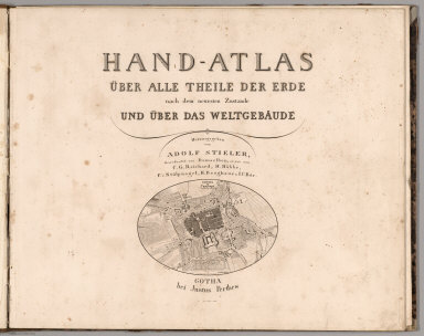
1837 Title Page: Hand Atlas Uber Alle Theile … World Atlas (Title Page) Hand Atlas Uber Alle Theile … |

1827 Das Planeten - System. (The Planetary Sy … World Atlas No. II. Stielers Hand-Atlas (No. 4).Das … |

1837 Westliche Halbkugel. (Western Hemisphere … World Atlas No. IV. Stieler's Hand-Atlas No. 6. West … |

1832 Oestliche Halbkugel. (Eastern Hemisphere … World Atlas No. V. Stieler's Hand-Atlas No. 7. Oestl … |

1837 Die bekannteren Hohwn uber der Meeresfla … World Atlas No.IX. Stieler's Hand-Atlas No. 10. Die … |

1833 Europa. (Europe}. World Atlas No. XI. Stieler's Hand-Atlas No. 12. Eur … |

1835 Spanien und Portugal. (Spain and Portuga … World Atlas No. XII. Stieler's Hand-Atlas No. 13. Sp … |

1829 Frankreich und Umgebungen von Paris. (Fr … World Atlas No. XIII. Stieler's Hand-Atlas (No. 14.) … |

1823 Die Brittischen Inseln. (British Isles). World Atlas No. XVII. Stielers Hand-Atlas (No. 15). … |

1822 Danemark, Island u. Faroer, Schweden und … World Atlas Stielers Hand-Atlas (No. 16). Danemark, … |

1835 Daenemark mit Schleswig, Holstein, und L … World Atlas No. XXI. Stieler's Hand-Atlas (No. 16b.) … |

1831 Germany. Netherlands. Belgium. World Atlas No. XXVII. Stieler's Hand-Atlas (No. 21. … |

1831 Nord-Ostliches Deutschland. (Northeast G … World Atlas No. XXVIII. Stieler's Hand-Atlas (No. 22 … |

1833 Die Preussischen Provinzen, Preussen und … World Atlas No. XXIX. Stielers Hand-Atlas (No. 22b). … |

1834 Mittel-Ostliches Deutschland. (East Cent … World Atlas No. XXX. Stieler's Hand-Atlas (No. 23). … |

1835 Sudwestliches Deutschland ... Schweiz. ( … World Atlas No. XXXI. Stieler's Hand-Atlas (No. 24). … |

1836 Sud-Ostliches Deutschland .... (Southeas … World Atlas No. XXXII. Stieler's Hand-Atlas (No. 25) … |

1833 Der Rhein .... (Rhine). World Atlas Stieler's Hand-Atlas (No. 30 und 31). De … |
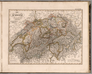
1834 Die Schweiz. (Switzerland). World Atlas No. XXXIV. Stieler's Hand-Atlas (No. 32) … |

1828 Jtalien. (Italy). World Atlas No. XXXV. Stieler's Hand-Atlas (No. 33). … |

1835 Galizien, Ungarn mit Slavonien und Croat … World Atlas No. XXXVIII. Stieler's Hand-Atlas (No. 3 … |

1834 Ostsee-Laender und Inneres Russland bis … World Atlas No. XXXIX. Stieler's Hand-Atlas (No. 36) … |

1833 Europaeisches Russland auch Schweden u. … World Atlas No. XL. Stieler's Hand-Atlas (No. 37). E … |