Browse All

1824 Covers: A General Collection Of Maps, Ch … World Atlas (Covers to) A General Collection Of Maps … |

1824 Title Page: A General Collection Of Maps … World Atlas (Title Page to) A General Collection Of … |

1824 Map of the World World Atlas A Map of the World from the Best Authori … |

1824 Part of North of Europe. World Atlas Part of North of Europe. (1824) |

1824 Map of the United States of America. World Atlas Map of the United States of America. Des … |

1824 Map of New Orleans and Adjacent Country. World Atlas Map of New Orleans and Adjacent Country … |

1824 Jamaica. World Atlas Jamaica. (1824) |

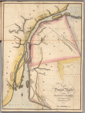
1824 Map of Detroit River and Adjacent Countr … World Atlas Map of Detroit River and Adjacent Countr … |

1824 Lakes of Mexico. World Atlas Lakes of Mexico. Front. Vol. II. A. Laws … |

1824 Anahuac, or the Empire of Mexico, the Ki … World Atlas Anahuac, or the Empire of Mexico, the Ki … |

1824 Greece. World Atlas Greece. (1824) |

1824 Switzerland. World Atlas Switzerland. Engraved by J. Warr, Jr. (1 … |

1824 Italy. World Atlas Italy. Engraved by J. Warr, Jr. (1824) |

1824 Map of the Course fo the Rhine, in the E … World Atlas Map of the Course fo the Rhine, in the E … |

1824 Map of Abyssinia. World Atlas Map of Abyssinia. Copied from the Origin … |

1824 Bataille de Mont Saint Jean. World Atlas Bataille de Mont Saint Jean. Ordre de ba … |

1824 Map of Albania. World Atlas Map of Albania. (1824) |

1824 A Map of the Vendee, South of the Loire … World Atlas A Map of the Vendee, South of the Loire … |

1824 A General Chart ... Davis Straits & Baff … World Atlas A General Chart Showing the Track and Di … |

1824 The Seven United Provinces of Holland, G … World Atlas The Seven United Provinces of Holland, G … |

1824 Sweden, Denmark, Norway, and Finland fro … World Atlas Sweden, Denmark, Norway, and Finland fro … |

1824 Map of the Country belonging to the Cher … World Atlas Map of the Country belonging to the Cher … |

1824 Quebec and Adjacent Country ... during t … World Atlas Plan of Quebec and Adjacent Country Shew … |

1824 East End of Lake Ontario and River St. L … World Atlas East End of Lake Ontario and River St. L … |

1824 St. Lawrence and Adjacent Country. World Atlas Map of the St. Lawrence and Adjacent Cou … |

1824 Chart of the Atlantic Ocean. World Atlas Chart of the Atlantic Ocean. John Melish … |

1824 Countries Situated between Shiraz and Co … World Atlas Sketch of the Countries Situated between … |

1824 Sketch of the Action on the Heights of C … World Atlas Sketch of the Action on the Heights of C … |

1816 Map of the United States with the contig … Case Map Map of the United States with the contig … |

1819 Covers: Advice to Emigrants to the Unite … Guide Book (Covers to) Information and Advice to Em … |

1819 United States Guide Book United States...Improved to 1818 |

1819 Chart of the Atlantic Ocean Guide Book Chart of the Atlantic Ocean |

1823 Composite: United States with the contig … Case Map (Composite of) Map of the United States … |

1816 Cover: Map, United States with British & … Case Map (Covers to) Map of the United States wit … |

1816 A Map of the State of Louisiana. Case Map A Map of the State of Louisiana With Par … |

1816 Composite: Map of the United States with … Case Map Map of the United States with the contig … |

1813 Cover: United States military, topograph … National Atlas (Covers to) A Military and Topographical … |

1813 Map of the American Coast, from Lynhaven … National Atlas Map of the American Coast, from Lynhaven … |

1813 Title Page: Military and topographical a … National Atlas (Title Page to) A Military and Topograph … |

1813 Map of the Seat of War in North America. National Atlas Map of the Seat of War in North America. … |

1813 View of the Country round the Falls of N … National Atlas View of the Country round the Falls of N … |

1813 East End of Lake Ontario. National Atlas East End of Lake Ontario. |

1813 Plan of Montreal, with a Map of the Isla … National Atlas Plan of Montreal, with a Map of the Isla … |

1813 Southern Section of the United States in … National Atlas Southern Section of the United States in … |
1813 Map of Detroit River and Adjacent Countr … National Atlas Map of Detroit River and Adjacent Countr … |

1813 Plan of Quebec and Adjacent Country. National Atlas Plan of Quebec and Adjacent Country Shew … |

1807 Covers: Untitled Atlas of 12 Outline and … School Atlas (Covers to) (Untitled Atlas of 12 Outlin … |

1807 A: Untitled landform map School Atlas A: (Untitled landform map). |

1807 B: Untitled outline map of the world School Atlas B: (Untitled outline map of the World). |

1807 C: Untitled outline map of North America School Atlas C: (Untitled outline map of North Americ … |