Who What Where WhenWHOShow More |
REFINE
Browse All : Atlas Map by Mitchell, Samuel Augustus of New Mexico
1-16 of 16
Author
Mitchell, Samuel Augustus
Full Title
A new map of the State of California, the Territories of Oregon & Utah, and the Chief part of New Mexico. Entered ... 1853, by Thomas, Cowperthwait & Co. ... Pennsylvania.
Publisher
Thomas, Cowperthwait & Co.
Author
Mitchell, Samuel Augustus
Full Title
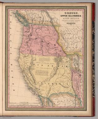
Oregon, Upper California & New Mexico. Published By S. Augustus Mitchell. N.E. corner of Market & 7th. Sts. Philadelphia. 1849. Entered ... 1845 by H.N. Burroughs ... Penna.
Publisher
S.A. Mitchell
Author
Mitchell, Samuel Augustus
Full Title
Map of the State of California, the Territories of Oregon & Utah, and the Chief Part of New Mexico.
Publisher
Thomas, Cowperthwait & Co.
Author
Mitchell, Samuel Augustus
Full Title
A New Map of Nebraska, Kansas, New Mexico and Indian Territories. Published by Charles Desilver, Philadelphia. Entered ... 1856 by Charles Desilver ... Pennsylvania.
Publisher
Charles DeSilver
Author
Mitchell, Samuel Augustus
Full Title
Map of the state of Texas. Engraved to illustrate Mitchell's school and family geography. Entered ... 1846 by S. Augustus Mitchell ... Eastern District of Pennsylvania.
Publisher
Thomas, Cowperthwait & Co.
Full Title
County map of the state of Texas. Showing also portions of the adjoining states and territories. (with) Plan of Galveston and vicinity. Copyright 1887 by Wm. M. Bradley & Bro. (1890)
Publisher
John Y. Huber & Co.
Full Title
County and township map of Arizona and New Mexico. Copyright 1887 by Wm. M. Bradley & Bro. (1890)
Publisher
John Y. Huber & Co.
Author
Mitchell, Samuel Augustus
Full Title
Arizona and New Mexico. Entered ... 1870 by S. Augustus Mitchell, Jr. ... Pennsylvania.
Publisher
[R.A. Campbell, S.A. Mitchell, Jr.]
Author
Mitchell, Samuel Augustus
Full Title
County map of the state of Texas. Showing also portions of the adjoining states and territories. Drawn and engraved by W.H. Gamble, Philadelphia. (with) Plan of Galveston and vicinity. Entered ... 1879 by S. Augustus Mitchell ... Washington. (1880)
Publisher
S.A. Mitchell
Author
Mitchell, Samuel Augustus
Full Title
County map of Arizona and New Mexico. Entered ... 1879 by S. Augustus Mitchell ... Washington. (1880)
Publisher
S.A. Mitchell
Author
Mitchell, Samuel Augustus
Full Title
A New Map of Kansas by W.H. Holmes. Published by C. Desilver. No. 714 Chesnut St., Philadelphia. Herline & Hensel, Philada. Entered according to Act of Congress in the year 1859 by C. Desilver in the Clerk's office if the District Court of the Eastern District of Pennsylvania.
Publisher
Charles Desilver.
Author
Mitchell, Samuel Augustus
Full Title
A New Map of Nebraska, Kansas, New Mexico, and Indian Territories. Published By Charles Desilver, Philadelphia. Entered according to Act of Congress in the year 1859 by Charles Desilver in the Clerk's office if the District Court of the Eastern District of Pennsylvania. 38.
Publisher
Charles Desilver.
Author
Mitchell, Samuel Augustus
Full Title
Map Of Texas From the most recent authorities. (with) Texas North Of Red River. Philadelphia: Published by C.S. Williams N.E. corner of Market & 7th Streets. Entered ... 1845 by C.S. Williams ... Pennsylvania.
Publisher
S.A. Mitchell
Author
Mitchell, Samuel Augustus
Full Title
A New Map of Nebraska, Kansas, New Mexico, and Indian Territories. Published By Charles Desilver, Philadelphia. Entered according to Act of Congress in the year 1856 by Charles Desilver in the Clerk's office if the District Court of the Eastern District of Pennsylvania. 38.
Publisher
Charles Desilver.
Full Title
County map of the state of Texas. Showing also portions of the adjoining states and territories. (with) Plan of Galveston and vicinity. Copyright 1886 by Wm. M. Bradley & Bro.
Publisher
Wm. M. Bradley & Bro.
1-16 of 16
|